
Operational Models (Except ECMWF) Leaning in Weak La Nina Direction Later This Year
06/16/2025, 11:43 am EDT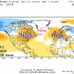
NAWH Pattern Strongest Since 2018, Fuels Mid-summer East N.A./Europe Heat (and Dryness)
06/22/2025, 9:40 am EDT
![]()
Climate Impact Company Daily Feature
Issued: Thursday, June 19, 2025
Highlight: The just-issued NOAA/CPC long-lead climate forecasts. Identifying IMPORTANT climate risks ahead.

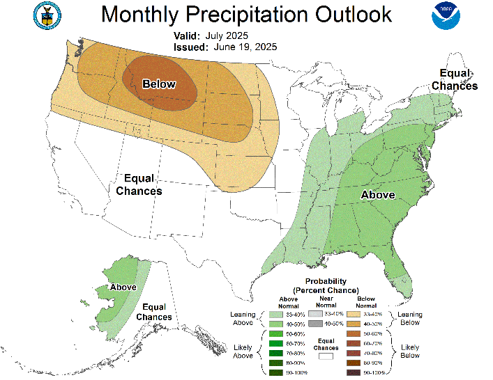
Fig. 1-2: The NOAA/CPC temperature and precipitation probability forecast for July 2025.
Discussion: NOAA/CPC long-lead climate forecasts have significantly improved their skill and worthwhile is a close review of the just-issued outlooks. First, let’s review the July 2025 outlook. As discussed by Climate Impact Company many times, a large wet soil region during summertime will resist anomalous warm/hot climate. Note that the NOAA/CPC temperature outlook stresses “equal chances” over the Mid-south (and eastward) wet soil region which means equal chance of above, below, or normal temperature (Fig. 1). In this wet soil region, a weakness (trough) in the upper air pattern is compensated for by high pressure in the West where a high confidence hot mid-summer outlook is indicated. The high pressure causes strong dry risk to shift into the Northwest U.S. (and Western Canadian Prairies) where oncoming drought is expected (Fig. 2). The weak upper trough over the Mid-south U.S. causes a heavy rain pattern in the East during July. Tropical moisture is certainly involved with the East U.S. wet regime and flooding rains should be expected. A tropical cyclone impacting the Northeast Gulf or Southeast Coast is possible.
The 90-day outlook, valid for JUL/AUG/SEP 2025, thematic is maintaining a soaking wet risk in the Southeast to Mid-Atlantic U.S., increased risk of very warm to hot and very humid climate in the Northeast, continued hot risk Interior West, and dry risk continuing across the Northwest and North-central U.S. to the Canadian Prairies (Fig. 3-4). Clearly, the outlook identifies the Southeast U.S. and Florida to the Mid-Atlantic Coast as candidates for coastal tropical cyclone strikes. The dry pattern does not reach the Midwest U.S. High electricity demand for PJM-East and NEPOOL can be expected. Northwest U.S. to northern Plains drought expectations remain in-place. A hostile fire season is organizing for the West/Northwest U.S.
The U.S. Seasonal Drought Outlook emphasizes drought expansion in the Northwest U.S. adding Central California (Fig. 5). Western drought is widespread and extends to Nebraska. Climate forecasts from Climate Impact Company (issued earlier this week) and today’s NOAA/CPC outlook are increasing wet risk across much of the eastern half of the U.S. therefore expectations of eastward shifting drought toward the Midwest States during the summer season is less likely.

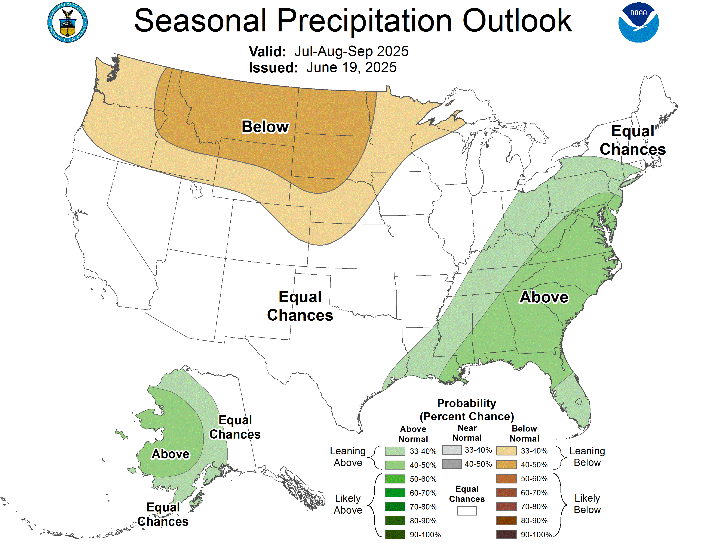
Fig. 3-4: The NOAA/CPC temperature and precipitation probability forecast for JUL/AUG/SEP 2025.
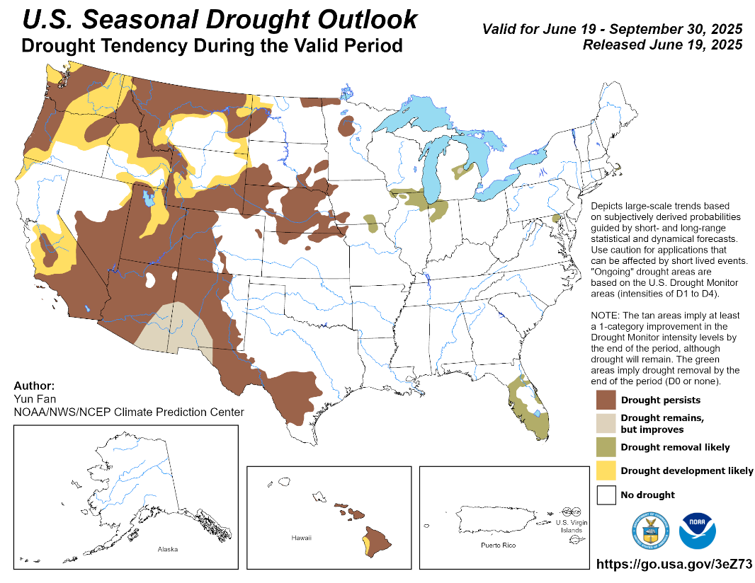
Fig. 5: The U.S. Seasonal Drought Outlook valid through Sep. 30, 2025.