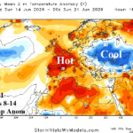
Cool/Wet U.S. AG Belt; Dangerous Heat and Dry West/Central Europe
06/14/2026, 2:24 pm EDT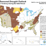
New NOAA Long-lead Climate Forecasts Including Seasonal Drought Outlook
06/18/2026, 9:48 am EDT
Climate Impact Company Daily Feature
Issued: Wednesday, June 17, 2026
Highlight: Emerging wet Midwest to Northeast U.S. climate and Europe drought for mid-summer 2026!
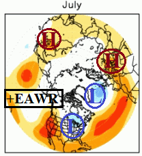
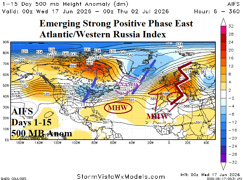
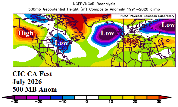
Fig. 1-3: Mid-summer positive phase of the East Atlantic/Western Russia 500 MB anomaly pattern, the AIFS 15-day 500 MB anomaly forecast, and Climate Impact Company constructed analog 500 MB anomaly forecast for July 2026.
Discussion: Positive phase of the East Atlantic/Western Russia (+EAWR) index is present when an amplified upper-level high pressure ridge emerges over Europe compensated for by a downstream upper trough near the Caspian Sea while a deep trough resides over the North Atlantic and a second high pressure area forms over Northeast China. Another related trough forms over the Midwest U.S. during the +EAWR regime as identified by NOAA/CPC climatology (Fig. 1). The AIFS 15-day 500 MB anomaly forecast identifies the +EAWR climate signal regime across North America, North Atlantic, and Europe specifically with a Midwest U.S. trough, elongated trough enhanced by the North Atlantic warm hole (NAWH) southeast of Greenland, and the compensating (drought-producing) upper ridge made stronger by marine heatwaves (MHW) in the Mediterranean and Norwegian Sea over Europe (Fig. 2). The Climate Impact Company constructed analog (CIC-CA) 500 MB anomaly forecast for July 2026 indicates the +EAWR pattern may continue bringing wet/cool weather to the northeast quadrant of the U.S. (occasional brief hot interruptions in the Mid-Atlantic) and an ongoing drought-enhancing ridge over Central/Southern Europe (Fig. 3). The latest EAWR 15-day forecast extending into early July indicates an emerging vigorous positive phase (Fig. 4).
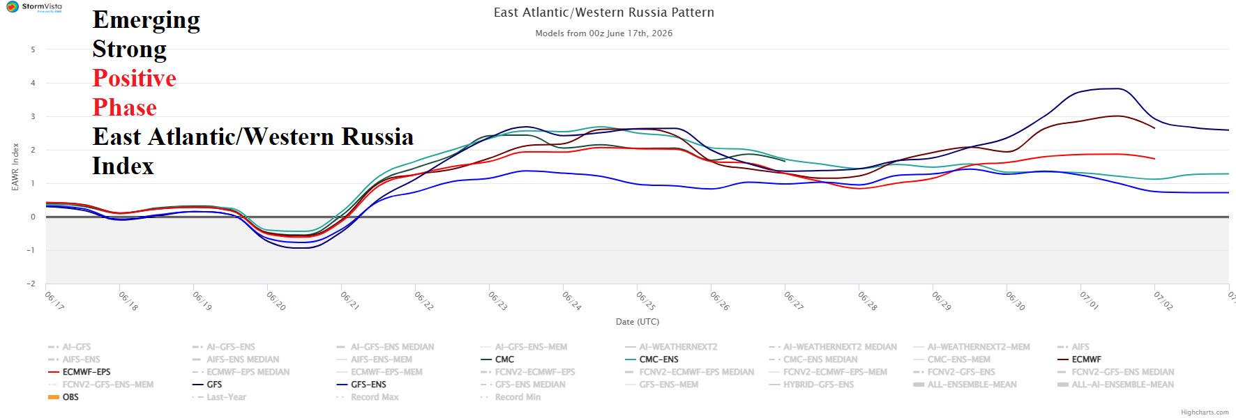
Fig. 4: Utilizing all models, an emerging strong positive phase of the East Atlantic/Western Russia index beginning next week.