
Using Cleveland and Baltimore HDD’s, 2026 (and 2025) Rank Coldest Since 2014-15. JAN-26 Cold Similar to JAN-25 in Houston.
02/02/2026, 5:13 am EST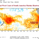
The Great West Coast of South America Marine Heatwave
02/05/2026, 4:06 pm EST![]()
Climate Impact Company Daily Feature
Issued: Tuesday, February 3, 2026
Highlight: Did oceanic forcing cause the warmer pattern-change across North America?
Discussion: The latest “polar vortex” winter has gripped eastern North America during much of the past 2 months and continues into early February (Fig. 1). Interestingly, JAN/FEB 2025 (also) produced a PV pattern which was centered just east of New England. During each PV episode, the polar stratosphere has been colder than normal although regional warming is present at times to assist in PV generation. The FEB-21 U.S. arctic outbreak which caused Winter Storm “Uri” was an example of a recent top-down cold event where the polar vortex extended from the stratosphere through the troposphere. As mid-February approaches, a complete reversal in the North America weather pattern is expected. ECM ENS indicates a buoyant 500 MB upper ridge from Northeast Canada to the Gulf of Mexico sure to cause a warm-up that melts snow and river ice. In the Central/East-central U.S. (Fig. 2). The “ridge bridge” high pressure over Alaska reverses to a cold upper trough. A potential trigger to the pattern change is less likely the stratosphere rather forcing caused by ocean effects. The eastern Pacific Basin is warmer than normal and warming. Note the marine heat wave (MHW) off the North America West Coast and aggressively expanding equatorward (Fig. 3), similar with warming in this location prior to the 2015-16 El Nino. The La Nina signature in the far eastern equatorial Pacific Ocean has dissipated. During January, a subsurface warm Kelvin Wave shifted across the equatorial East Pacific (Fig. 4) recently reaching the northwest coast of South America. The Nino12 region off the northwest coast of South America warmed 1.1C during the past 30 days. The majority of global SSTA forecast models are forecasting El Nino onset during northern hemisphere spring. The onset of that ENSO change has occurred and may have contributed to the sensible weather pattern change across North America as mid-February approaches.
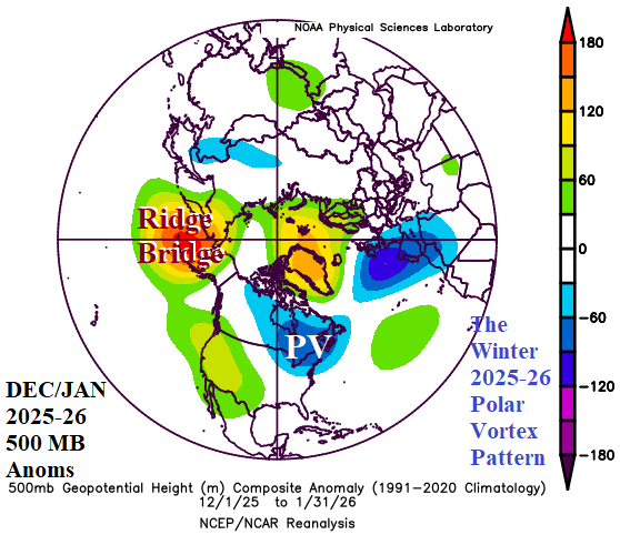
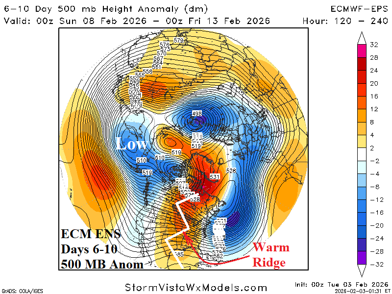
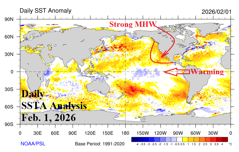

Fig. 1-4: The JAN/FEB 2025-26 500 MB anomalies, ECM ENS 6-10-day 500 MB anomaly forecast, daily global SSTA analysis, and upper ocean heat anomalies across the equatorial Pacific from the past year.