
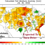
Mid-south U.S. Drought Development Ahead
07/31/2026, 1:42 pm EDT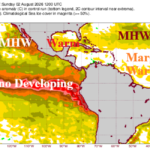
The 2026 Seasonal Forecast Cut Lower – Again Due to Developing Super El Nino
08/03/2026, 6:07 am EDT
Climate Impact Company Climate Research
Issued: Sunday, August 2, 2026
Highlight: Current ocean and atmosphere observations (easily) support dynamic model projections record-strength super El Nino later this year.
Discussion: The daily Nino12 SSTA is a buoyantly warm +4.04C which is frighteningly impressive! Weekly Nino12 SSTA exceeding +4.0C occurred only once, during the 1982-83 El Nino when +4.5 was observed in late June 1983 during the mature phase of that El Nino episode. Entering August, 2026-27 El Nino is in its infancy. A glance at potential energy observations to gauge potential El Nino strength, July 2026 subsurface upper ocean heat anomalies are, by far, the warmest on record eclipsing the previous record warm observations produced by the 1997-98 El Nino episode (Fig. 1). Once again, previous upper ocean heat records reached by 1982-83, 1997-98, 2015-16 (historical) El Nino events were each attained during the mature stage which is at least 6 months away from now for the 2026-27 episode. Is the atmosphere reacting to the record warm ocean? Absolutely! The (Long Paddock) southern oscillation index (SOI) in July 2026 was -2.68, just short of the March 1983 record -2.77. The 2026-27 monthly -SOI will easily eclipse the old record in the coming months. In summary, dynamic models forecasting record strength El Nino for later 2026 are on target as oceanic and atmospheric observations easily support the prediction.
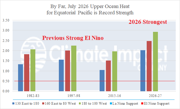
Fig. 1: Warmest upper ocean heat anomalies on record.
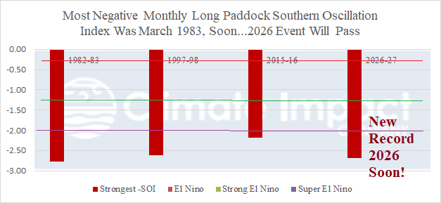
Fig. 2: The strongest monthly negative phase southern oscillation index on record.