
Comparing Best Dynamic and Machine Learning Forecast Models for Australia Outlook
07/18/2025, 5:44 am EDT
Eastern Europe to The Black Sea Region Shifts Wetter/Cooler
07/22/2025, 4:49 am EDT
Climate Impact Company Sunday Global AG Report
Global Weather/Climate Report
Issued: Sunday July 20, 2025
Highlights: Extreme rain and heat affect major U.S. crop areas; Transitional wet pattern for Europe; Chill (and wet) ahead for Australia.
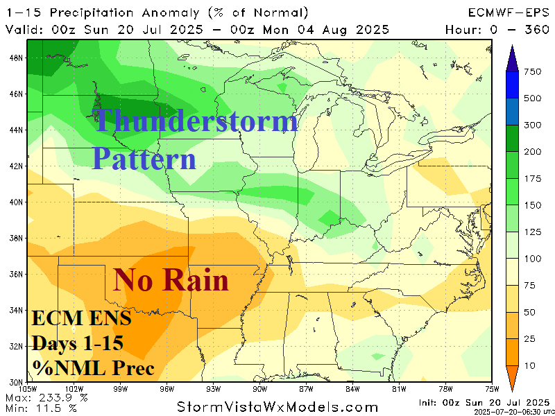
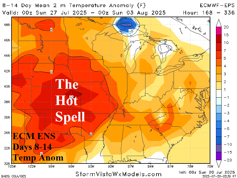
Fig. 1-2: The ECM ENS 15-day percent of normal rainfall forecast and ECM ENS 8-14-day temperature anomaly outlook.
Discussion: The 2-week outlook across the U.S. features harsh high impact weather including a stretch of heavy rain, severe thunderstorms, and local flooding from the Southern Canadian Prairies across the North-Central U.S. and through the Midwest States (Fig. 1). The GFS indicates the wet weather may ease in the 11-15-day period. The mid-summer heatwave develops during the 6-10-day period centered on the Missouri Valley shifting westward to Kansas in the 11-15-day period (Fig. 2). The risk of 100F stretches from the northwest Great Plains to the Southern U.S. Corn Belt and southward to the Gulf States during the medium range. The risk of night temperatures not dipping below 77-81F at night affects the central U.S. Corn Belt and most of the U.S. soybean growing areas.
A wet pattern shifts across Europe during the next 2 weeks. This week, 1-3 in. of rain affects the Northern France to Germany stretch plus parts of West Russia (Fig. 3). The wet weather is accompanied by cool weather. The wet pattern stretches across Central Europe in the 6-10-day period (Fig. 4). Wet weather is centered on Western Russia in the 11-15-day period while Western Europe is dry and turns warmer (Fig. 5). The newfound periodic weather will continue to break down the Europe Drought (Fig. 6).
In Australia, a cooler pattern ahead remains in the forecast. This week, the West turns cooler (Fig. 7) and the chill broadens in the 8-14-day period (Fig. 8). The cooler weather is accompanied by unusually heavy rain including Southwest Australia, much of the South Coast, Southeast and East Australia (Fig. 9).


Fig. 3-6: The ECM ENS 15-day percent of normal rainfall forecast across Europe and the daily soil moisture anomaly analysis.

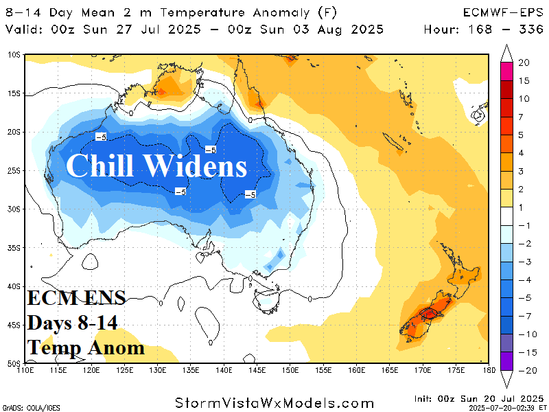
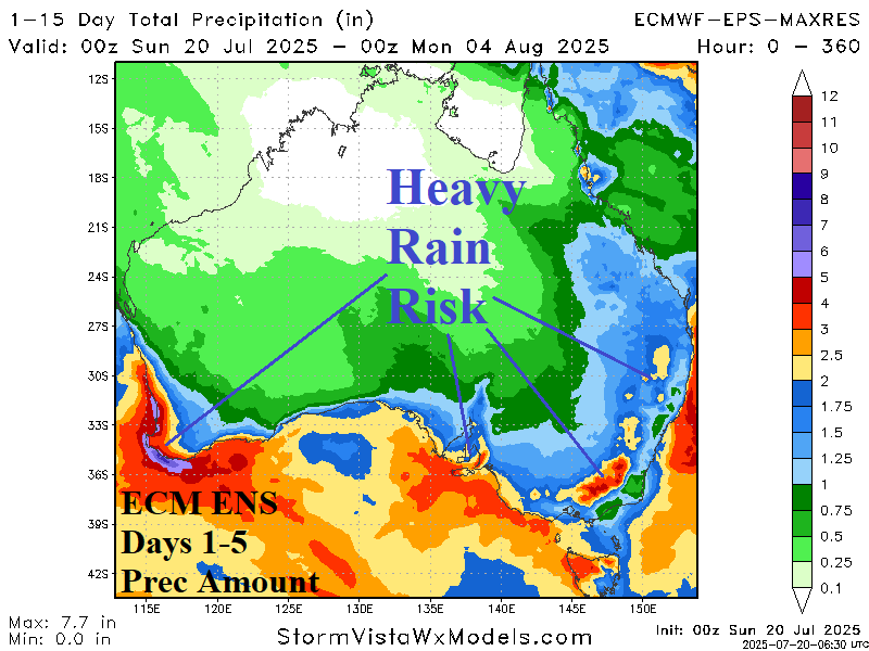
Fig. 7-9: ECM ENS 14-day temperature anomaly forecast across Australia plus the ECM ENS 15-day rainfall amount outlook.