
Extended-range CDD Forecasts Shift Hotter
07/02/2026, 8:16 am EDT
France Heatwave, Nearly as Strong as June, Collapses Days 11-15
07/08/2026, 5:17 am EDT

Climate Impact Company Sunday Global Weather/Climate Report
Issued: Sunday July 5, 2026
Highlight: The Great Plains concern; Next Europe heatwave impressive, not as strong as June episode; Wetter Southeast Brazil ahead.
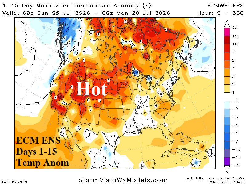
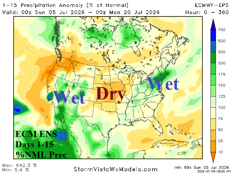
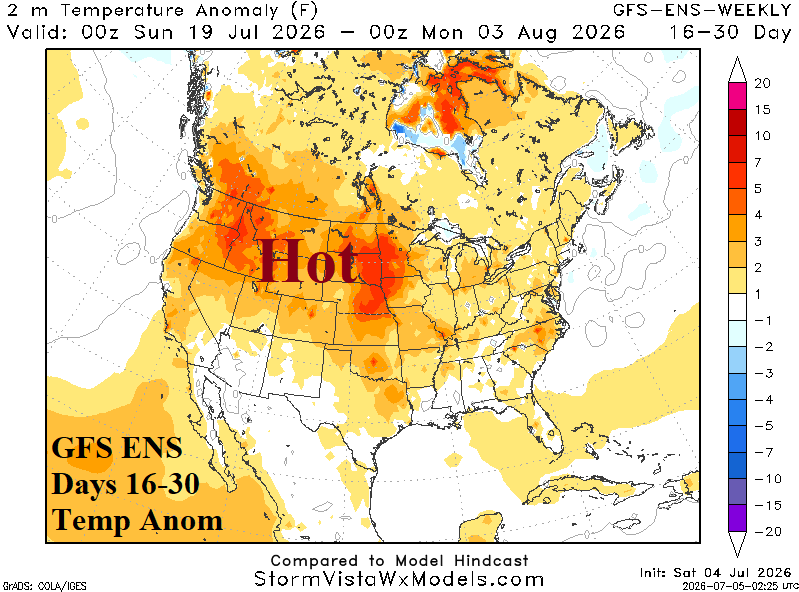
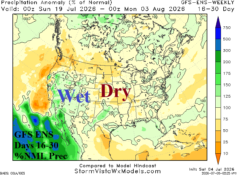
Fig. 1-4: ECM ENS 15-day temperature anomaly and percent normal rainfall forecast across North America plus GFS ENS “weeklies” 16-30-day projection of U.S. temperature anomalies and percent normal rainfall.
Discussion: Generally, there exists potential for significant drying in the Great Plains coupled with anomalous heat in the 1-15-day and 16-30-day periods (Fig. 1-4). ECM leads the charge with other operational models (CMC ENS and GFS ENS) while AI models are somewhat cooler but generally drier, especially eastern Great Plains.
In Europe, the latest heatwave will spread eastward over the next 2 weeks, peaking late this week/next weekend (Fig. 5). France is hardest hit although cooling toward normal is indicated in the 11-15-day forecast (Fig. 6). Forecasts are mostly drier than normal except patchy thundershowers across Central and East Europe during the next 2 weeks. Soil moisture anomalies analysis indicates worsening drought conditions (Fig. 7).
The weather word in South America is wet for Southeast Brazil beginning in the 8-14-day period and widening/strengthening in the 16-30-day forecast (Fig. 8-9).
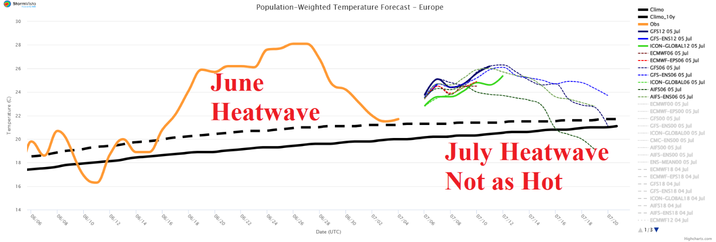
Fig. 5: The Europe 15-day population weight daily average temperature forecast across Europe utilizing all operational models with 30-day history.
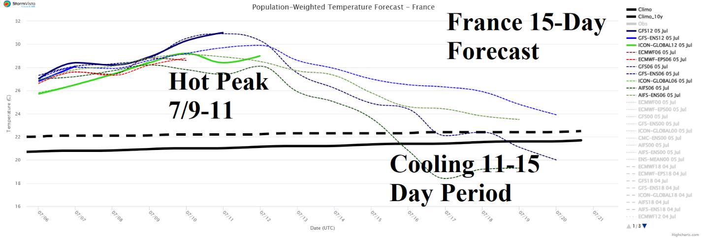
Fig. 6: The France 15-day population weight daily average temperature forecast.
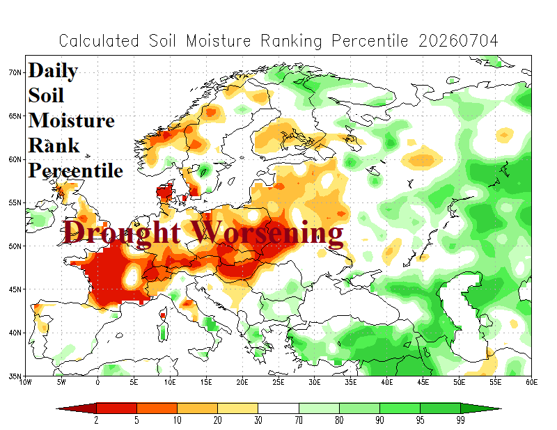
Fig. 7: Daily soil moisture ranked percentiles identify worsening Europe drought.
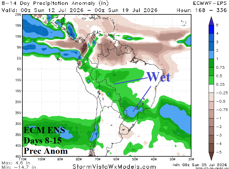
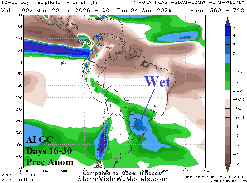
Fig. 8-9: ECM ENS 8-14-day rainfall anomaly forecast, and AI Graph Cast 16-30-day rainfall anomaly projection for South America.