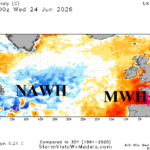
North Atlantic Warm Hole Correlated With Europe Heat Risk; Expect Repeat in July and August
06/25/2026, 7:58 am EDT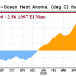
Near Strong Oceanic El Nino Threshold
06/30/2026, 6:01 am EDT
![]()
Climate Impact Company Sunday Global Weather/Climate Report
Issued: Sunday June 28, 2026
Highlight: ALERT issued for BOTH short and long-term hazardous (hot and dry) weather centered on the Western U.S. Corn Belt. Europe heat core shifts.
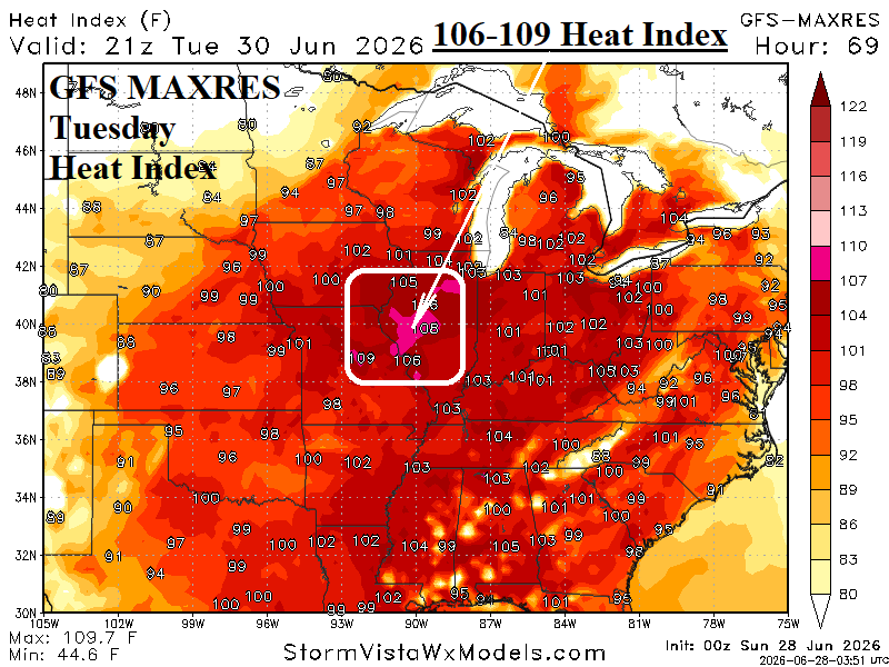
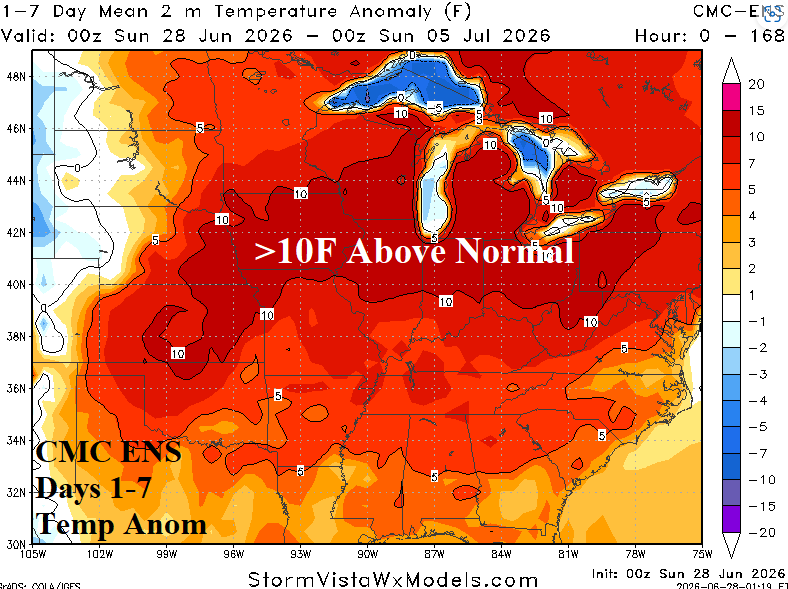
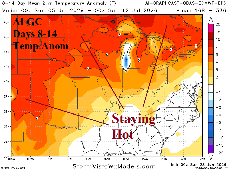
Fig. 1-3: Maximum heat index during this week is in west-southwest Illinois on Tuesday. The U.S. AG Belt 1-7-day and 8-14-day temperature anomalies forecasts.
Discussion: Excessive Heat Warnings are positioned directly across the U.S. Corn Belt for early this week. The most impressive heat stress is a forecast of near 110F heat index centered over west-southwest Illinois on Tuesday (Fig. 1). The CMC ENS 7-day temperature anomalies forecast indicates >10F temperature anomalies from the East Kansas eastward through Ohio (Fig. 2), one of the hottest spells on record for this zone. Forecasts vary, but anomalous heat is likely to linger in the 8-14-day period in the Great Plains based on the AI Graph Cast (Fig. 3). The Midwest to Kansas has observed a sharply wetter soil moisture trend during June. Expect that trend to reverse as July arrives.
Climate Impact Company issues an ALERT for accelerating dry soil in the Western Corn Belt during the 16-30-day period, also the peak hottest time of summer climatologically. ECM and AI GC differ on whether hot weather is present, but each forecast agrees on dryness (Fig. 4-7).
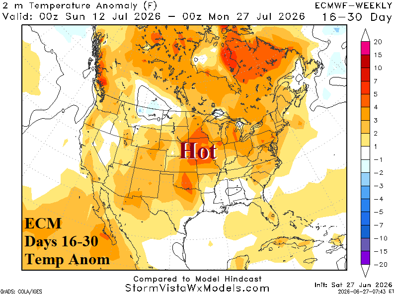
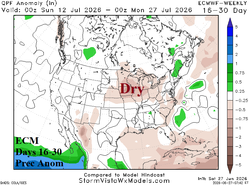
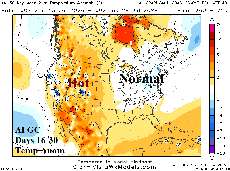
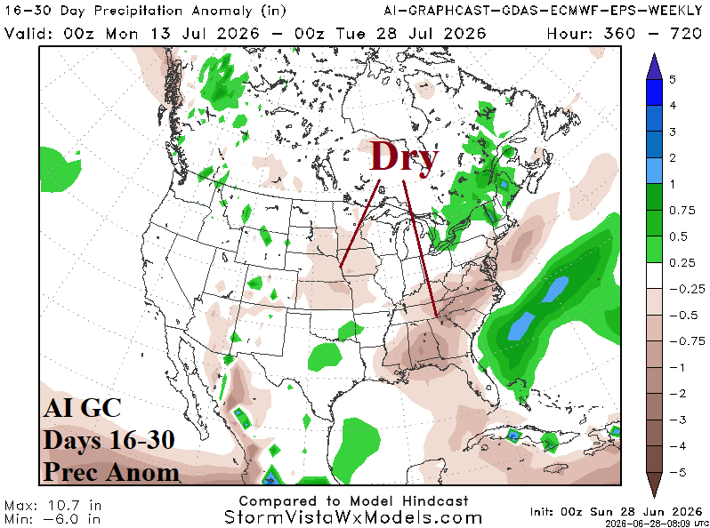
Fig. 4-7: ECM and AI Graph Cast 16-30-day temperature and precipitation anomaly forecasts.
While the U.S. AG Belt shifts hotter and drier as July arrives, the Canadian Prairies stay wet. The 10-day forecast indicates additional heavy rain (Fig. 8). Both the GFS and ECM indicate the wet weather may break after 10 days.
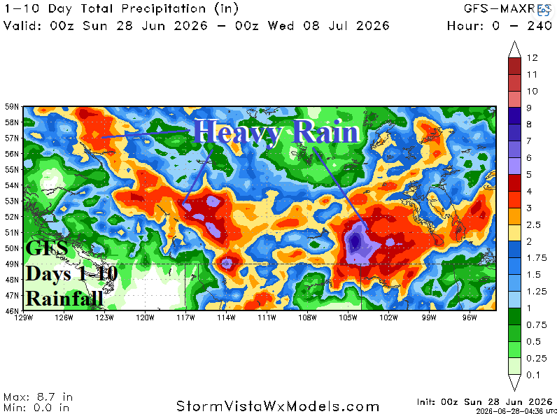
Fig. 8: GFS 1-10-day rainfall forecast across the Canadian Prairies.
Searing heat remains in the forecast for Europe during the last 10 days of June (Fig. 1). The hot weather episode is hotter than 2 recent events (6/18 and 5/26). Paris, France is above 100F all week (Fig. 2). The 15-day forecasts are very dry and hot (Fig. 3-4) accelerating drought concerns. Climate signals indicate the heat should ease in the 11-15-day period.
In Europe, the core of the heat wave shifts east and rests on Eastern Europe this week (Fig. 9). The heat core retreats to Southwest Europe during the 6-10-day period as Northwest Eurasia cools (Fig. 10). The heat begins to rebuild in 11-15 days (Fig. 11). In the 16-30-day period, dynamic and AI models regenerate high pressure ridging, strongest over U.K. with an eastward extension to the Black Sea region.
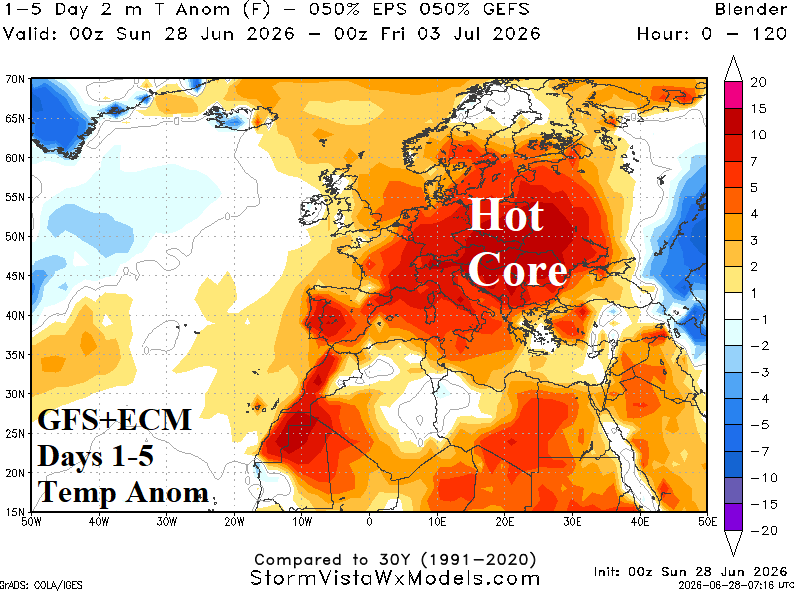
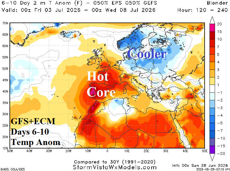
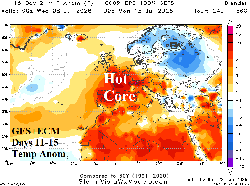
Fig. 9-11: GFS 1-10-day rainfall forecast across the Canadian Prairies.