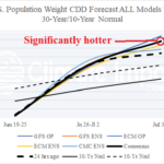
Climbing Cooling Degree Days for Early July in U.S.
06/25/2026, 8:00 am EDT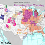
Searing U.S. Heatwave Emerging, Expands This Week
06/29/2026, 4:47 am EDT
Climate Impact Company Early AG Market ALERT
Issued: Friday June 26, 2026
Highlight: Patchy rains U.S. AG Belt next 2 weeks; Europe heat constricts.
Discussion: The U.S. Drought Monitor indicates 69.95% of the U.S. is in D0-D4 dry-to-drought condition, down from a peak of 80.01 during mid-spring. Vigorous D2-D4 drought conditions are 33.54% of the U.S. in late June, down from a peak of 43.83% about 5-6 weeks ago. Harsh D3-D4 drought conditions affect 11.56% of the U.S. down nearly 50% from mid-spring. Last week, widespread wetter changes were observed including the central/south Great Plains, Texas, and the Southeast U.S. The 15-day outlook features patchy heavy rain across the U.S. AG Belt (Fig. 1) with the 24-hour change wetter Upper Midwest and Mid-south U.S. (Fig. 2). Looking ahead to late summer and mid-autumn, NOAA/CAS soil moisture anomaly forecasts indicate ongoing drought for the west/central Great Plains, increasingly moist conditions in the U.S. Corn Belt, and wetter in the Mid-south U.S. sector (Fig. 3).
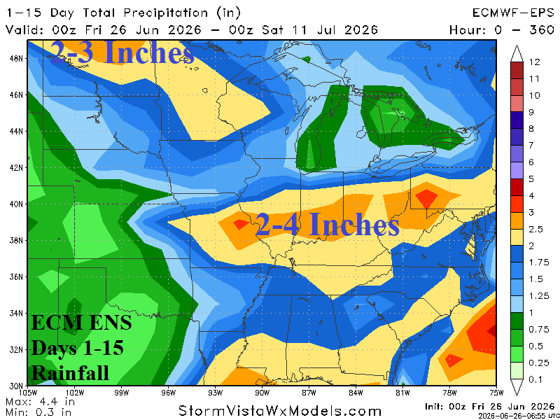
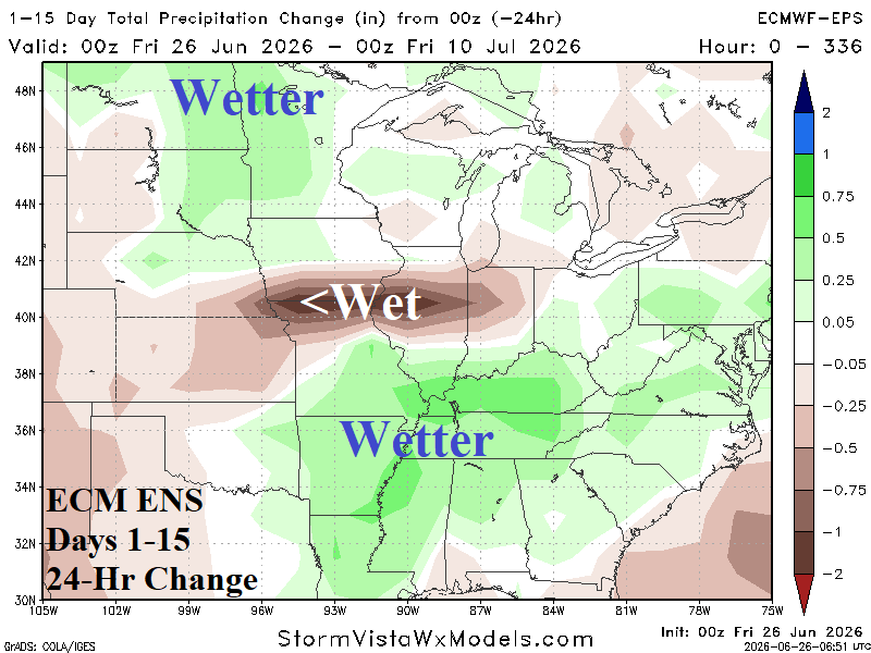
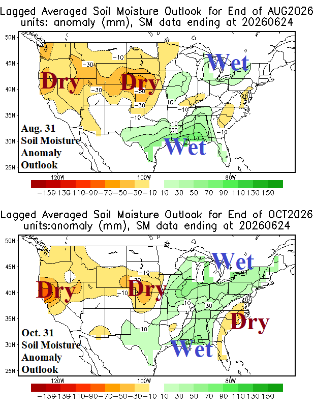
Fig. 1-3: ECM ENS 15-day rainfall forecast across the U.S. AG Belt and 24-hour change in the outlook plus the NCEP/CAS soil moisture anomaly forecast for Aug. 31, 2026, and Oct. 31, 2026.
The Europe heatwave remains intense and widens into the weekend (Fig. 4) followed by cooler changes for the northern half of Europe in the 6-10-day period (Fig. 5). In the 11-15-day period, GFS and ECM (equally) combine to produce a cooler Northwest Eurasia forecast while Southwest Europe stays hot (Fig. 6). The 15-day precipitation forecast is wetter in the Baltic region and just west of the Black Sea region (Fig. 7).
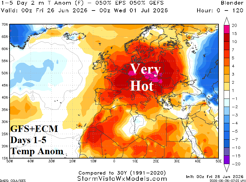
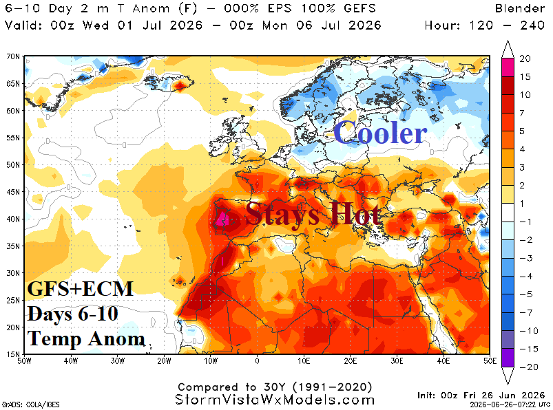
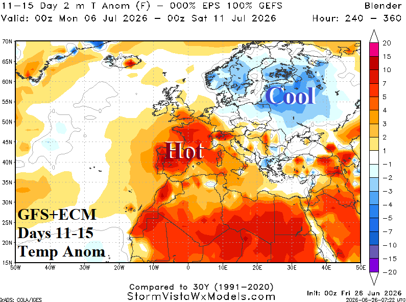
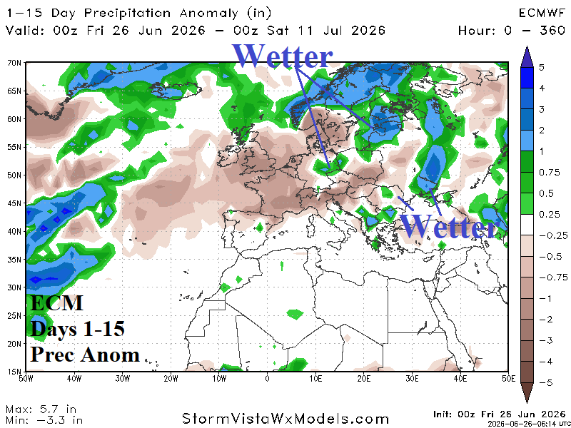
Fig. 4-7: ECM 15-day temperature anomaly forecast and precipitation anomaly outlook.