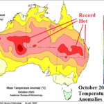
Explaining Unexpected October 2025 Heat and Dryness across Australia
11/03/2025, 5:07 am EST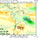
Wet Climate Develops Brazil; Argentina Turns Drier
11/07/2025, 6:05 am EST
Climate Impact Company Early AG Market ALERT
Issued: Wednesday November 5, 2025
Highlight: NOAA (model) announcement, the dry Great Plains, and rains arrive in Brazil coffee area.
ANNOUNCEMENT from CWG/SVWM: The NOAA Eagle AI model which is based on the Graph Cast that is initialized with the GFS ensemble will be eventually renamed AI-GEFS with the Eagle name retired. This will consolidate both the GFS Op and Ensemble with the AI-GFS and AI-GEFS for faster update times too. We’ll need to wait for government shutdown to end before operational. During the past 60 days, the NOAA AI Eagle has performed well forecasting the weather pattern (500 MB anomalies) across the northern hemisphere during the 6-10-day/11-15-day medium range forecast (Fig. 1).
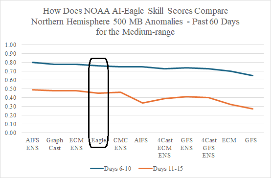
Fig. 1: Skill scores of all models from the past 60 days forecasting northern hemisphere 500 MB anomalies.
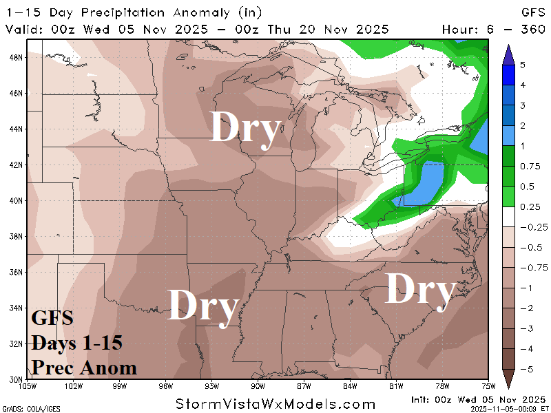
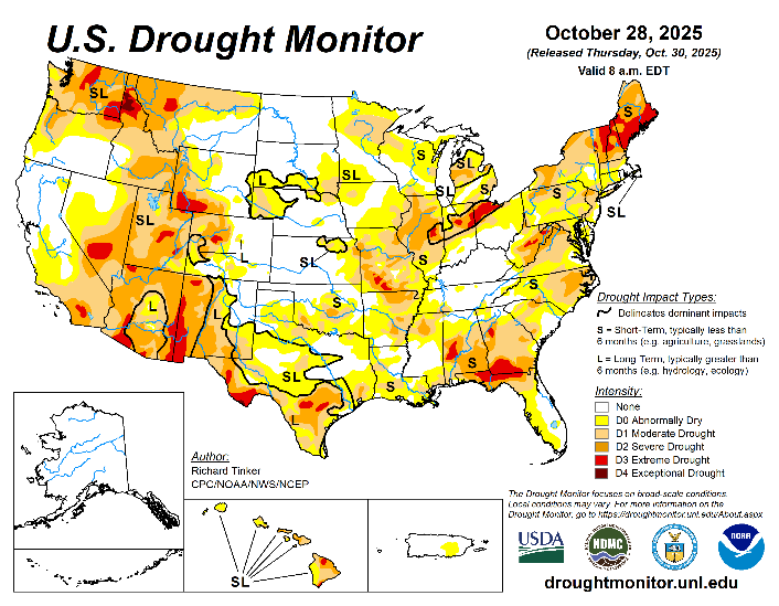
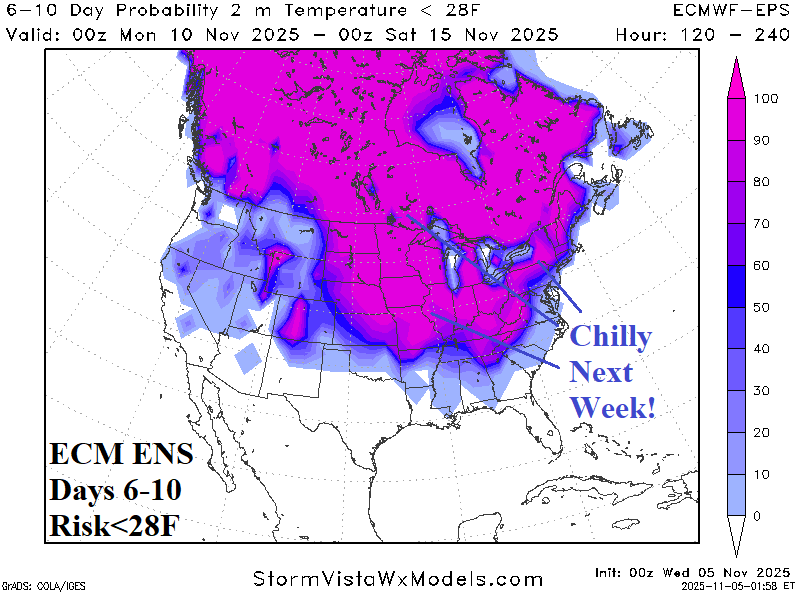
Fig. 2-4: The GFS 15-day precipitation anomaly forecast, last week’s U.S. Drought Monitor, and 6-10-day risk of <28F.
Discussion: The precipitation outlook across the Great Plains, Midwest, and Mid-south U.S. is arid through the next 15 days (Fig. 2) as dry soil conditions worsen in the Midwest to Gulf States (Fig. 3). Next week’s cold risk (<28F) extends southward through the Missouri and Tennessee Valleys (Fig. 4).
In South America, the 15-day rainfall outlook across South-central and East Brazil is wetter than normal (Fig. 5). Interestingly, the 24-trend indicates the heavier rain is across a narrow channel extending from Bolivia and eastward and much wetter in East Brazil while the southern portion of the potential wet area shifts much drier, most dramatic in Southeast Brazil (Fig. 6). The 7-day rainfall observations reveal wet weather has arrived in the Brazil coffee-growing areas (Fig. 7).

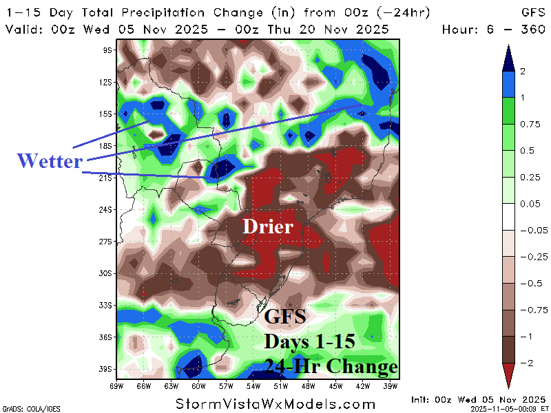
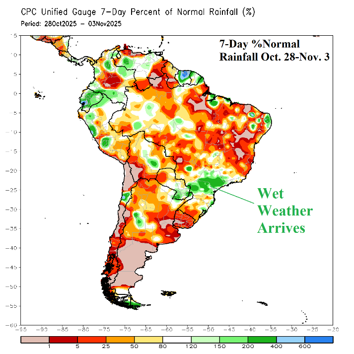
Fig. 5-7: The GFS 15-day rainfall anomaly forecast across Brazil into Argentina and the 24-hour change.