
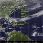
Subtropical Storm May Form Off Southeast U.S. Coast This Weekend
11/19/2026, 11:50 am EST
Climate Impact Company Early U.S. Report
Issued: Friday November 20, 2026
Highlight: Major storms ahead! Snowstorms included!
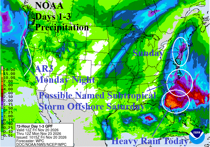
Fig. 1: NOAA/WPC 3-day quantitative precipitation forecast across the U.S.
Discussion: Low pressure develops off the Florida Coast today and coupled with strong wind gradient to the north causes a rain and wind storm into the east and northeast coast of Florida gradually working northward along the Southeast Coast tonight and Saturday (Fig. 1). Deepening low pressure over very warm ocean temperatures enhanced by the Gulf Stream suggest a subtropical storm may form on Saturday. NOAA/NHC indicates 50% risk. The rain areas shifts northward unloading possible flooding rain on the Interior Northern Mid-Atlantic to southwest New England on Sunday.
Meanwhile, atmospheric river events are developing and point toward the West/Northwest U.S. Coast beginning in earnest early next week. The NOAA/WPC 4-5-day precipitation outlook (Fig. 2) indicates AR-4 intensity events from Washington to Northern California (and including Southwest Canada). Early next week, the weekend storm is departing New England while another storm evolves off the Carolina Coast.
Middle of next week and into Thanksgiving Day early winter weather arrives! Another East Coast significant storm is expected. However, this time enough cold air is involved to produce significant snow in the Appalachian States (Fig. 3). Meanwhile, the AR pattern into the Northwest U.S. and Southwest Canada intensifies with significant mountain snow adding the Intermountain Northwest.
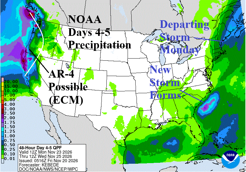
Fig. 2: NOAA/WPC 4-5-day quantitative precipitation forecast across the U.S.
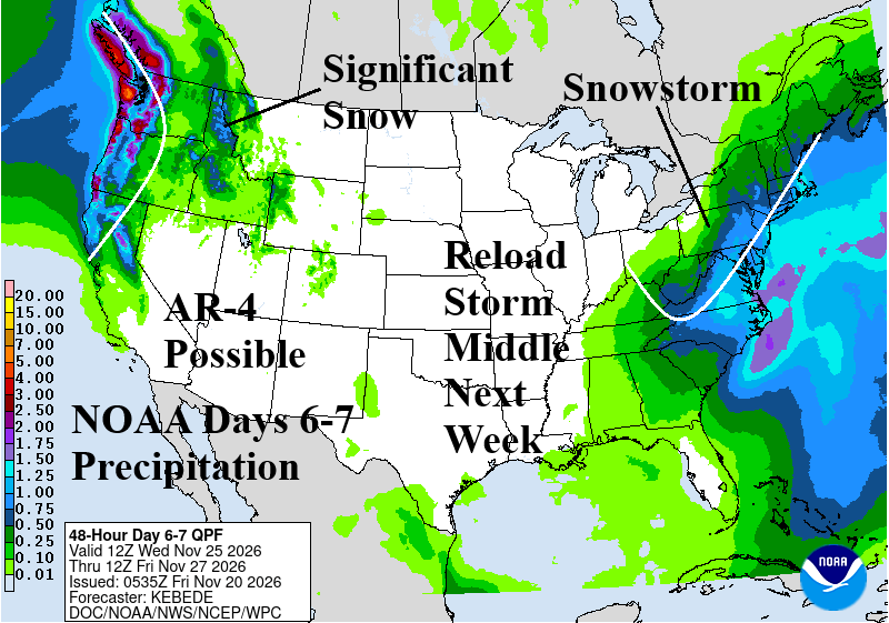
Fig. 3: NOAA/WPC 6-7-day quantitative precipitation forecast across the U.S.