
Warm HDD Forecasts for U.S. Sinter 2026-27
10/26/2026, 8:49 am EDT
Climate Impact Company Weekly ENSO Climate Diagnostics
Issued: Tuesday October 27, 2026
Highlight: Has Super El Nino 2026 intensity peaked?
Discussion: Beginning late last May, outgoing longwave radiation anomalies (OLRA) shifted sharply negative across the central and eastern tropical Pacific Ocean (Fig. 1) due to the presence of persistent deep convection inspired by the warming surface waters produced by oncoming Super El Nino. The -OLRA signature in this region produced 3 peak intensities, likely associated with significant tropical cyclones, in mid-July, mid-August, and early September. The ENSO response (with minor brief exceptions) has been persistent sharp negative phase of the southern oscillation index (SOI). However, the deep convection (-OLRA) signal has weakened during the past week, and SOI has shifted to positive for the first time since earlier in the year (Fig. 2). Is Super El Nino 2026 shifting past peak intensity? A possible explanation for the weakening -OLRA pattern and emergence of +SOI is emergence of the Madden Julian oscillation (MJO) convection signal shifting to the tropical Indian Ocean and forecast to remain while intensifying (phase_3) during November according to ECMWF (Fig. 3). During November, MJO phase_3 is historically a warm signal for U.S. climate and stormy across California while India to Indonesia shifts wetter and South America is normally drier. The most recent NCEP CFS V2 (conventional) Nino34 SSTA forecast indicates El Nino peak has occurred and gradual weakening follows for boreal winter 2026-27 (Fig. 4).
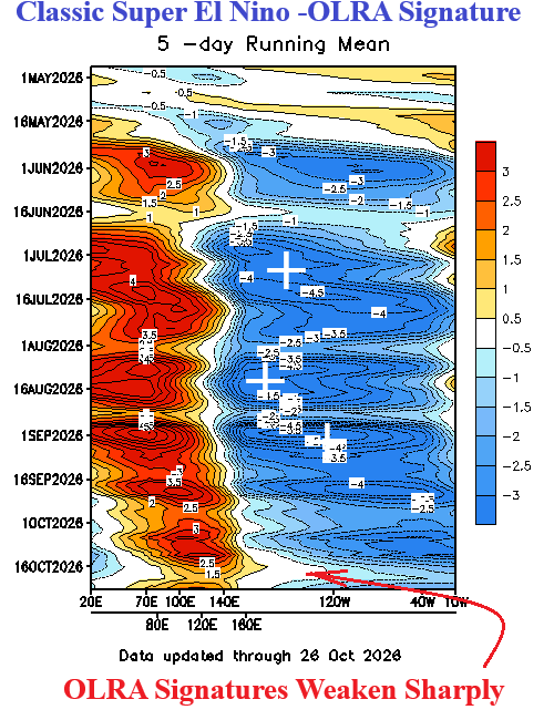
Fig. 1: NOAA/CPC outgoing longwave radiation anomalies since May 2026.
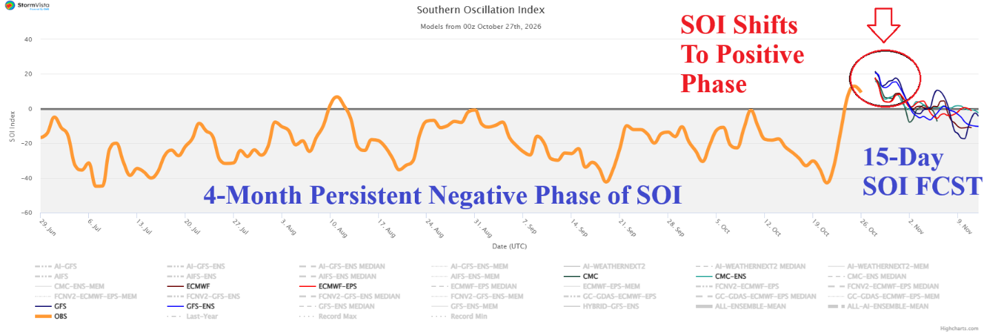
Fig. 2: 120-day southern oscillation index observations and 15-day forecast.
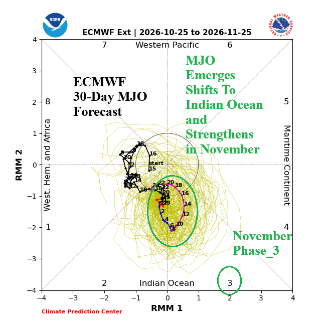
Fig. 3: ECMWF 30-day Madden Julian oscillation forecast.
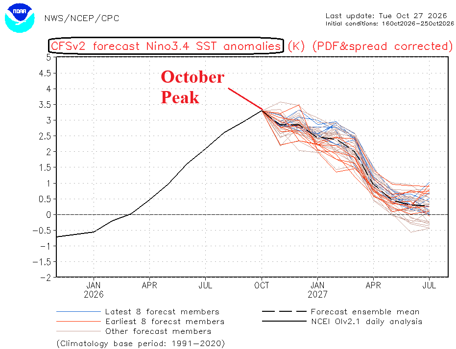
Fig. 4: NCEP CFS V2 Nino34 SSTA forecast through July 2027.