
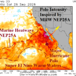
NEP25A, MJO, and Major Hurricane Polo Combine to Flood Southwest/South-central U.S. This Week
09/27/2026, 10:29 am EDT
Climate Impact Company Weekly ENSO Climate Diagnostics
Issued: Tuesday September 29, 2026
Highlight: Record warm Nino34, Nino3, and Nino12 SSTA still warming; Warming may accelerate next couple months.
Discussion: The Nino SSTA regions in the east-central and far east equatorial Pacific Ocean continue to warm. Currently, Nino34, Nino3, and Nino12 (Fig. 1) have shattered previous record warm SSTA produced by the Super El Nino episodes of 1982-83, 1997-98, and 2015-16. Unlike previous Super El Nino episodes when intensity tendency was to level off during Q4 followed by peak intensity during Q1 of the following year, the current Super El Nino is forecast to accelerate intensity beyond current record strength through Q4 (Fig. 2). Peak intensity of Super El Nino 2026-27 should occur before Christmas Day. Also unusual is the rapid deceleration in intensity forecast by some models (NCEP CFS V2) whereas ENSO collapses to neutral phase by northern hemisphere mid-to-late spring 2027 (Fig. 3). In this scenario, this time next year, La Nina is developing.
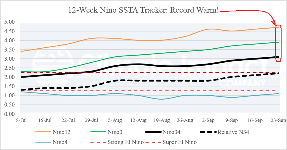
Fig. 1: The 12-week Nino SSTA monitor identify the evolution of record warm Nino34, Nino3, and Nino12 regions.
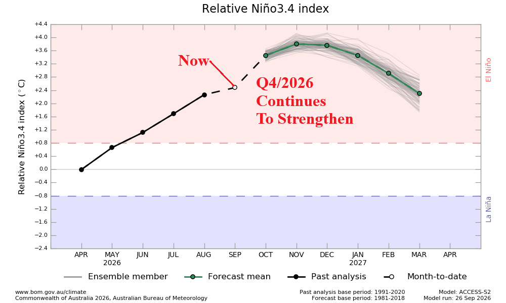
Fig. 2: The 12-week monitor of the Nino SSTA regions indicates strengthening Strong to Super El Nino.
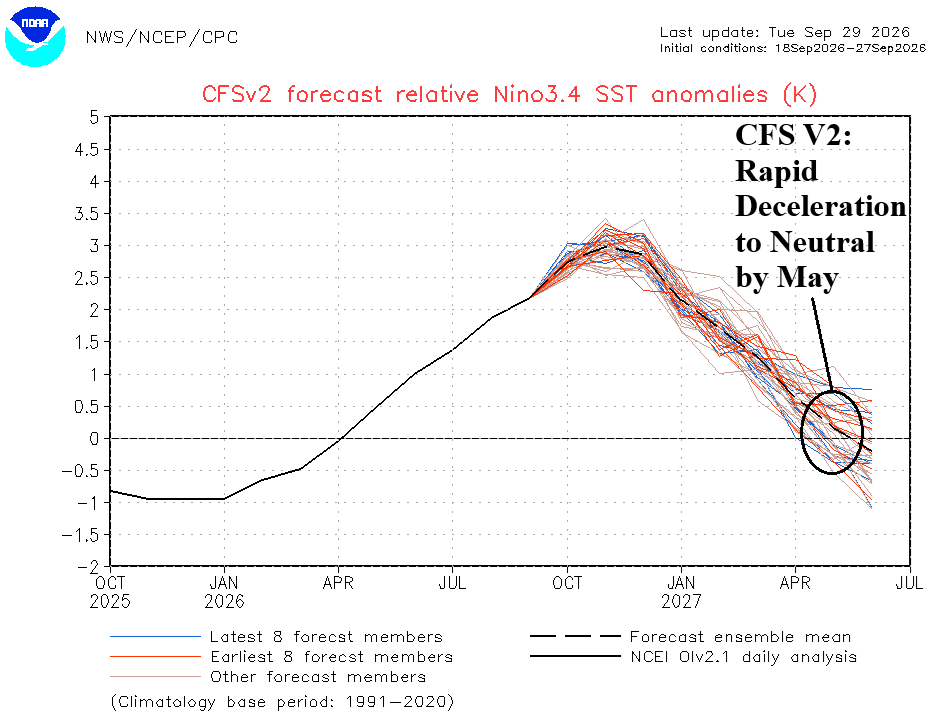
Fig. 3: The 12-week monitor of the Nino SSTA regions indicates strengthening Strong to Super El Nino.