
Queensland and Western Australia Dry-to-Drought Development
07/22/2026, 5:24 am EDT
Climate Impact Company North Atlantic Basin 10-Day Monitor
Issued: Thursday July 23, 2026
Highlight: Bertha likely remains minimal tropical storm today making landfall south of Galveston Bay early this evening. However, an immense rainfall event just offshore!
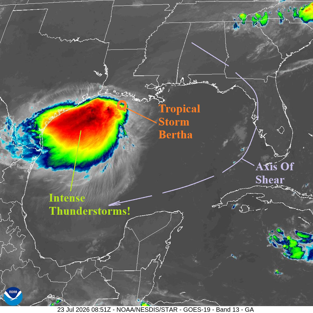
Fig. 1: Gulf of America weather satellite weather view.
Discussion: At 5AM EDT, Tropical Storm Bertha was located at 29.0N/92.2W or about 95 miles southeast of Lake Charles, LA. Bertha is moving west at 13 mph with top wind near 45 mph and central pressure 1003 MB. Bertha has reformed off the central coast of Louisiana. However, all the action is in the southwest quadrant of the storm where extreme rain from intense thunderstorm activity is taking place. NOAA/NHC indicates a meso-low pressure area within the heavy convection. Consequently, where Bertha’s actual center is located is erratic today. NOAA/NHC track remains consistent with a west to west-southwest trek making landfall near or south of Galveston Bay late today. Dry air entrainment from the strong high-pressure area to the north prevents much strengthening of Bertha today and the extreme offshore rainfall is expected to weaken by late today as Bertha makes landfall. Forecast models indicate periods of 35-40 mph wind gusts on the Texas to Southwest Louisiana Coast are likely today as the storm drifts westward. Tropical Storm Warning’s are issued for east of Freeport, TX through Galveston Bay and along the Louisiana South Coast. Bertha weakens rapidly once inland tonight and Friday.
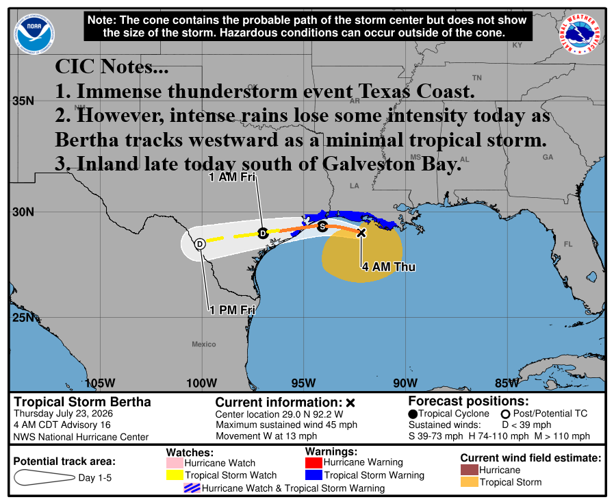
Fig. 2: NOAA/NHC 3-day forecast track for Tropical Storm Bertha.
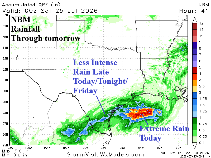
Fig. 3: NBM THU/FRI rainfall forecast for ERCOT.