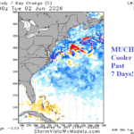
Western North Atlantic SSTA Cool Off Sharply
06/03/2026, 8:49 am EDT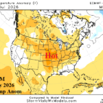
ECM “Monthlies” Hot/Dry Great Plains JUL/AUG
06/05/2026, 1:55 pm EDT
Climate Impact Company Week 2-4 Outlook
Australia
Issued: Thursday June 4, 2026
Highlight: Changeable pattern; Wet again East late month.
Charts of the day: May 2026 rainfall/temperature review.
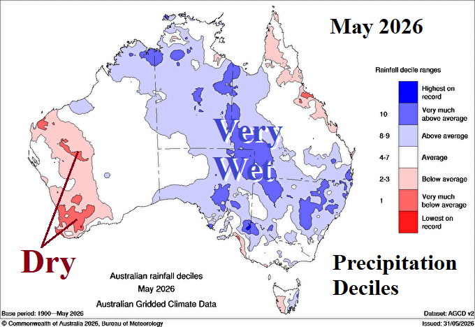
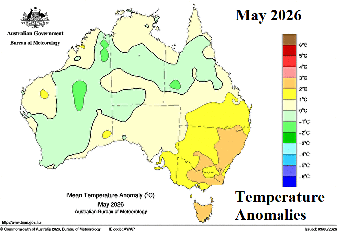
Discussion: During May 2026, the prevailing upper air pattern featured an upper trough across western continent with a compensating ridge in the East. The upper trough was causal to heavy rain across central and eastern continent during May while the upper ridge warmed New South Wales. The wet pattern during May was primarily related to the proximity of the Madden Julian oscillation.
Week-2 (June 14-21, 2026): Warm/mostly dry North and East Australia.
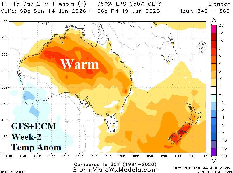
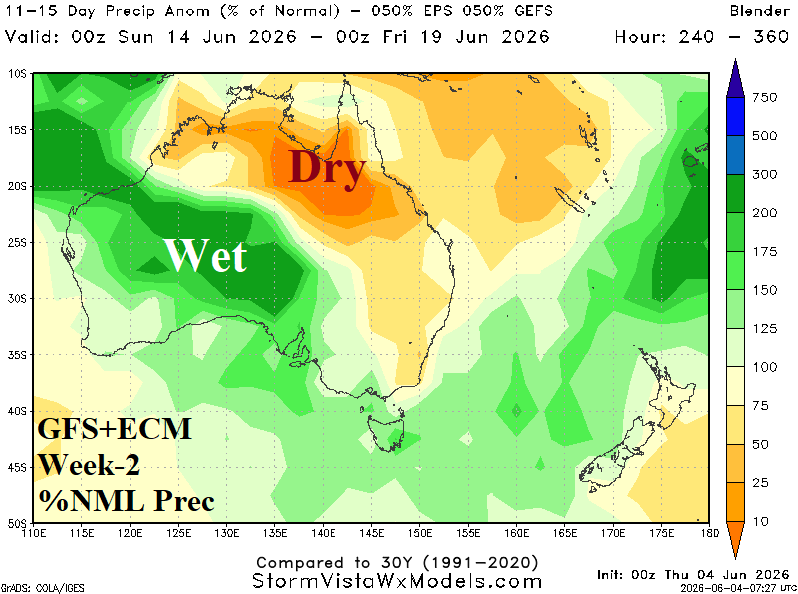
Discussion: Weak upper trough adheres to the West Coast and causes wet weather for parts of the western continent while dryness and anomalous warmth are likely North and East Australia.
Week-3 (June 21-28, 2026): Wetter, less warm.
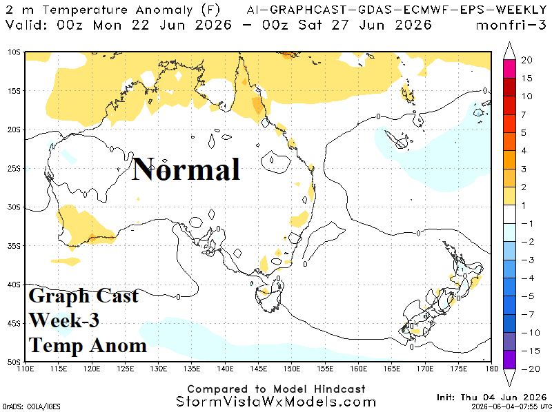
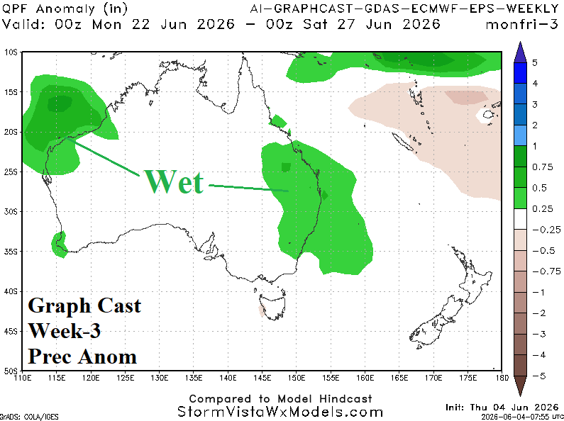
Discussion: AI Graph Cast emphasizes wet weather on the Northwest and East Coast and a cooler national pattern in late June.
Week-4 (June 28-July 5, 2026): Warmer North.
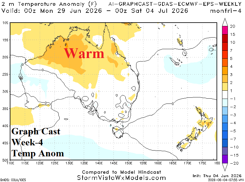
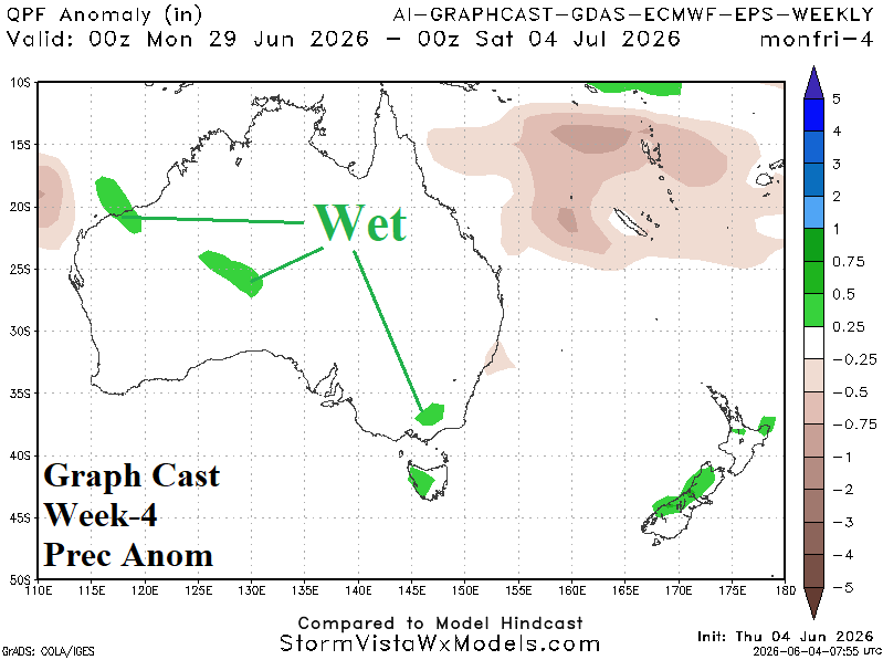
Discussion: Anomalous warmth and dryness regenerates across the North. Marginally wet weather streaks from the northwest coast into Southeast Australia.