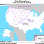
Snowy Last Week of November Northwest/North-central U.S.
11/16/2025, 12:19 pm EST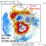
12Z GFS Shifts Stratospheric Warming to Northern Canada, Causes Cold 11-15-day Forecast for U.S.
11/18/2025, 12:44 pm EST
Climate Impact Company Early AG Market ALERT
Issued: Monday November 17, 2025
Highlight: Wet shift to Brazil, wetter Europe, wild temperature changes Australia.
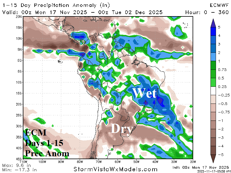

Fig. 1-2: The ECM 15-day precipitation anomaly forecast for South America plus the ECM “Weeklies” model 16-30-day percent of normal rainfall outlook.
Discussion: The Antarctic oscillation (AAO) remains highly negative. The -AAO regime supports above normal strength of mid-latitude upper troughs in the southern hemisphere. A strong upper trough is located off the South America East Coast this week. The tail end of the trough extends to Brazil and lingers the next 2 weeks causing heavy rainfall risk to shift exclusively to Brazil (Fig. 1). In the extended range, the -AAO regime lingers. Additionally, the Madden Julian oscillation (MJO) shifts from phase_6 (Maritime Continent to the Dateline) eastward to phase_7 (including the longitude of the Americas) increasing South America rainfall risk. The -AAO/MJO combination sustain the wet pattern in Brazil during the 16-30-day period (Fig. 2).
The upper air pattern projected across Europe during the next 1-2 weeks features a deep upper-level low-pressure trough (Fig. 3) causing chilly weather for the next 10 days (at least) and excessive rainfall capable of producing flooding in parts of central, south, and southeast portions of Europe (Fig. 4). Heavy snows are likely in the South-central Europe mountain areas, and the wet regime extends eastward to include Ukraine.
In Australia, the 10-day rainfall forecast indicates heavy rains on the North Coast while Southeast/Southwest Australia crop areas are wet (Fig. 5). A hot spike in the East in the 6-10-day period is followed by a much cooler regime in the 11-15-day forecast (Fig. 6-7).

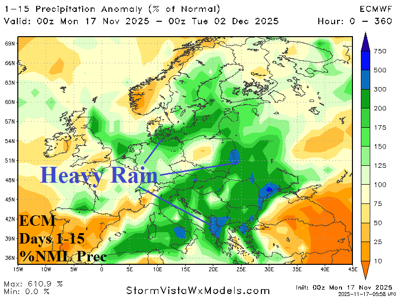
Fig. 3-4: The ECM 15-day precipitation anomaly forecast for South America plus the ECM “Weeklies” model 16-30-day percent of normal rainfall outlook.
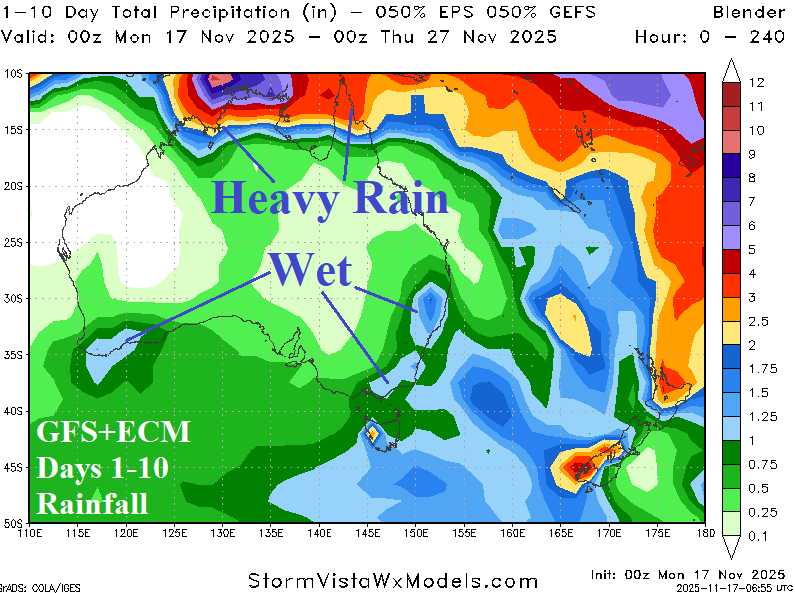
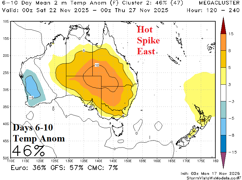
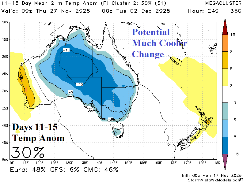
Fig. 5-7: The Australia 10-day rainfall forecast and medium range temperature anomaly risk pattern change.