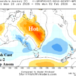
Shifting MJO Delivers Hot/Dry Changes to East Australia Late JAN/Early FEB
01/16/2026, 10:26 am EST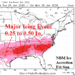
Incoming Arctic Air Causes Widespread Major Ice Storm South/Southeast U.S. This Weekend
01/20/2026, 5:14 am EST
![]()
Climate Impact Company MLK Day Report
Issued: Monday, January 19, 2026
Highlight: Arctic air, snow and ice. Cold blast East finishes January.
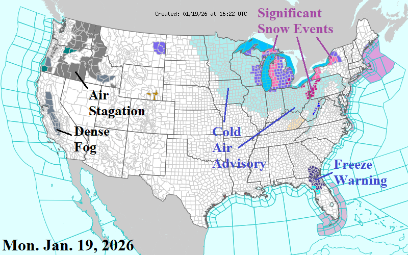
Fig. 1: The NOAA/NWS weather watch, warning, and advisories.
Discussion: Cold air, made more intense by wind, roars across the Great Lakes region today (Fig. 1). High impact weather includes snow squalls making travel impossible downwind the Great Lakes. The high wind/colder temperatures shift across fresh snow cover in the Northeast tonight. Yet another Freeze Warning for Northeast Florida tonight. Air stagnation and fog is an issue in the Northwest U.S. and San Juaquin Valley.
The next major issue for the U.S. is an arctic outbreak scheduled to arrive across the northern Great Plains Wednesday night, according to the just arrived 12Z GFS. On Thursday, the arctic boundary shifts southward reaching Des Moines to Chicago early evening, accelerating southward Thursday night to northwest Texas Friday morning and eastward across Arkansas to the Ohio Valley. By Friday afternoon, the arctic air is filtering through New England and into the northern Mid-Atlantic region southwestward to northern Texas.
The core of the arctic air shifts from South-central Canada Thursday morning to Ontario/Quebec next weekend. Chicago makes a run at -10F Friday night while weekend mornings are around 5F in New York City. Dallas dips to 20F late weekend mornings; 10F by Monday morning in Richmond, VA. Mid 20’s are possible late weekend, in Houston.
The southern periphery of the arctic air mass will be associated with high impact weather including snow, sleet, freezing rain/ice, and wind. For now, preferable is the NBM snow and ice forecast which indicates a swath of significant snow across the southwest Great Plains Friday and eastward to Virginia for the weekend (Fig. 2-4). Low level arctic air carving through the Southern States implies freezing rain/ice accretion risk most dramatic Central Texas to Arkansas and Louisiana Saturday shifting to the Interior Southeast and Carolinas Sunday (Fig. 5).
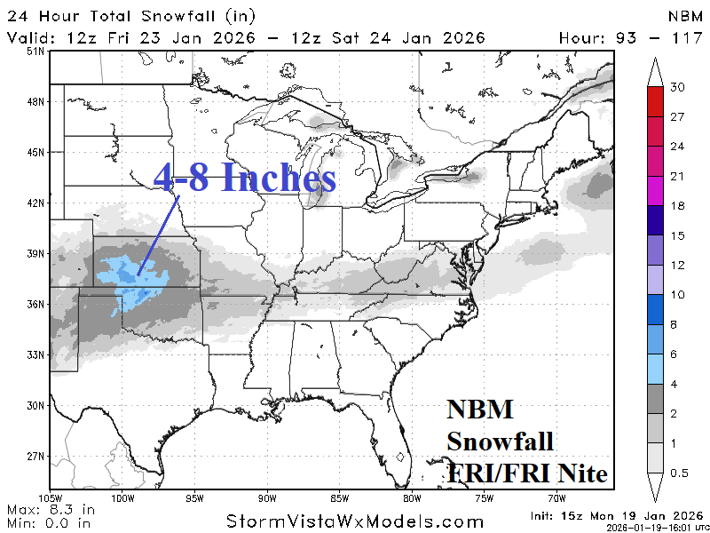
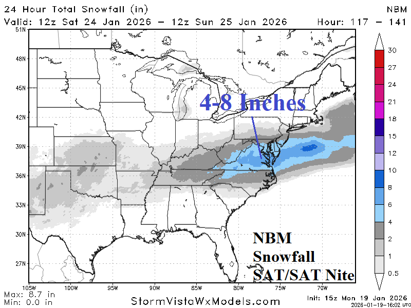
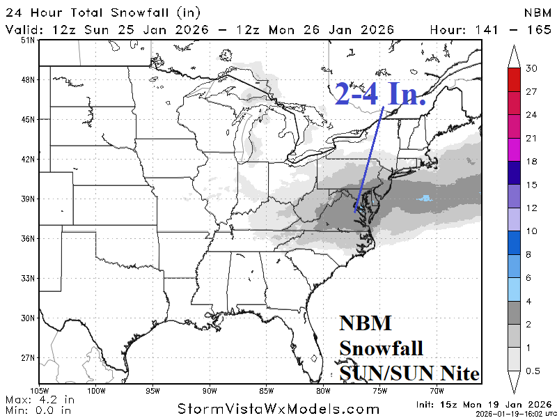
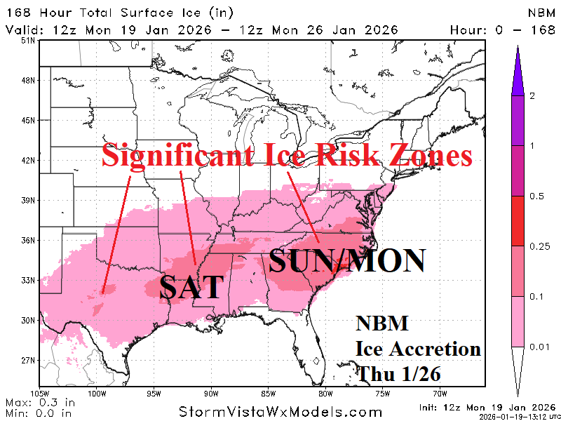
Fig. 2-5: NBM 24-hour snowfall forecasts for FRI, SAT, and SUN plus the ice accretion forecast through next Monday morning.
ECM ENS is aggressively cold across the eastern half of the U.S. during the medium range forecast enhanced, in-part, by expanding snow cover (Fig. 6-7). The U.S. gas population weight HDD forecast has skyrocketed colder over the weekend for the last week of January (Fig. 8). The 12Z GFS was not as cold as the consensus of overnight forecasts for next week but colder for early February.
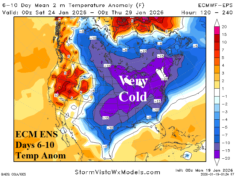
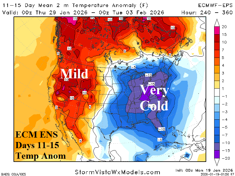
Fig. 6-7: The ECM ENS U.S. medium range temperature anomaly forecast.
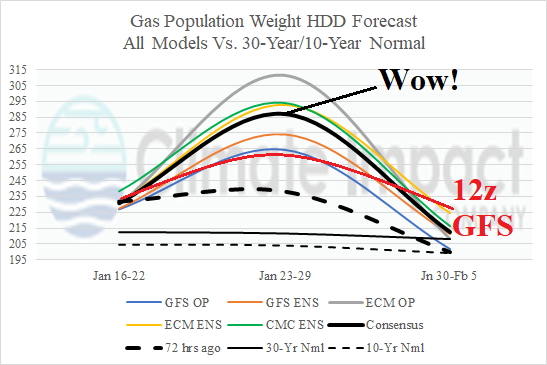
Fig. 8: U.S. gas population weight HDD forecast utilizing all models, their consensus and comparison with 72 hours ago and 10-year/30-year normal.