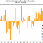
Northern Hemisphere Snow Cover for NOV-25 Near Normal But Lowest Amount Since 2009
12/05/2025, 6:30 am EST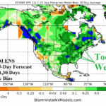
Is Lack of Equatorial Warm SSTA Contributing to Wet Bias of Operational/AI 15-day Forecasts?
12/10/2025, 7:09 am EST![]()
Climate Impact Company Midday Update
Issued: Monday December 8, 2025
Highlight: Solar maxima passed, minima ahead. Cold retreat days 11-15. But! Northern U.S./Canada snow depth immense by Christmas Day.
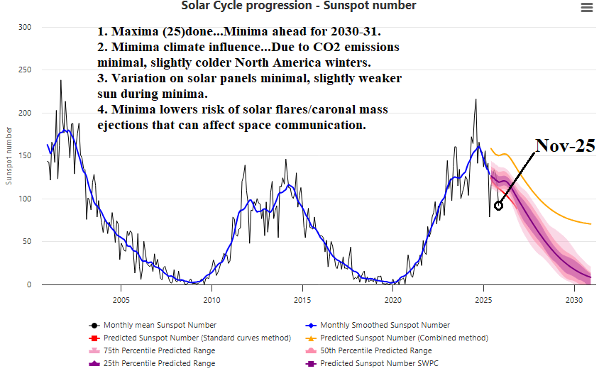
Fig. 1: The solar cycle progression/sunspot number for NOV-25 clearly indicates maxima has passed and solar minimum is ahead.
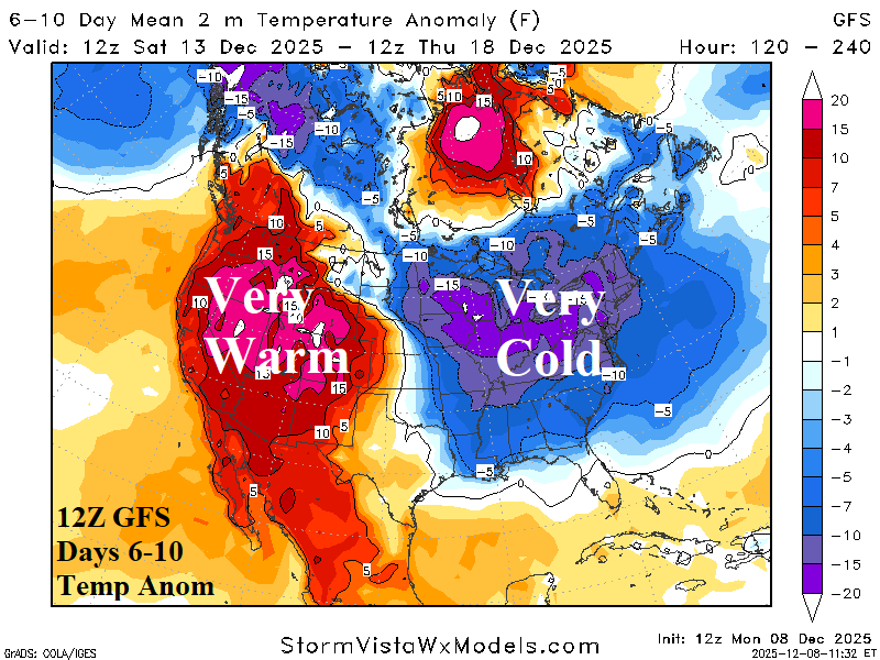
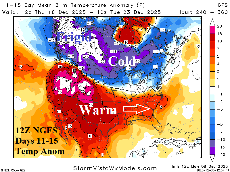
Fig. 2-3: The 12Z GFS medium range temperature anomaly forecast.

Fig. 4: The 12Z GFS snow depth forecast by day-16 indicates piling northern latitude amount.
Discussion: Solar cycle maxima 25 has passed and the NOV-25 sunspot number indicates deceleration toward solar minima likely by 2030-31 is underway (Fig. 1). Common questions are influences on climate which is minimal due to CO2 emissions although slightly colder North America winters are favored. There are minimal effects on solar panels due to a weaker sun during solar minimum. The 12Z GFS maintains the warm West/cold East 6-10-day forecast while western warmth extends to the Southeast States as cold air retreats (in the East) during the 6-10-day period (Fig. 2-3). The 12Z GFS snow depth forecast is reasonably reliable and indicates exceptionally deep snow cover by Christmas Day for the Northern U.S. and Canada (Fig. 4).
| EIA End | Forecast | 12-Hour Change | 24-Hour Change | 30-Year Normal | 10-Year Normal |
| 12/11 | 201.8 | +0.3 | +3.3 | 179.1 | 167.4 |
| 12/18 | 215.9 | -0.3 | -4.8 | 189.7 | 174.9 |
| 12/25 | 187.8 | +6.3 | -18.1 | 197.7 | 182.1 |
Table 1: The midday 12Z GFS U.S. gas population weight HDD projections into later December.