U.S. CDD Forecast Reverses Below Normal Electricity Demand Next Week to Above Normal Following Week
05/26/2026, 8:47 am EDT
+ABNA Index Dominates North America Climate Signals
06/01/2026, 9:07 am EDT![]()
Climate Impact Company Midday Update
Issued: Thursday May 28, 2026
Highlight: 12Z GFS warm forecast is steady but cooler/wetter East.
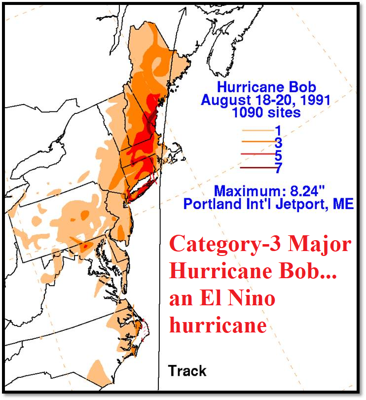
Fig. 1: It’s an El Nino tropical cyclone season but hurricanes can still be dangerous and make U.S. landfall.
Discussion: While the number of hurricanes is diminished during El Nino, damaging hurricanes can still form. Famous moderate-to-strong El Nino year hurricanes include Category-4 Major Hurricane Idalia striking the Big Bend Region of Northwest Florida (2023), Category-4 Major Hurricane Lili striking the Southwest Louisiana Coast (2002), and Category-3 Major Hurricane Bob (Fig. 1) making 2 landfalls in Rhode Island (1991).
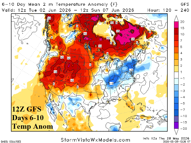
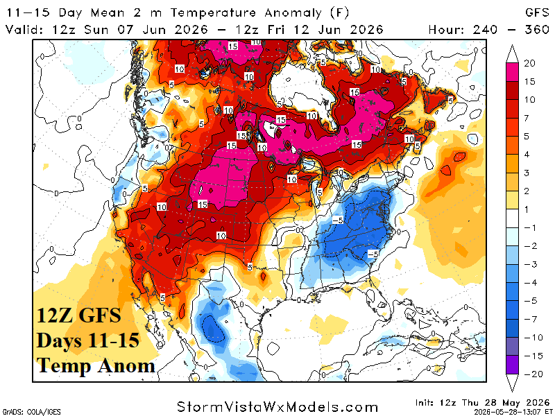
Fig. 2-3: The 12Z GFS U.S. medium range temperature anomaly outlook.
The 12Z GFS steadily emphasizes anomalous warmth from California (away from the coast) and the Southwest U.S. northeastward through Canada (Fig. 2-3). The East shifts wetter and cooler.
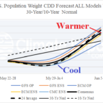
| CDD EIA End | Forecast | 12-Hour Change | 24-Hour Change | 30-Year Normal | 10-Year Normal |
| 5/28 | 35.6 | 0.0 | +0.2 | 35.1 | 38.5 |
| 6/4 | 37.5 | -1.0 | +1.9 | 42.0 | 45.8 |
| 6/11 | 52.3 | -22.9 | -9.0 | 49.2 | 53.8 |
Table 1: The midday 12Z GFS U.S. population weight CDD projections into middle June.