
Mild Winter 2026-27 Europe/Western Russia Outlook
09/03/2026, 5:50 am EDT
U.S. Daily Report: Summer 2026 is hottest on record.
09/09/2026, 4:21 pm EDT

Climate Impact Company U.S. Labor Day Report
Issued: Monday, September 7, 2026
Highlight: East Pacific tropics contributing to the North America weather pattern.
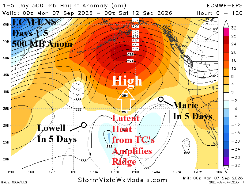
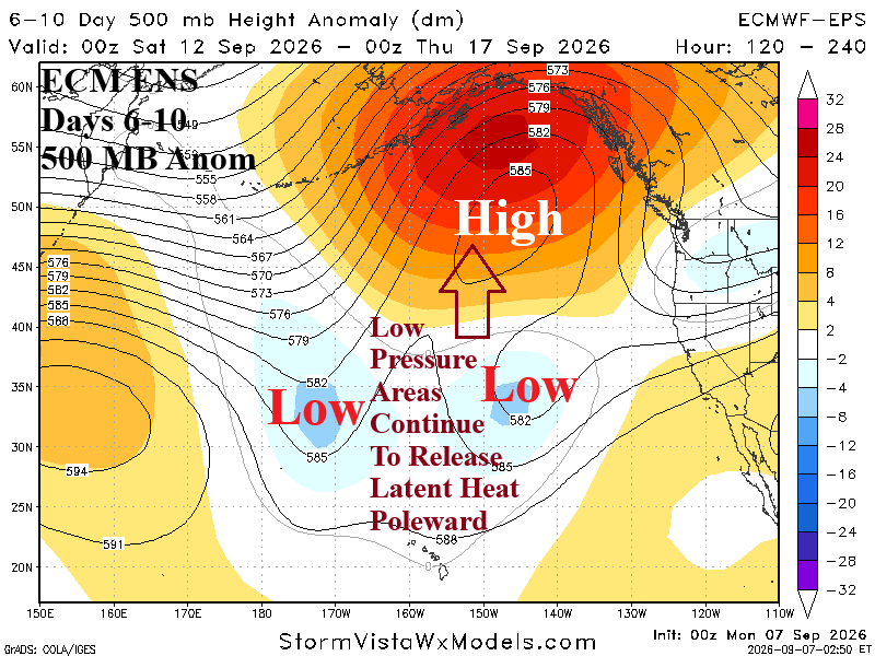
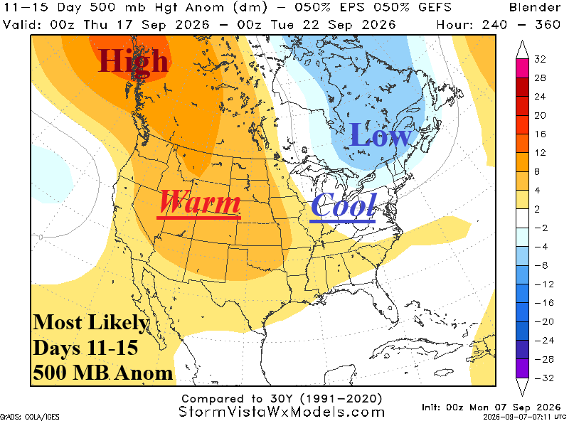
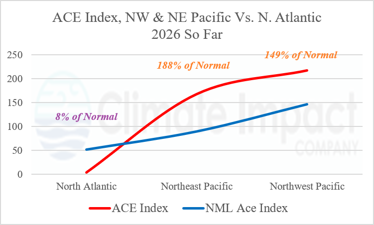
Fig. 1-4: ECM ENS 500 MB anomaly forecast for the East Pacific (upper), mega-cluster ensemble “most likely” 500 MB anomalies forecast for days 1-15, and ACE index for 3 ocean basins during the 2026 tropical cyclone season (so far).
Discussion: Hurricane Lowell moves north, to just west of Kauai tonight, and weakens slowly to a tropical storm while turning westward later this week while Tropical Storm Marie drifts northwestward staying well west of California. Additional tropical systems are possible in the East Pacific this week. The latent heat release from the attendant convection of each system causes the high-pressure system to the north to amplify this week (Fig. 1) and shift slightly eastward in the 6-10-day-period (Fig. 2) maintaining strength as additional latent heat from tropical/subtropical convection to the south continues. In the 11-15-day period, the amplified ridge pattern across Northwest North America is compensated for by a cool upper-level low-pressure drought extending into the East U.S. from Quebec (Fig. 3). The Northeast Pacific tropics have been busy as identified by a 168.0 accumulated cyclone energy index, almost double normal for early September (Fig.4). The Northwest Pacific has been busy with nearly 150% of normal ACE while the North Atlantic observes record quiet with an ACE of 4.1, just 8% of normal. The busy East Pacific tropics are certainly affecting the North Atlantic upper air pattern heading toward mid-September.
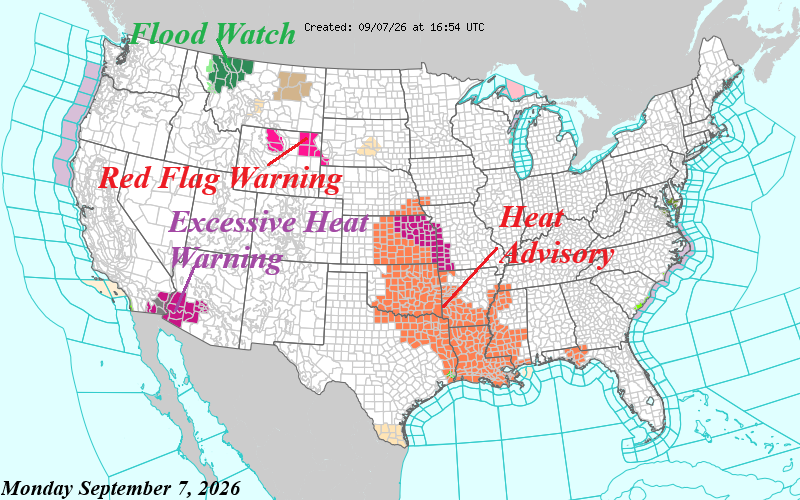
Fig. 5: Latest NOAA/NWS weather watch, warning, and advisory areas.
Currently, the Mid-south U.S. heatwave lingers with advisories extending from Kansas to Louisiana (Fig. 5). Excessive Heat Warnings are in effect for the Desert Southwest. Flooding is taking place in the northwestern Montana Mountains.
During the medium range, hot weather stays in the Mid-south and pulses into the East (Fig. 6). However, as the ridge builds in the West, a compensating trough amplifies cooling the Midwest to Northeast States in the 11-15-day period (Fig. 7). The latest U.S. population weight CDD forecast maintains the above normal U.S. cooling demand through mid-September cooling to near normal for the following week (Fig. 8).
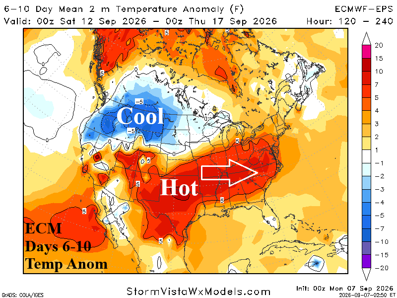
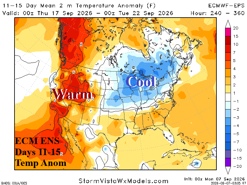
Fig. 6-7: ECM ENS U.S. medium range temperature anomalies forecast.
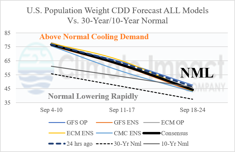
Fig. 8: Utilizing all models, the latest U.S. population-weight CDD forecast through early September compared with the 24-hour ago outlook and normal.