
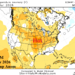
ECM “Monthlies” Hot/Dry Great Plains JUL/AUG
06/05/2026, 1:55 pm EDT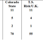
All Seasonal TC Forecasts Updated…Below Normal El Nino Year
06/10/2026, 1:46 pm EDT
Climate Impact Company Early U.S. Notes
Highlight: Severe weather alley…North-central/Midwest/South-central U.S. this week; Southeast flooding rains next week.
Today: New CIC 2-year ENSO outlook issued. What follows El Nino?
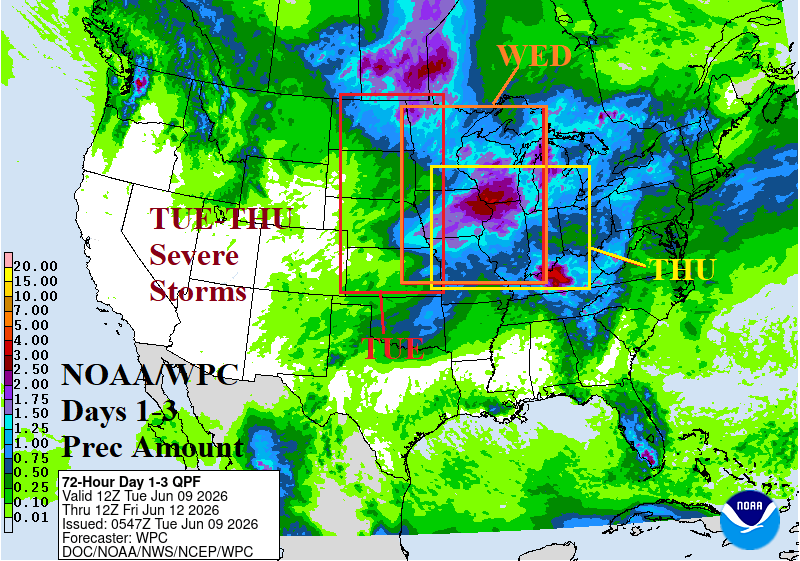
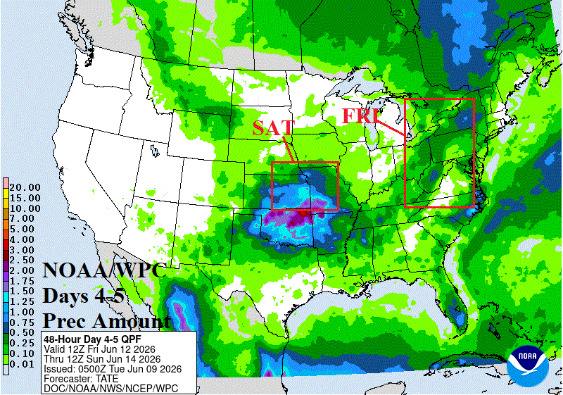
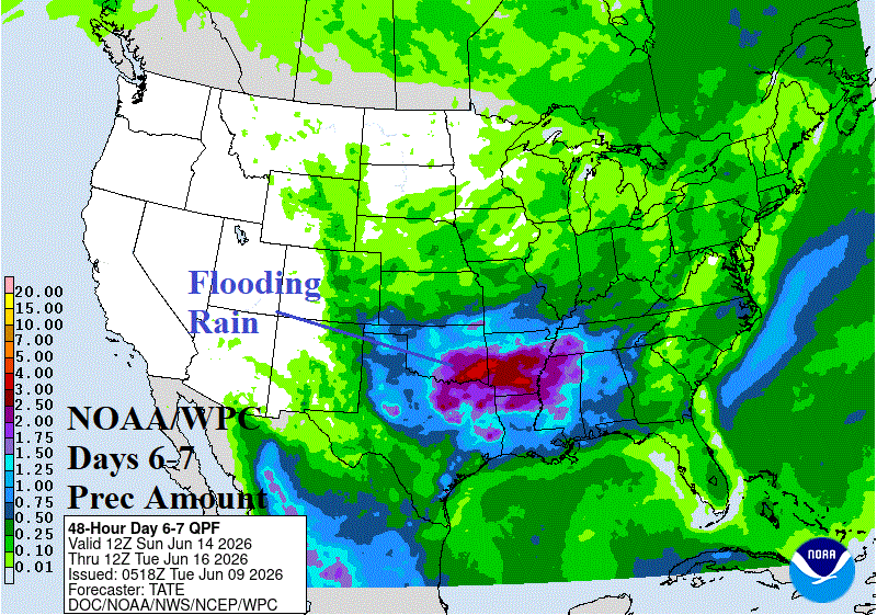
Fig. 1-3: The NOAA/WPC 1-7-day quantitative precipitation forecast with annotated severe weather zones,
Discussion: A plethora of severe weather is forecast this week into the weekend across the North-central U.S. to the Midwest States redeveloping in the South-central U.S. by the weekend. In the 3-day forecast, heavy rain is centered on North Dakota to the far eastern Canadian Prairies plus Illinois (Fig. 1). Severe storms produce much of the rain. An unusually high tornado risk for North Dakota today. An equally high tornado risk tomorrow is centered on the Iowa/Illinois/Wisconsin region. St. Louis to Chicago tornado risk is indicated for Thursday. By Friday, severe storms shift to the Interior Northeast U.S. (Fig. 2) and redevelop in the eastern Great Plains Saturday. On the weekend, heavy rain convenes in the Mid-south likely to feature severe storms (Fig. 3).
Excessive rain and attendant flood risk shift to the Southeast U.S./Gulf States next week, highest risk in the North-central Gulf region (Fig. 4). Next week (also) features excessive heat away from the coast in the West U.S. plus South Carolina to Florida (Fig. 5).
In a big win for AI, the cooler shift in U.S. CDD for next week was well forecast several weeks ahead thoroughly defeating ECM and CFS. The latest outlook utilizing all models into late June is somewhat cooler for next week as national CDD shifts toward the 30-year normal (Fig. 6). The week 3-5 forecast continues to offer cooler AI vs. warmer CFS/ECM differences although edging a little closer since Sunday’s outlook (Fig. 7).
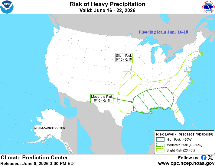
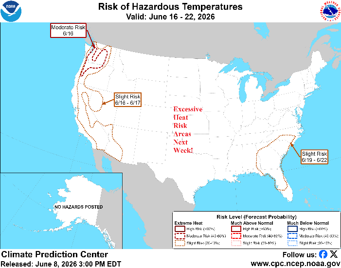
Fig. 4-5: NOAA/CPC high impact weather zones forecast for next week.
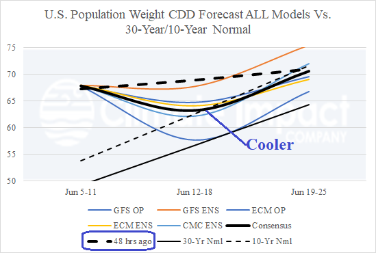
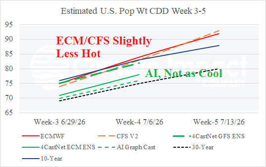
Fig. 6-7: The U.S. population weight CDD forecast utilizing all models through late June and estimates based on ECM/CFS and AI for week 3-5 ahead.