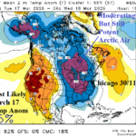
12Z Models Become Convincing on Significant Cold East-central Next Week (and Hot Weather Southwest)
03/09/2026, 5:02 pm EDT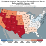
Winter 2025-26 State Temperature/Precipitation Rankings. Record Warm West/South; Scarry Dry Mid-south U.S.
03/11/2026, 9:51 am EDT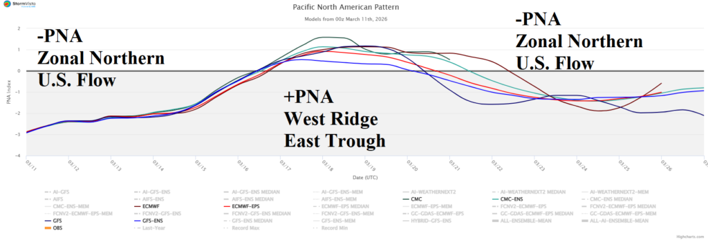

Climate Impact Company Early U.S. Notes
Issued: Wednesday March 11, 2026
Highlight: -PNA pattern rules; Big heat Southwest next week, cold pulse East.
Announcement from ECMWF: Coming in 2027…ERA6, the next generation of climate reanalysis from the Copernicus Climate Change Service (C3S).
C3S has started the production of our new reanalysis that responds to some of the main requests of our users. The result of almost a decade of research at the European Centre for Medium-Range Weather Forecasts – ECMWF, ERA6 will offer major improvements:
– More than double the horizontal resolution of ERA5 (down to ~14 km)
– Hourly reconstructions of the Earth system over more than 75 years
– An ocean model for consistent ocean–atmosphere–wave coupling
– Expanded historical observations, including rescued and reprocessed records
– Better access and usability for applications such as wind energy
The first decades of ERA6 will be released towards the end of 2027, with users able to download data from the first four decades by early 2028. ERA5 will continue to run operationally in parallel as long as needed.
Climate Impact Company comment: Big improvement in climate forecasts!
Discussion: The pick of the day climate signal is the Pacific North America (PNA) regime. The 15-day outlook (Fig. 1) reveals ongoing negative phase into the weekend helping to fuel a Pineapple Express into Washington (Fig. 2), shift to positive phase next week causing an amplified upper ridge to roast the Southwest U.S. (Fig. 3), and return to negative phase sustaining the cool/stormy North and warm/dry South split pattern (Fig. 4).
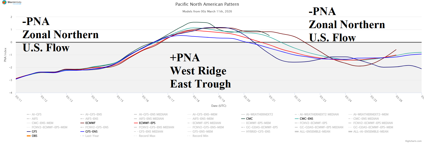
Fig. 1: Dominant in the 15-day outlook is the fluctuating Pacific North America (index) pattern.
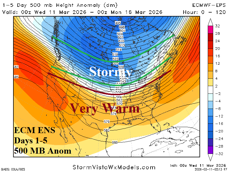
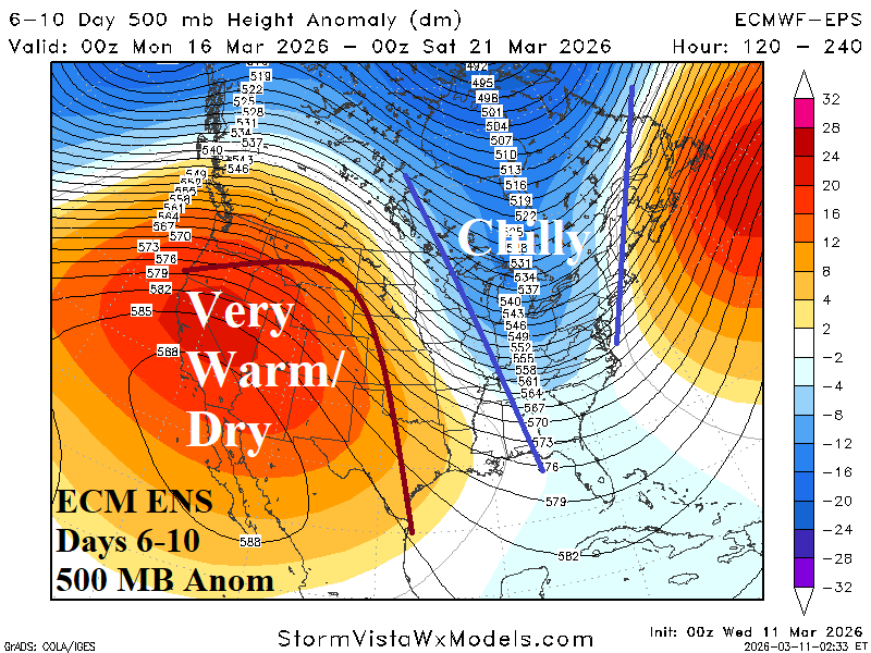
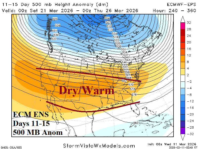
Fig. 2-4: The ECM ENS 500 MB anomaly 15-day forecast for North America.
Enough buckling in the upper air pattern remains in the forecast to deliver a late winter chill to PJM (Fig. 5) centered on March 16-18 when Chicago cold peak is 30/10 (March 17th). The cold peak is 3-5F less cold than forecast earlier this week.
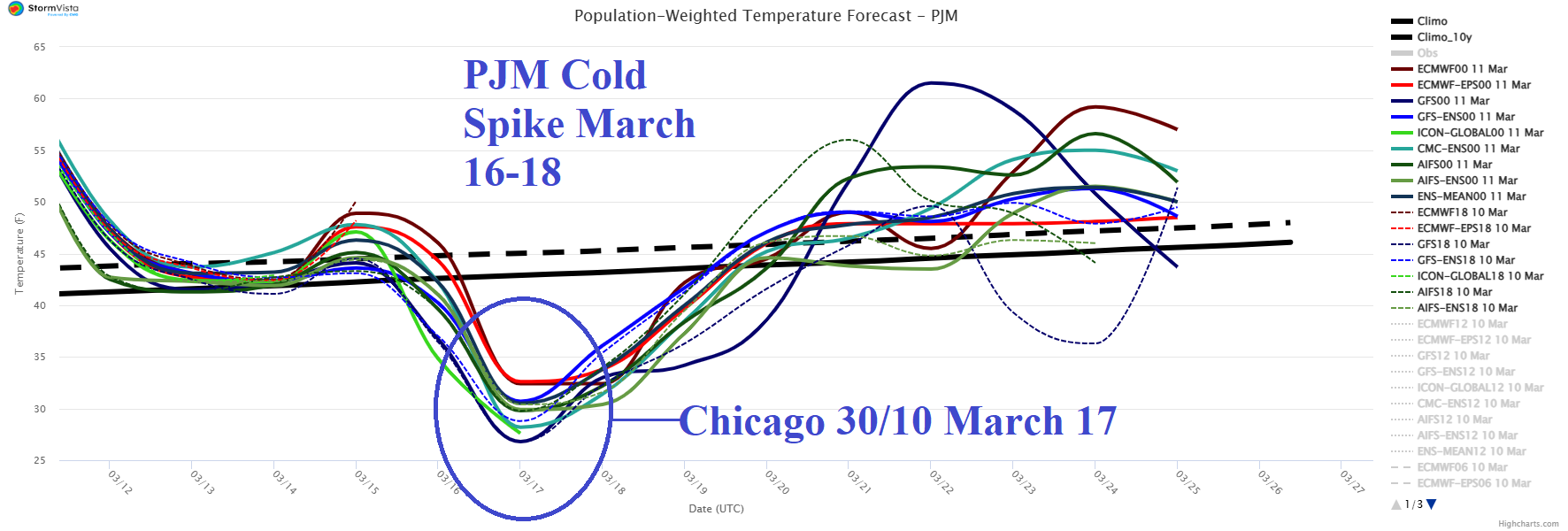
Fig. 5: The PJM 15-day population-weight daily average temperature tracker.
The Northwest Hydro 15-day percent of normal precipitation forecast remains buoyant due to a Pineapple Express storm track (Fig. 6). The 24-hour change is wetter especially into British Columbia (Fig. 7).
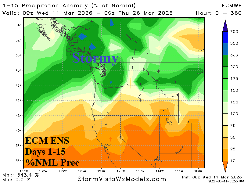
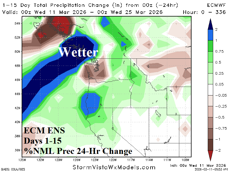
Fig. 6-7: The Northwest HYDRO 15-day percent normal precipitation forecast and 24-hour change.
The U.S. population weight HDD forecast is unchanged from yesterday showing moderate cold next week reversing warmer the following week (Fig. 8).
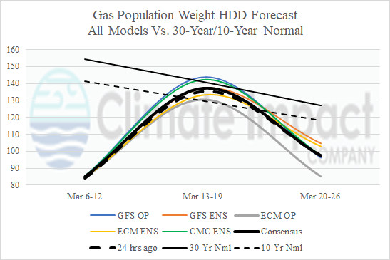
Fig. 8: The U.S. gas population weight HDD forecast utilizing all operational models, their consensus, and comparison with 24 hours ago and 30/10-year normal.