
-NAO Shifting East U.S. Medium Range Forecasts Colder
12/23/2025, 8:27 am EST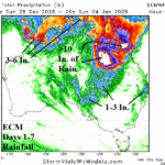
Excessive Rains This Week Queensland; More Heavy Rain East Australia Next Week
12/28/2025, 9:13 am EST
Climate Impact Company Early U.S. Notes
Issued: Friday December 26, 2025
One more day of excessive rainfall in Southern California plus today’s northern Mid-Atlantic snowstorm. A following storm and cold early next week.
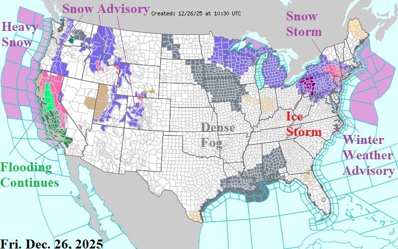
Fig. 1: NOAA/NWS weather watch, warning, and advisory areas.
Discussion: Many weather hazards continue this holiday weekend. Ongoing flooding is widespread in California as the “atmospheric river” storm track begins to wind down (Fig. 1). Heavy mountain snow continues for Northern California and Sierra Nevada Mountain Ranges. Snow advisories extend inland to the Rocky Mountains. Dense fog in the Midwest and Northern Gulf States, typical of unseasonably mild air. An ice storm rages in Western Pennsylvania and Winter Storm Warning for the northern Mid-Atlantic region today for heavy snow.
NOAA/WPC projects flooding rainfall in the San Diego to Los Angeles Basin stretch today (Fig. 2). The “atmospheric river” pattern abates after today. The snowfall amount forecast for today’s Northeast snowstorm continues to increase. NBM projects 8-12 inches of snow across Southeast New York including up to 6 inches in NYC (Fig. 3). Significant ice accretion is ongoing in Western Pennsylvania where amounts reach 0.50 inches causing widespread power outages (Fig. 4). The next storm brings heavy rain and flood risk early next week to Ohio/Western Pennsylvania (Fig. 5). Cold air with high wind follows causing snow squalls through the rainfall zone while ongoing heavy snow continues in Canada (Fig. 6). Arctic air forms over the deep snow cover in Southern Canada while cold Canadian polar air rushes into the South U.S. early-to-middle next week (Fig. 7-8).
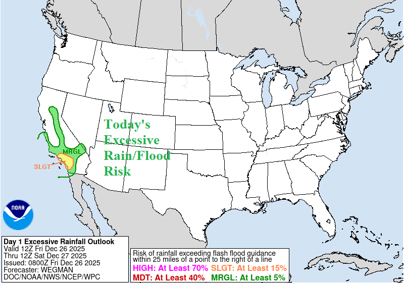
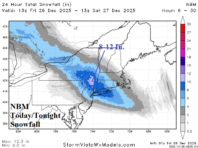
Fig. 2-3: Today’s excessive rain/flood risk area across Southern California and NBM snowfall amount forecast for the Northeast.
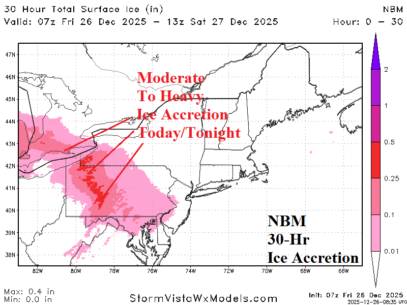
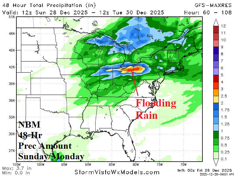
Fig. 4-5: Today’s NBM ice accretion forecast for the Interior Northeast and 48-hour precipitation amount forecast for the Sunday/Monday storm.
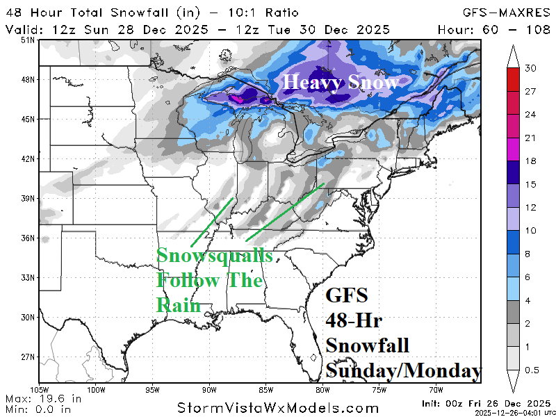
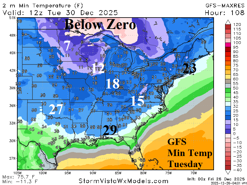
Fig. 6-7: The GFS 48-hour snowfall forecast for the Sunday/Monday storm and following (Tuesday) morning low temperature forecast by GFS.
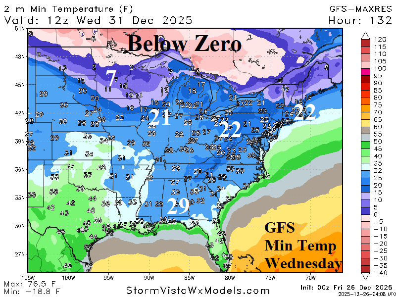
Fig. 8: GFS Wednesday morning low temperature forecast.