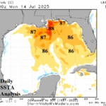
Low Pressure Drifting Toward 86-88F Water Temperatures Northern Gulf Later This Week
07/15/2025, 4:54 am EDT
Subsurface Equatorial East Pacific Showing Signs of Cooling
07/21/2025, 1:36 pm EDT
Climate Impact Company U.S. Daily Report
Issued: Thursday July 17, 2025
Highlight: New NOAA long-lead climate forecasts implicate the Southeast U.S. for tropical cyclone risk during peak season.
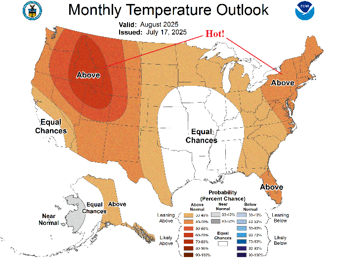
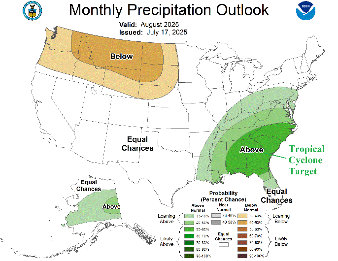
Fig. 1-2: The NOAA/CPC August 2025 probabilistic temperature and precipitation forecast.
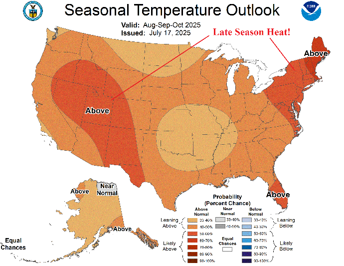
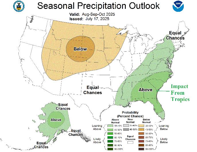
Fig. 3-4: The NOAA/CPC AUG/SEP/OCT 2025 probabilistic temperature and precipitation forecast.
Discussion: NOAA/CPC has updated their monthly long-lead probabilistic temperature and precipitation forecasts. Additionally, a new Seasonal Drought Forecast is issued. Of note, is the precipitation outlook for both August and AUG/SEP/OCT. The outlooks indicate a high probability of above normal rainfall in the Southeast U.S. The August probability forecast for above normal rainfall in the Southeast U.S. is exceptionally confident. Given the peak of seasonal activity of tropical cyclones occurring during August into early October plus climatology (and seasonal forecasts), favored is the Northeast Gulf and Southeast/Mid-Atlantic U.S. for coastal impacts and attendant heavy rain/flood risk extending well inland.
NOAA/CPC continues to emphasize a dry and hot climate causing drought to expand in the Northwest/North-central U.S.
Much of the West, Northeast, and Florida are aggressively forecast hotter than normal for late warm season into autumn.
The U.S. Seasonal Drought Outlook expands drought for the western half of the U.S. and eliminates drought for the eastern half of the nation.
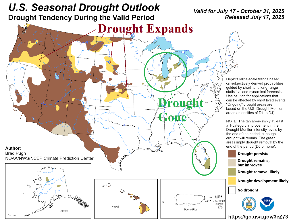
Fig. 5: The NOAA U.S. Seasonal Drought Outlook valid through Oct. 31, 2025.