
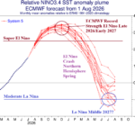
An Abrupt End to El Nino Early 2027; La Nina Possible by Mid-year
08/14/2026, 5:42 am EDT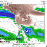
Northern Brazil Drought; Southeast Brazil Flooding for Spring
08/18/2026, 8:19 am EDT
Climate Impact Company Week 1-4 Outlook
North Atlantic Tropics
Issued: Sunday August 16, 2026
Highlight: Gradually increasing risk of TC development in a hostile El Nino environment.
Charts of the day: Tropical upper ocean heat; North Atlantic SSTA.
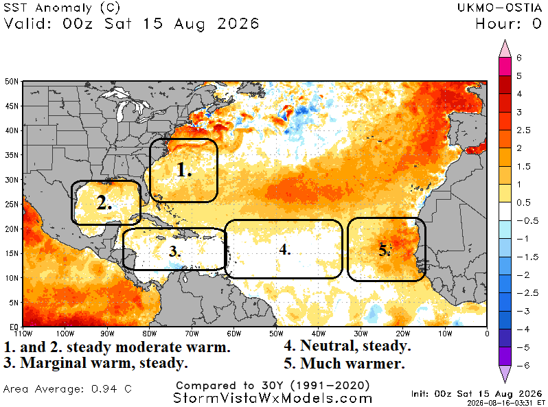
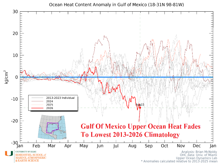
Discussion: The North Atlantic basin is the warmest on record while a strong El Nino is present. The warming is inspired by marine heat waves in the subtropics and off the coast of Western Europe. The Gulf of Mexico, Caribbean Sea, and western North Atlantic basin are moderately warmer than normal with little recent change. In the tropics, SSTA is near normal in the central basin with sharp warming off the West Africa Coast. Upper ocean heat in the deep tropics is near normal given the 2013-25 available climatology. Interestingly, upper ocean heat in the Gulf of Mexico has plummeted to lowest levels on record given the 2013-25 climatology.
Week-1 Ahead (August 16-23, 2026): Monitoring subtropics/deep tropics but no development expected.
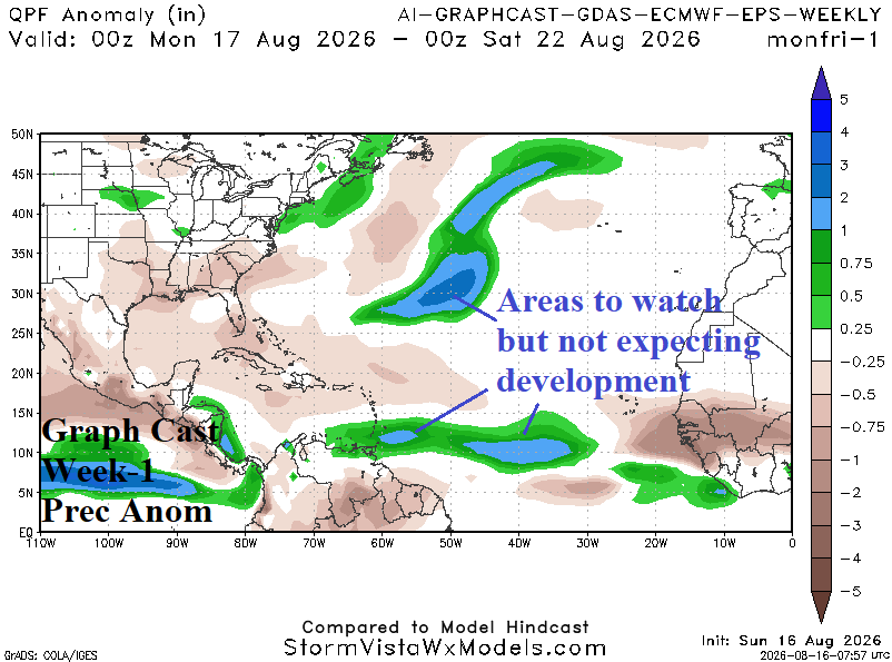
Discussion: Utilizing AI Graph Cast, areas of potential development for monitoring are present east of Bermuda and later this week in the deep tropics. However, tropical cyclone activity is not expected.
Week-2 Ahead (August 23-30, 2026): Increasing risk of TC development east of Bermuda and in the deep tropics.
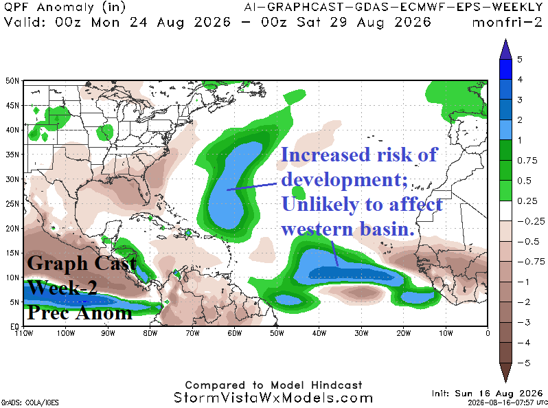
Discussion: Increased risk of development east of the Bahamas helped by somewhat warmer than normal surface temperatures. In the deep tropics, given emergence of tropical waves across very warm waters off the coast, systems maintain intensity shifting westward and could strengthen to a tropical cyclone.
Week-3 Ahead (August 30-September 6, 2026): Alert for northeast of Puerto Rico.
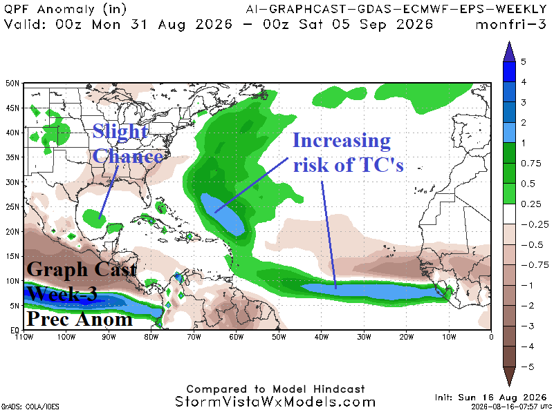
Discussion: Tropical cyclone risk increases, especially northeast of Puerto Rico, and possibly in the southwest Gulf of Mexico.
Week-4 Ahead (September 6-13, 2026): Increasing risk closer to U.S. Coast.
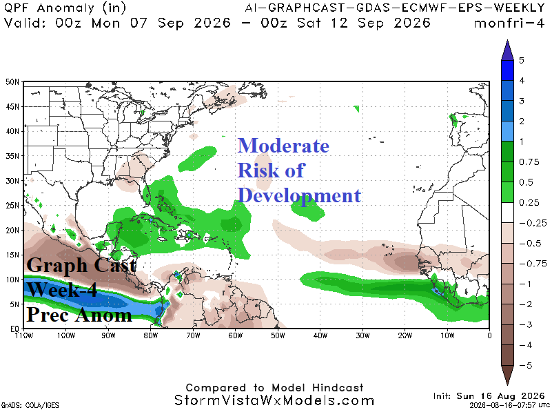
Discussion: As peak of season arrives, areas to watch for potential development shift westward to the Caribbean Sea and Bahamas.