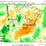
Super Dry Pattern East/South U.S. Continues
09/11/2025, 6:07 am EDT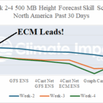
ECM “Weeklies” Rank No. 1 Past 30 Days for Week 2-4 Outlooks
09/16/2025, 2:29 pm EDT

Climate Impact Company North Atlantic Basin 10-Day Monitor
Issued: Monday September 15, 2025, 9:30AM EDT
Highlight: 92L likely to develop but stays out to sea.
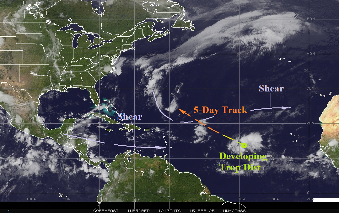
Fig. 1: Morning weather satellite view of the North Atlantic basin.
Discussion: A tropical disturbance in the east-central North Atlantic basin is developing. A tropical cyclone is likely by midweek. Upper shear northwest of this system may slow significant development. This system will stay well out to sea. Otherwise, no significant tropical cyclone risks exist in the 10-day outlook.
During late May 2013, the CIC seasonal forecast for North Atlantic basin tropical cyclone activity was 13 storms, 8 hurricanes, and 4 intense hurricanes. The verified total was 13 storms but only 2 hurricanes and o intense hurricanes. The unexpected issue that year was the presence of an intense upper tropospheric trough east of Florida erasing ventilation required in the upper atmosphere to allow tropical cyclones to form. This year, the late May CIC forecast indicated 16 storms, 7 hurricanes, and 3 intense hurricanes. So far, only Erin reached hurricane strength. This year, dry air in the mid-troposphere across the Gulf of Mexico and Caribbean Sea have been culprits plus (more recently) upper-level westerly shear. The under-performing tropical season in 2013 was followed by a “polar vortex” winter in North America and current (CIC) winter forecasts are indicating similar potential for JAN/FEB 2026.