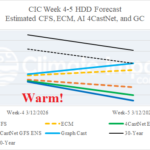
Estimated U.S. HDD for Week 4-5 Ahead (Very) Warm as Heating Demand Lowers
02/18/2026, 8:58 am EST
SUN/MON Northeast Coastal Storm Could Produce Blizzard Conditions
02/20/2026, 5:24 am EST

Climate Impact Company Week 2-4 Outlook
Europe/Western Russia
Issued: Thursday, February 19, 2026
Highlight: The cold North and warm/stormy South pattern gradually erodes.
Charts of the day: Scandinavia index identifies onset of pattern change.
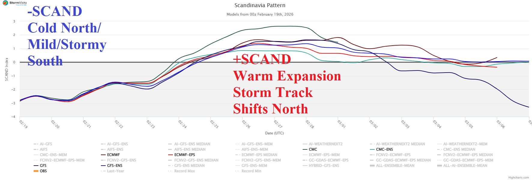
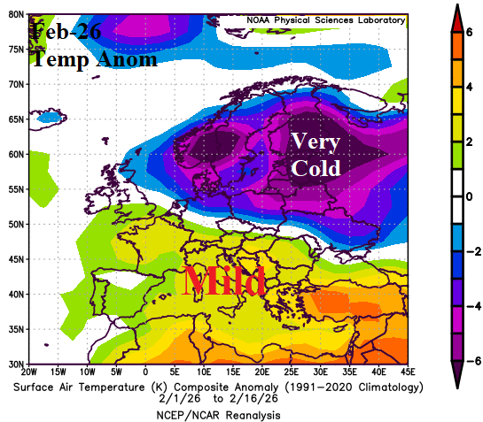
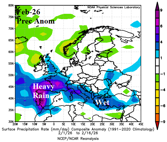
Discussion: The Scandinavia Index was negative during February and remains negative for the weekend. However, the -SCAND reverses to positive phase later next week causing the pattern to change from cold across the North and mild/stormy South so far in February to somewhat milder and drier for the southern half of Europe while cold eases in the North heading into March.
Week-2 Ahead Forecast valid March 1-8, 2026: Milder pattern change; Storm track shifts north and loses intensity.
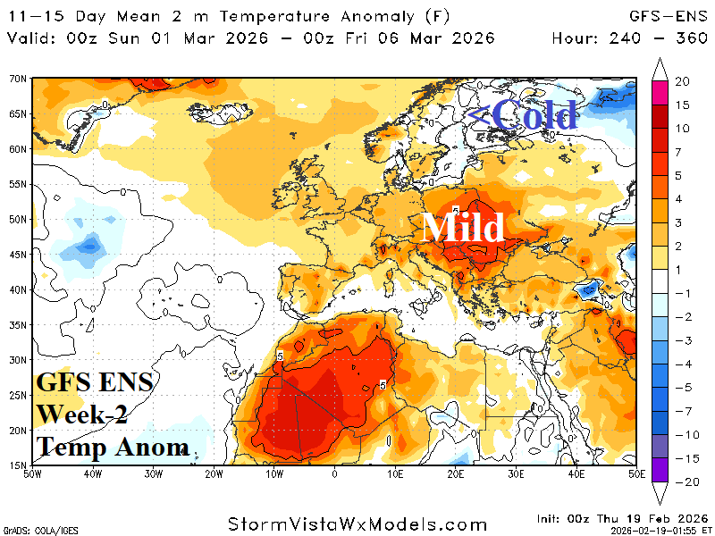
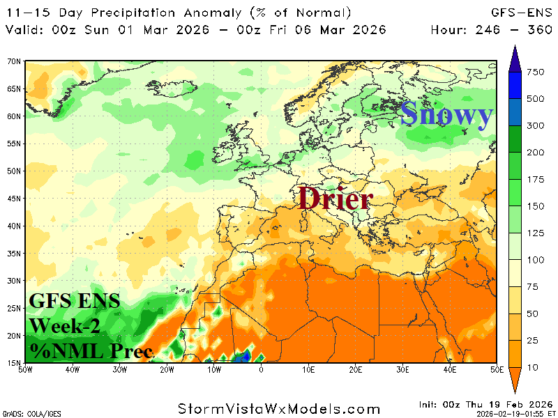
Discussion: Interestingly, the GFS ENS has scored number 1 in forecast skill the past 2 weeks for Europe. The GFS ENS is used to project the week-2 ahead regime. Indicated is broadening mild weather across Southern Europe while the storm track shifts northward.
Week-3 Ahead Forecast valid March 8-15, 2026: A drier pattern.
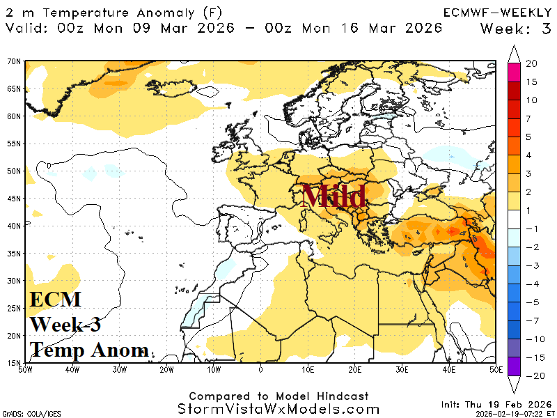
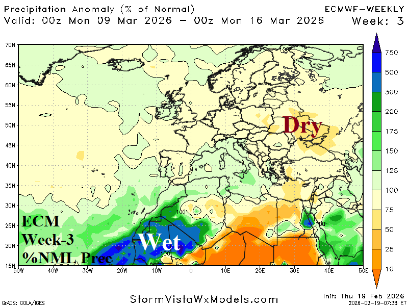
Discussion: Broad upper-level high-pressure ridge amplifies over Eastern Europe. The ridge causes a dry pattern. However, warmth is limited by snow cover.
Week-4 Ahead Forecast valid March 15-22, 2026: Mostly mild; storminess tries to return.
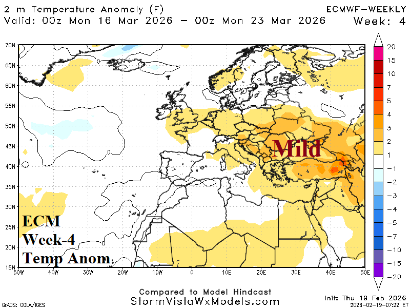
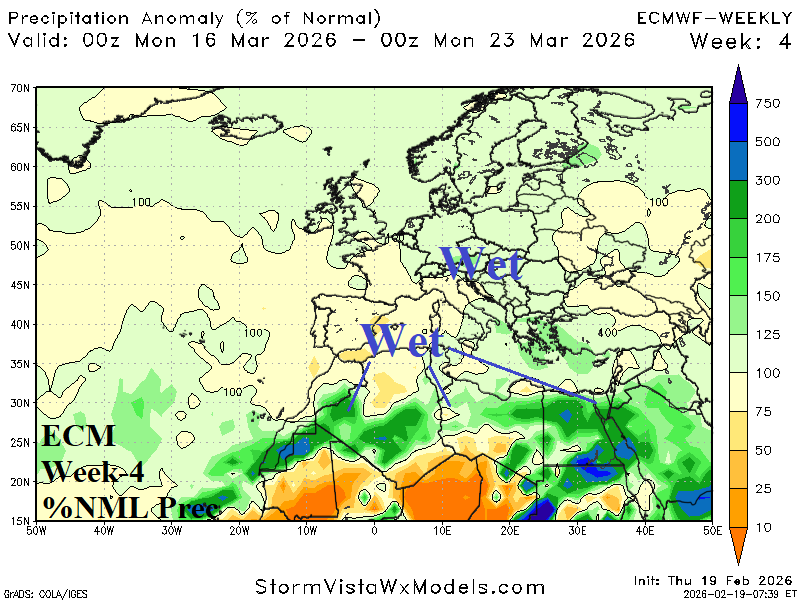
Discussion: Potential for wetter weather returning to Central Europe with (mostly) milder temperatures.