
Stratospheric Warming Vs. El Nino Climate
11/13/2026, 5:18 am EST
Climate Impact Company Research Report
Issued: Tuesday, November 17, 2026
Highlight: Developing cool (SSTA) pool in Northeast Pacific (along with Super El Nino) shapes North America winter pattern.
Discussion: Northeast of Hawaii and south of the Gulf of Alaska, an area of cool sea surface temperatures (SSTA) is developing clearly identified within the 30-day change (Fig. 1-2). Aloft, the large area of cooling ocean waters is well-correlated with a persistent upper trough stretching from the Aleutian Islands toward the California Coast (Fig. 3). Given the rate of cooling and the persistent upper trough pattern, Climate Impact Company expects the cool SSTA/upper trough pattern to persist (Fig. 4) and intensify through meteorological winter (Fig. 5).
A semi-permanent pressure system of this magnitude will cause a compensating downstream high-pressure area to form centered on Canada for most of the winter season. South of the “blocking” high pressure area, another semi-permanent low pressure area forms over the Southeast U.S.
Interestingly, while Super El Nino may enhance weather anomalies associated with the semi-permanent pressure systems described, especially Southern U.S. storm tracks, the El Nino is not causal. Climate Impact Company frequently identifies climate patterns associated with marine heatwaves (MHW) AND large cool pools of ocean waters which produce high impact climate not necessarily related to ENSO.
Note that as meteorological winter arrives anomalous low AND high pressure only effects North America. The regional SSTA pattern described in this report coupled with Super El Nino are responsible. Important is not to buy (completely) into high pressure over Canada automatically implies mild temperatures. Strong high pressure associated with arctic air can occur usually, but not always, attributed to sudden stratospheric warming (SSW) episodes.
High pressure in Canada, and possible attendant cold air, can flow southward into a vigorous East Coast winter 2026-27 storm track and cause “sneaky” heavy snows in this pattern, not typical of an El Nino winter. Strongest land-based low pressure persists across the Gulf States and combined with Super El Nino should cause a prohibitive cold season storm track featuring heavy rain, flooding, unusual severe weather, and possible mid-winter ice storms across the inland Gulf region.
The El Nino warming of surface water in the southeastern North Pacific northward to the California Coast suggests two high impact influences on climate. The prohibitive storm track generated by the gigantic low-pressure area across the North/Northeast Pacific when riding over the warm SSTA will cause excessive precipitation leading to heavy rain, mud slides, and very deep snow in mountain areas for California. At other times, the warm waters are causal to amplified high pressure areas bringing mild and dry relief.
Other impacts (for North America) include the likely near miss of atmospheric river patterns hammering the Canadian West Coast as most storms are to the south. Of course, the winter Super El Nino pattern should eliminate drought for the southern half of the U.S.
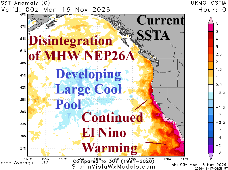
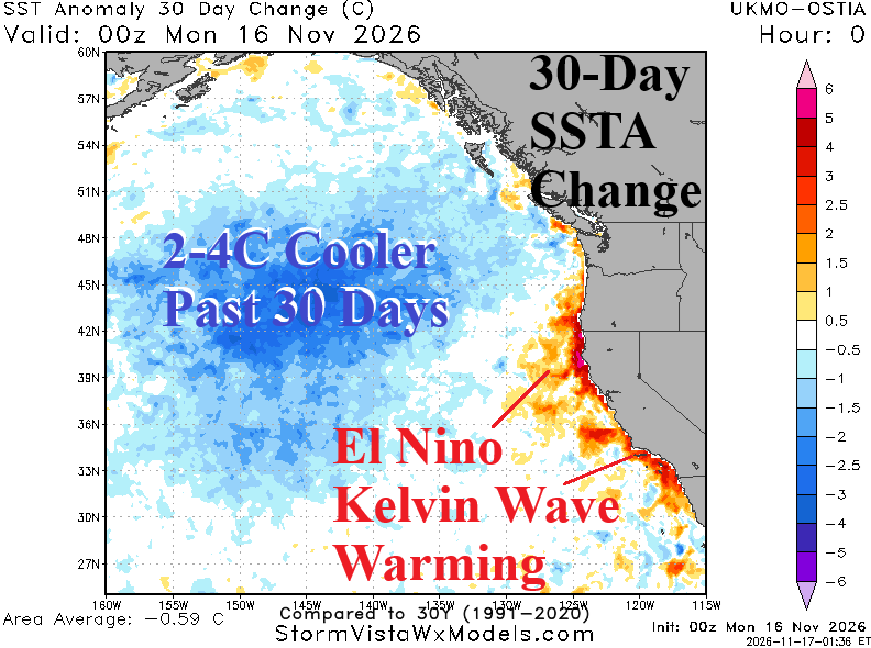
Fig. 1-2: Northeast Pacific Ocean daily SSTA analysis and 30-day change.
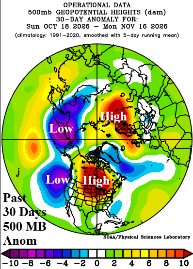
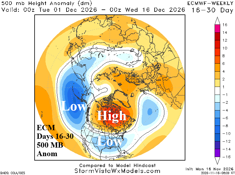
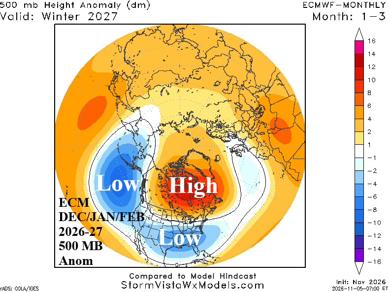
Fig. 3-5: Northeast Pacific Ocean daily SSTA analysis and 30-day change.