
Explaining The Natural Gas Price Rise
11/11/2026, 4:47 am EST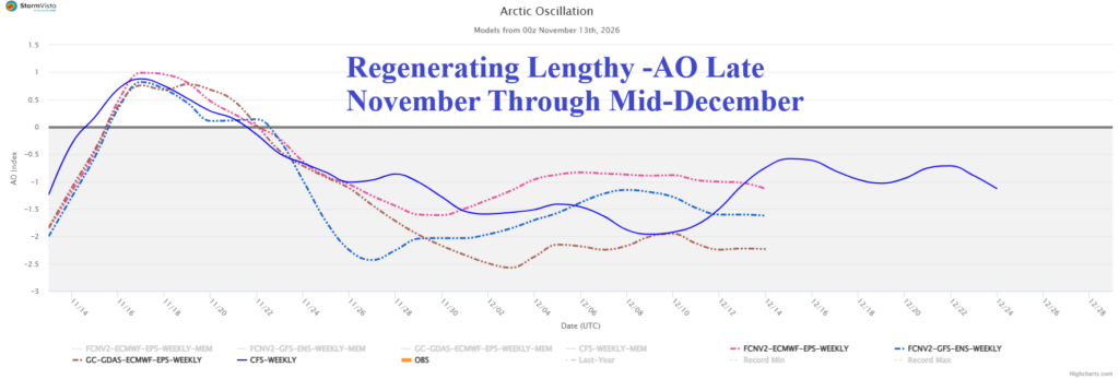

Climate Impact Company Daily Feature
Issued: Friday November 13, 2026
Sudden stratospheric warming causes peaking negative arctic oscillation now. However, -AO flattens next 10 days but returns in December. Trouble brewing?
Executive summary: There is a stratospheric warming/polar vortex cold vs. Super El Nino warm sentiment out there as meteorological winter approaches. The warming influence on the atmosphere by Super El Nino will be immense during northern hemisphere winter. Expectations of classic sudden stratospheric warming events to drive arctic outbreaks while not impossible will run into substantial resistance due to El Nino’s influence.
Discussion: The sudden stratospheric warming (SSW) episode occurring now peaked midweek when arctic oscillation (AO) plummeted to -2.25. However, the influence of this event is brief and AO forecasts are flat through Nov. 23 (Fig. 1). Regenerating -AO is possible Thanksgiving week but not due to stratospheric warming. A vigorous North to Northeast Pacific and North to Northeast Atlantic trough pattern is compensated for by building high pressure poleward causing -AO to evolve (Fig. 2). The stratosphere reverses cold over North America in 15 days (Fig. 3). Interestingly, -AO strengthens and persists through at least mid-December (Fig. 4) which increases risk of mid-latitude snow and cold as meteorological winter 2026-27 arrives although in the face of Super El Nino warming influences. Is the long duration -AO pattern causing evolving risk of a North America polar vortex? The East Pacific oscillation (EPO) outlook is flat for the first half of December (Fig. 5) after an interesting pulse of negative phase Thanksgiving week (caused by a short-term West U.S. trough moving eastward). Does the long-standing -AO generate a Northeast/East U.S. Coastal cold and stormy upper trough? The North Atlantic oscillation (NAO) is positive (warm bias East) the second half of November followed by a shift toward non-threatening weak negative phase mid-December (Fig. 6).
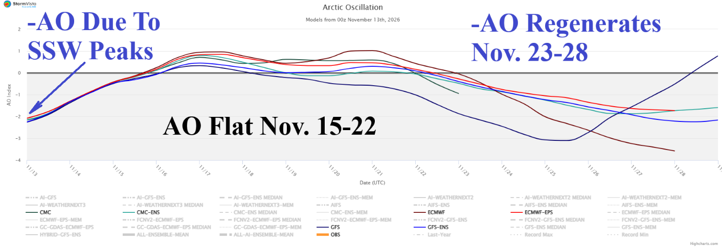
Fig. 1: The 15-day arctic oscillation forecast utilizing all models.
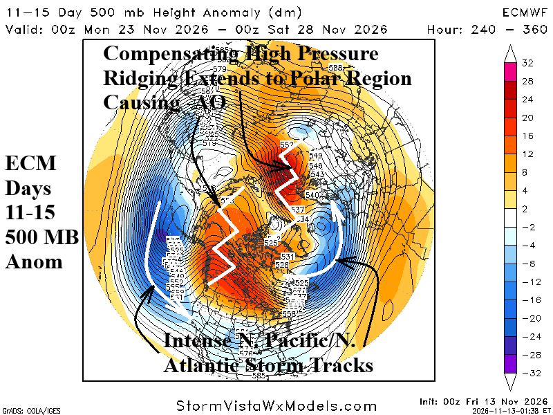
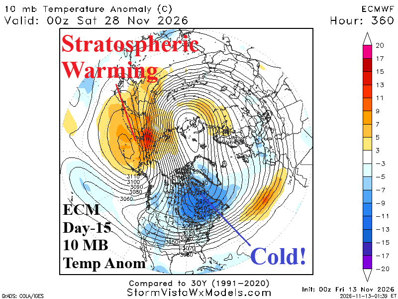
Fig. 2-3: The (ECM) 11-15-day 500 MB anomaly forecast for the northern hemisphere and (ECM) day-15 10 MB temperature anomaly outlook.
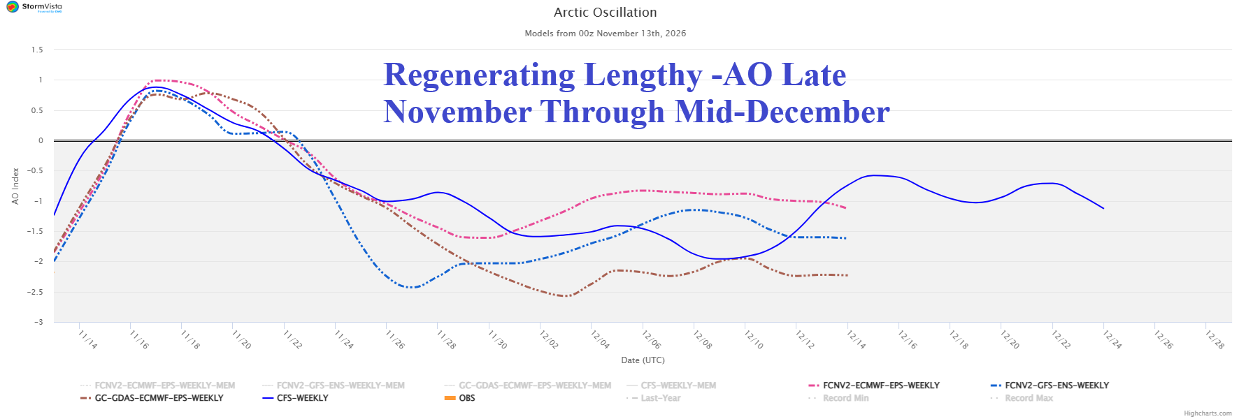
Fig. 4: The 4-week arctic oscillation index forecast.
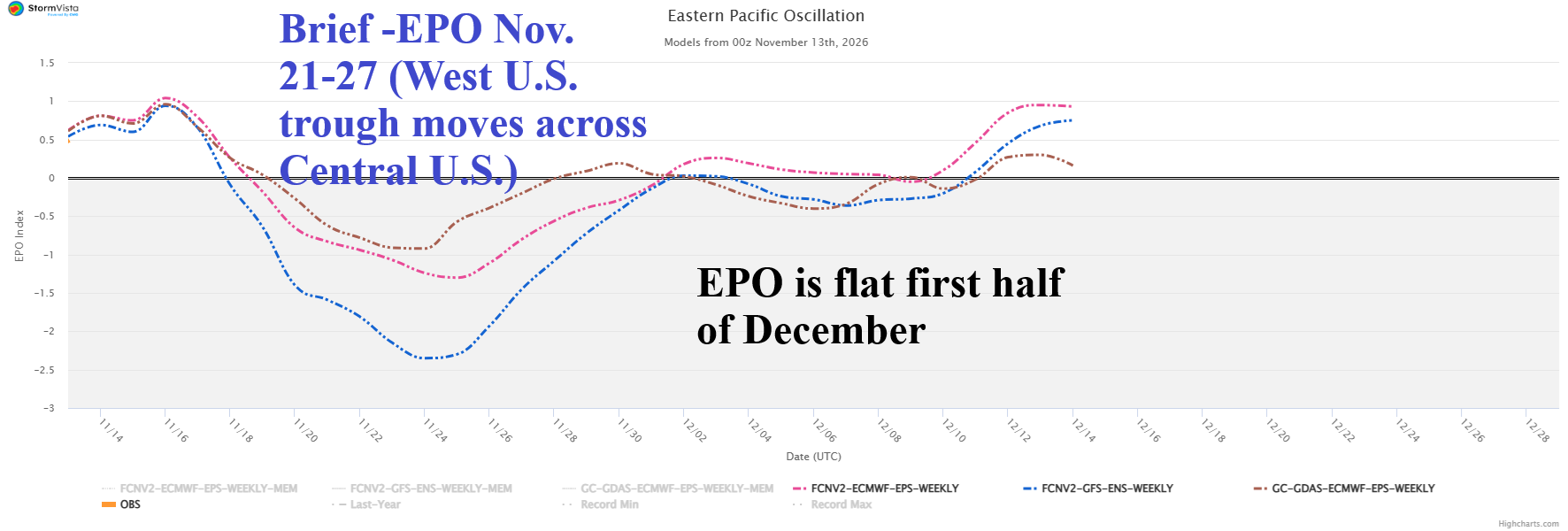
Fig. 5: The 4-week East Pacific oscillation index forecast.
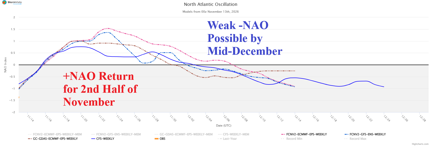
Fig. 6: The 4-week North Atlantic oscillation index forecast.