
Regional SSTA in South Atlantic Influencing Brazil Rainfalll
11/10/2026, 12:05 pm EST
Climate Impact Company Week 2-4 Outlook
Australia
Issued: Sunday November 15, 2026
Highlight: The dry pattern has returned to the East Coast.
Charts of the day: NOV-26 observed rainfall anomalies; ECM wet forecast bias Eastern Australia.
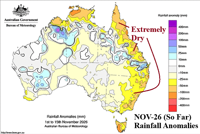
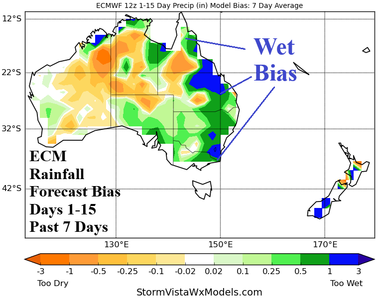
Discussion: After an extremely dry East/Southeast Australia pattern during September, Northeast/East Australia turned prohibitively wet in October. The first half of November reverses drier in the East (again). Are conventional operational models understanding the drier reversal in Eastern Australia? No! All models (ECM pictured) are much too wet in Eastern Australia with daily 15-day forecasts.
Week-2 Ahead (November 22-29, 2026): Support for some needed wet weather on the East Coast.
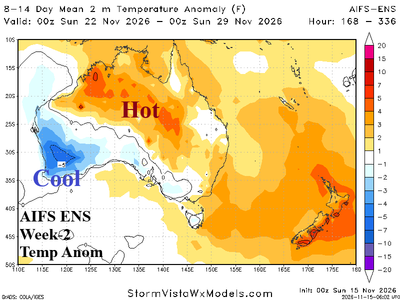
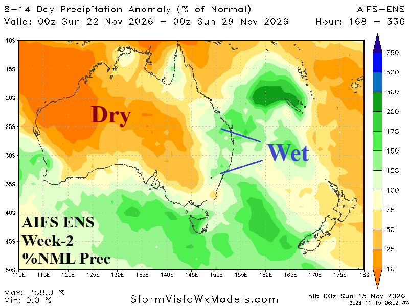
Discussion: Upper trough shifts from the West Coast to south of Southeast Australia during the period. The trough leaves Southwest Australia cooler than normal while this time support for wet weather is there for the East Coast. Ahead of the trough, the North and East is hotter than normal.
Week-3 Ahead (November 29-October 6, 2026): Widespread anomalous heat.
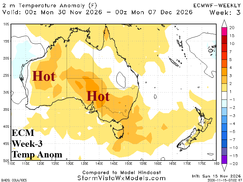
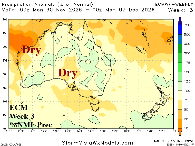
Discussion: High pressure ridge supports anomalous heat for much of the continent alongside widening dry weather.
Week-4 Ahead (December 6-13, 2026): Widening thundershowers.
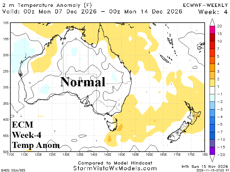
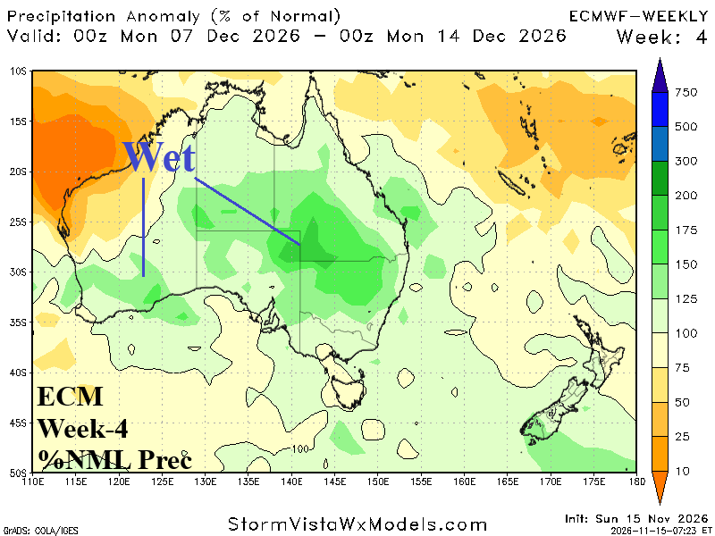
Discussion: Another pulse of wet weather likely driven by a transitional MJO episode. Wet weather suppresses anomalous heat.