
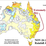
Eastern Australia Shifts Dry After Wet October
11/15/2026, 9:24 am EST
Climate Impact Company Week 2-4 Outlook
Australia
Issued: Wednesday November 18, 2026
Highlight: Driest climate evolving Northwest; Wet pulses elsewhere.
Charts of the day: Recent rains, more in the forecast, and why.
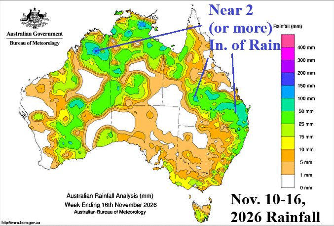
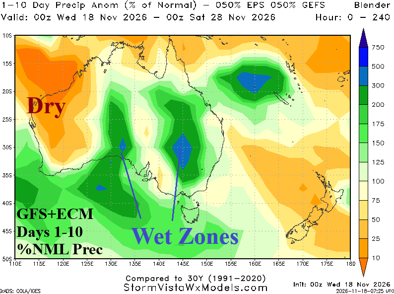
Discussion: The past week has featured 1-2 in. of rain across many sectors of Australia most notable in the Northwest and Queensland. The 10-day outlook equally combining GFS and ECM indicates additional wet weather patches West-central Australia and (also) the Interior East. The most likely explanation for the on again/off again wet tendency in Australia is related to strong positive global atmospheric angular momentum (+GLAAM) present during El Nino and responsible for stronger than normal mid-latitude upper air flow. Occasionally, upper troughs embedded within the stronger than normal mid-latitude jet stream extend northward to deliver rain to Australia.
Week-2 Ahead (November 29-December 6, 2026): Wet trough in the East.
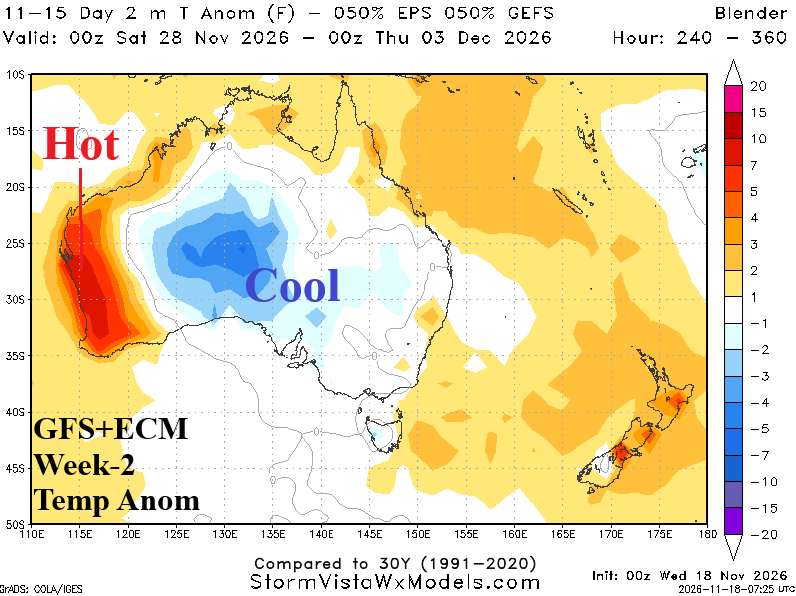
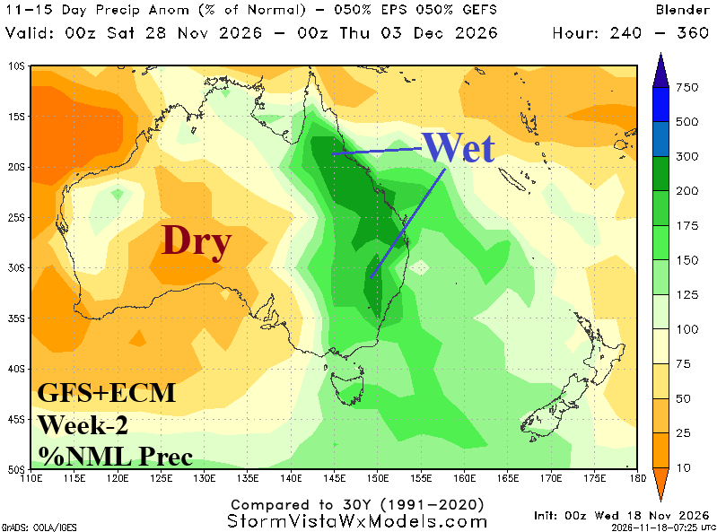
Discussion: ALL “weeklies” forecasts whether operational or AI, do not capture a wet East Coast trough as the month of December arrives. Therefore, combining GFS and ECM equally is used to generate the late NOV/early DEC forecast which reveals widespread rain in the East, cool anomalies Central Australia, and very hot weather on the West Coast.
Week-3 Ahead (December 6=13, 2026): Thundershowers East-central Australia.
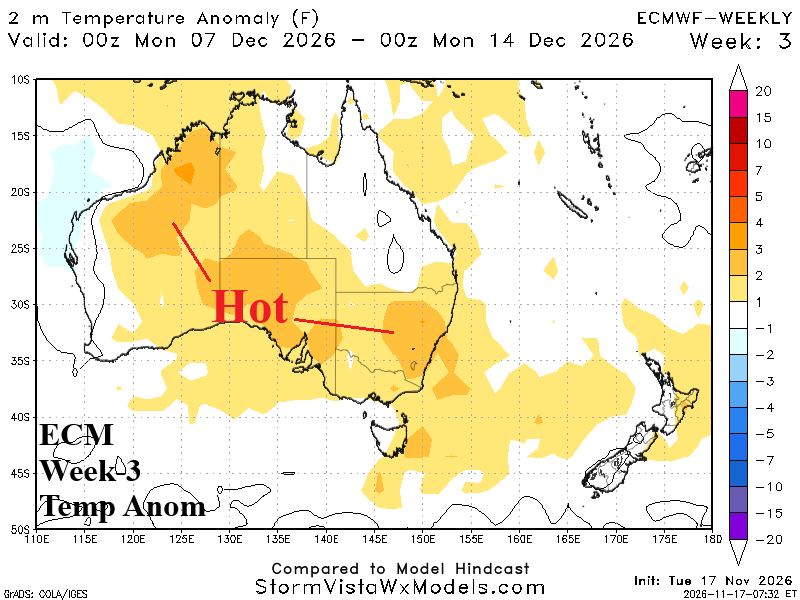
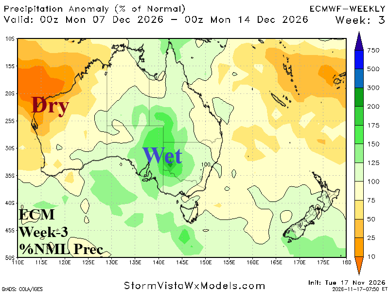
Discussion: Transient upper trough brings thunderstorms to East-central to Interior Southeast Australia while ahead of the trough New South Wales is hotter than normal. Anomalous heat dominates northwest to south-central continent.
Week-4 Ahead (December 13-20, 2026): Driest climate continues to evolve Northwest.
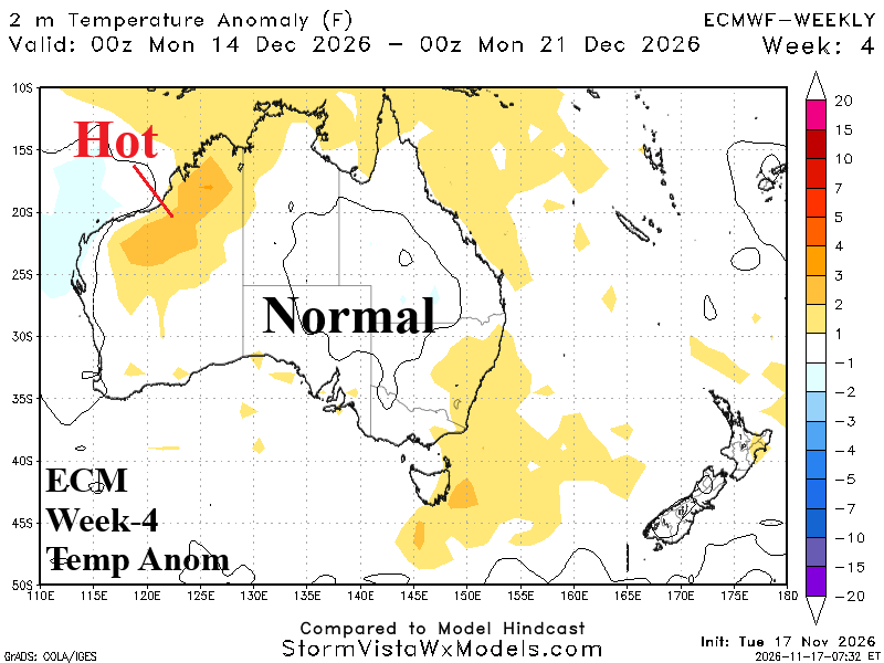
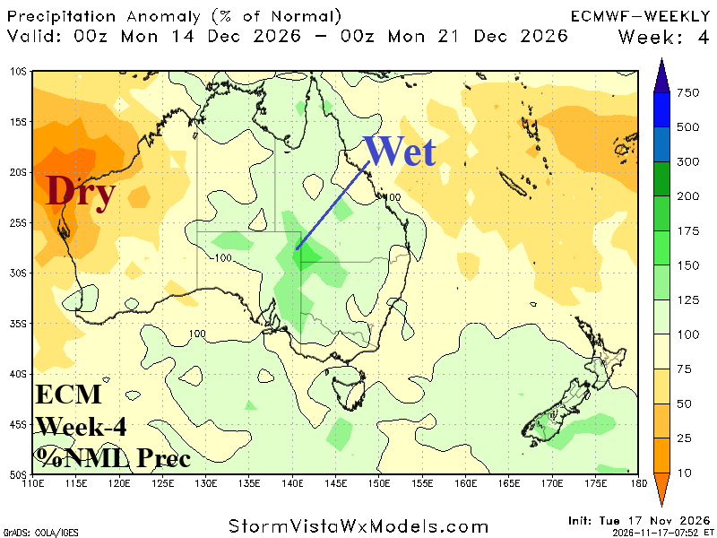
Discussion: Another upper trough suppresses anomalous heat risk across much of Australia with more wet weather East-central continent. Dryness and anomalous heat persist in the Northwest.