
Fuel From Pacific Ocean for Heavy Rain Events in U.S. Past 5 Weeks Diminishing
05/07/2025, 8:33 am EDT
Latest North Atlantic Basin SSTA Analysis
05/12/2025, 9:21 am EDT
Climate Impact Company Week 2-4 Outlook
Australia
Issued: Friday, May 9, 2025
Highlight: Areas of warm and wet weather persist.
Charts of the day: The power of marine heatwaves on the Australia climate.
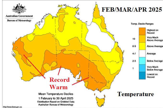
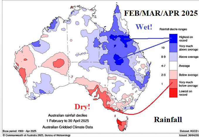
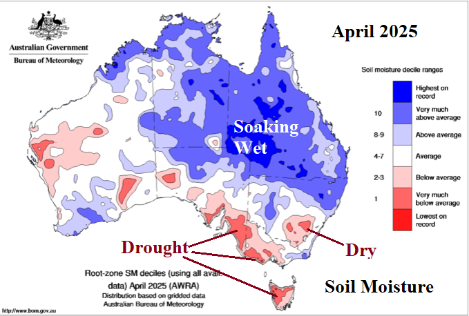
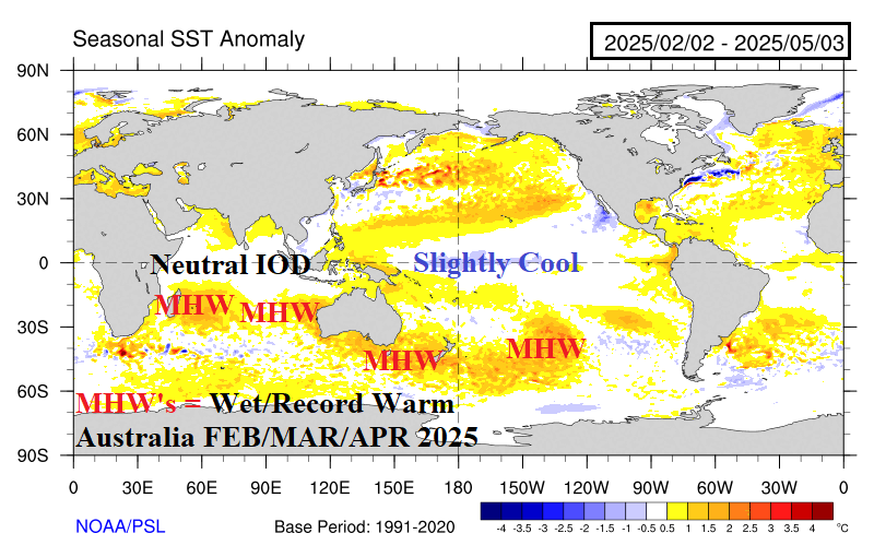
Discussion: During the past 3 months (FEB/MAR/APR 2025) the Australia climate was affected profoundly by the presence of ongoing marine heat waves (MHW) located off the West Coast and south and southeast of the continent. The entire continent, except for parts of rain-soaked Queensland, was hotter than normal with record heat across the southern tier including almost all of Victoria and South Australia. During this period, most of Queensland endured much above to record rainfall extending to parts of northeast New South Wales. Extremely dry and hot weather enhanced ongoing drought in southeastern South Australia to southwest Victoria recently adding much of Tasmania. The drenching rains in Queensland have caused widespread record wet soils. The primary culprit to the extreme heat observed across much of Australia during the past 3 months is the enhancing influence on subtropical upper-level high-pressure ridging stretching from southeast of New Zealand to Southern Australia by the presence of MHW’s. Warm SSTA, also northeast of Australia, increased available moisture in the lower atmosphere to enhance rainstorms including strengthening tropical cyclones causal to the Queensland rains.
Week-2 Ahead Forecast valid May 18-24, 2025: More heavy rain for Queensland.
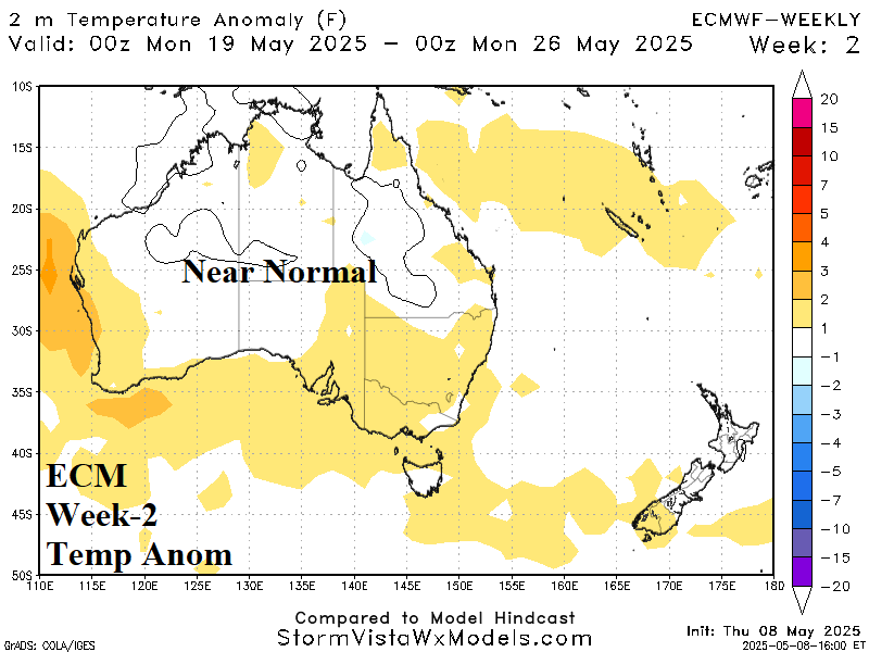
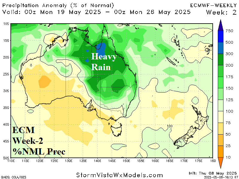
Discussion: The MHW-inspired subtropical ridge is powerfully on display centered off the coast of Victoria. North of the ridge, a wet tropical fetch will soak the northeast quadrant of the continent.
Week-3 Ahead Forecast valid May 25-31, 2025: Warmer Western Australia.
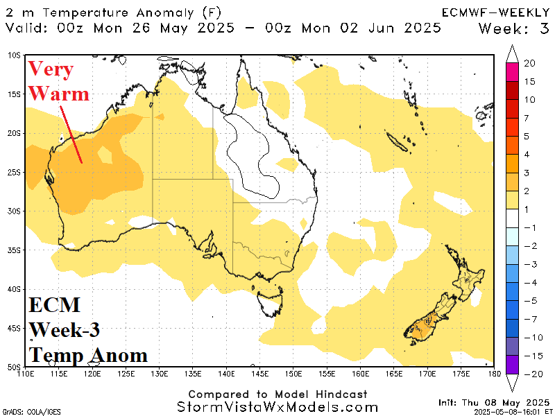
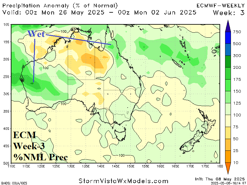
Discussion: The subtropical ridge extends into central continent and forces warming across Western Australia. Areas of heavy rain are forecast on the Western Australia coast and northeastern Queensland.
Week-4 Ahead Forecast valid June 1-7, 2025: Wetter South.
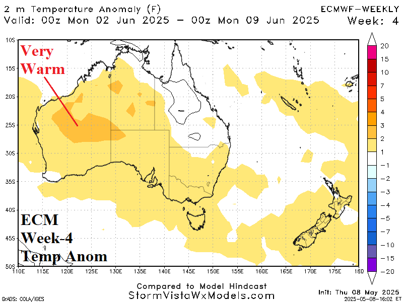
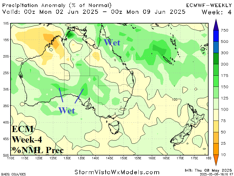
Discussion: Subtropical ridging remains across most of the continent. The anomalous warmth could be stronger than indicated. Wet weather ahead of an upper trough southwest of Australia spreads across the Interior South.