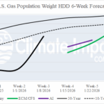
HDD Forecasts Still Favoring Below Average Heating Demand Through U.S. Mid-winter
12/19/2025, 5:46 am EST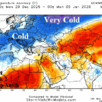
Europe Surprises…Shifts MUCH Colder!
12/22/2025, 12:40 pm EST
![]()
Climate Impact Company Sunday AG Report
Global Weather/Climate Report
Issued: Sunday December 21, 2025
Highlight: Warm/dry into early January U.S. AG Belt; Brazil drier than expected remainder of December (Northern Argentina wet). Chilly Europe, wet Northern Australia.
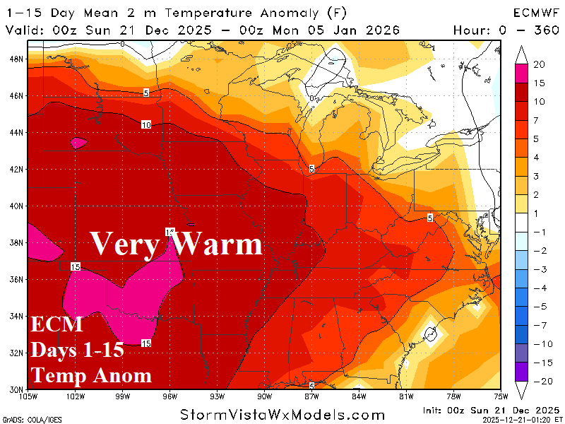
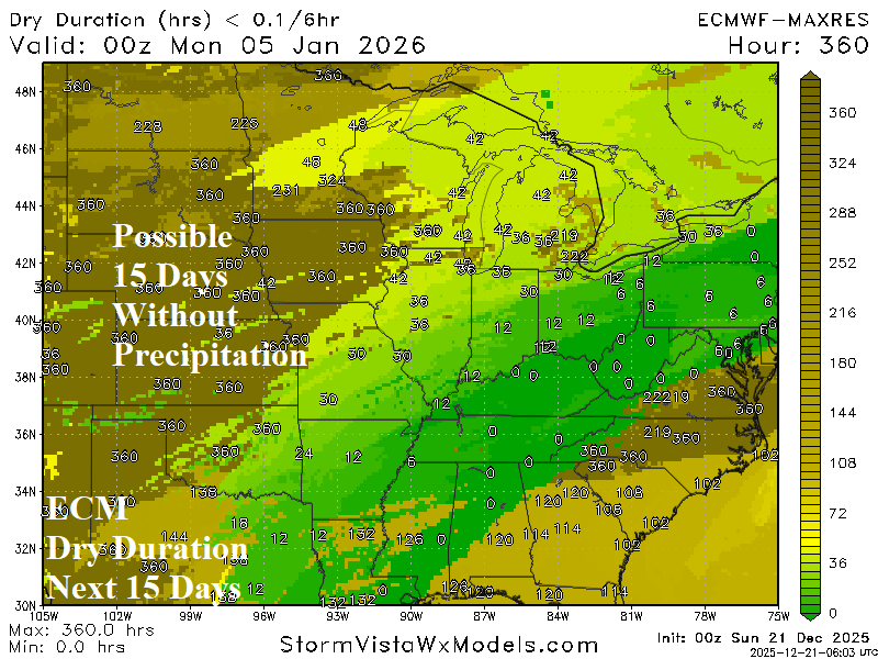
Fig. 1-2: The 12Z GFS 15-day temperature anomaly and percent of normal precipitation forecast.
Discussion: The persistent “atmospheric river” storm track slamming the U.S. West Coast, particularly California, into early January leaves the Great Plains very warm (Fig. 1) and without much precipitation. The ECM dry duration forecast is up to 360 hours across parts of the Dakotas, Western Corn Belt, and southwest Great Plains wheat growing areas (Fig. 2). Record warm temperatures are likely from Nebraska/Kansas to Texas during the warm pattern. Operational forecast models indicate the warmth continues into the 16-20-day period.
South America 7-day rainfall observations reveal heavy rain east of Paraguay and Eastern Bolivia (Fig. 3). Otherwise, mostly drier than normal weather was indicated for the remainder of Brazil and Argentina. The 15-day outlook is trending hotter across East Brazil and Argentina (Fig. 4). ECM 10-day rainfall forecast is drier than normal across Central and East Brazil plus North-central Argentina (Fig. 5). The West Brazil forecast is wet and Northern Argentina prohibitively wet during the next 10 days. In the 11-15-day period, wet weather shifts to Southeast Brazil (Fig. 6). GFS is not as wet as ECM in the 11-15-day forecast.
In Europe, a chilly upper low-pressure trough resides over Southwest Europe much of the next 15 days causing a chilly regime to widen from Southwest Europe to Poland (Fig. 7). The upper trough causes heavy rain across the Western Mediterranean Sea and the South Coast of Europe (Fig. 8). To the north, very dry weather is expected including lack of any snowfall.
Heavy rain is forecast across the northern and northeastern coast of Australia through the next 15 days (Fig. 9).
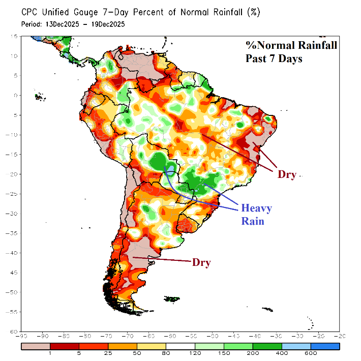
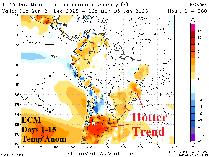
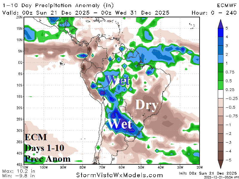
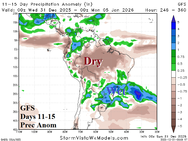
Fig. 3-6: The 7-day percent normal rainfall across South America plus the 15-day temperature anomaly forecast, and 10-day/11-15-day rainfall anomaly outlook.
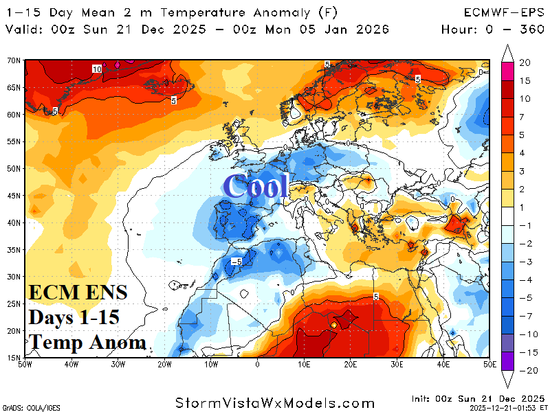
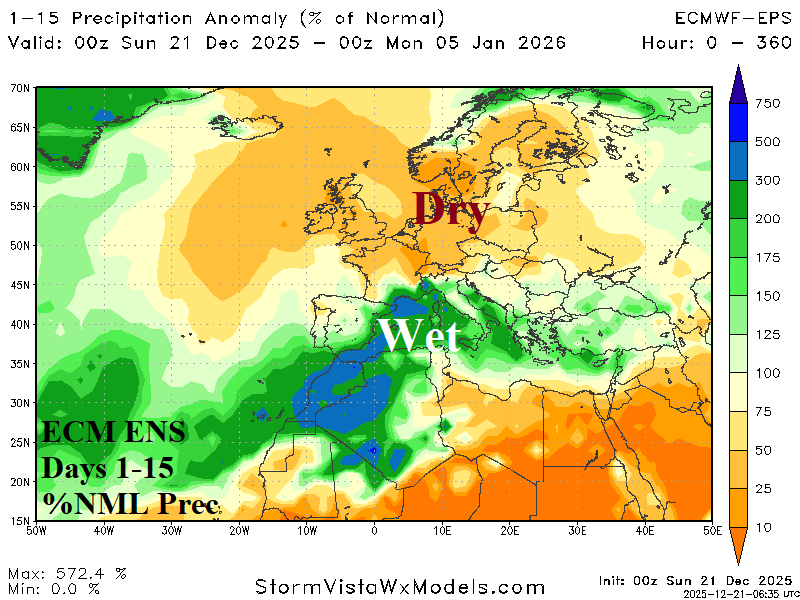
Fig. 7-8: The 15-day temperature anomaly and percent of normal precipitation forecast across Europe.
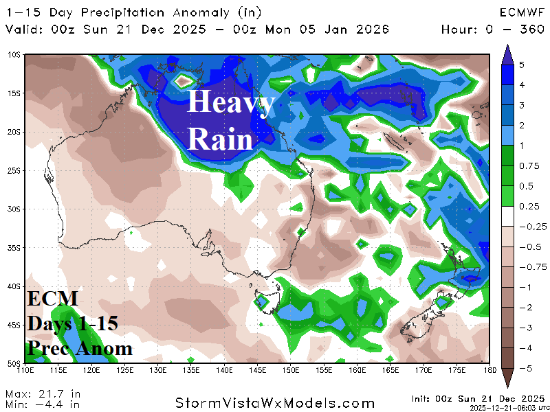
Fig. 9: The 15-day rainfall anomaly forecast across Australia.