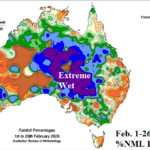
Extreme Rainfall in Australia during February 2026
02/26/2026, 12:09 pm EST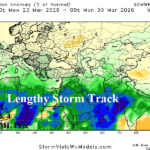
Extended-range Forecast: Evolving Elongated Southern Europe to Middle East Storm Track
03/02/2026, 1:31 pm EST
![]()
Climate Impact Company Sunday Global Weather/Climate Report
Issued: Sunday March 1, 2026
Highlight: Rapid Pacific Ocean subsurface warming, MJO outlook and impacts on Australia, South America, and U.S. and a mild/dry Europe pattern.
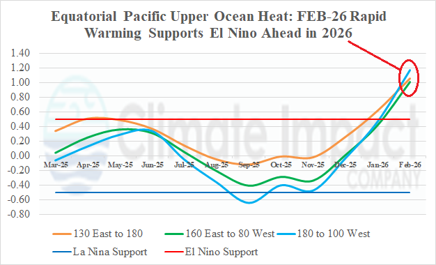
Fig. 1: Upper ocean heat across the equatorial Pacific from the past 12 months.
Discussion: During February, robust warming of the equatorial Pacific Ocean subsurface was observed and supports an El Nino ahead climate signal (Fig. 1). The last months when the entire equatorial Pacific subsurface were warmer than +1.0C was observed during April-June 2023 when Nino34 SSTA was +0.88C by June on the way to +1.99C by December. Multivariate ENSO index (MEI) shifted to an El Nino supporting +0.5 in June (2023) peaking at +1.1 in December. Interestingly, although oceanic El Nino 2023-24 was quite strong the atmospheric reaction to the tropical ocean warming was not nearly as potent. Speculated is oceanic warming poleward of the tropics may have weakened the El Nino climate signal. Reasonable is a similar scenario for 2026-27 as current equatorial subsurface warming suggests oceanic El Nino by June followed by peak strength late 2026. MEI remains in a La Nina signature (-0.8) and is likely to lag the anticipated Nino34 SSTA warming in 2026. Global SSTA is about twice as warm (now) than March 1, 2023.
The Madden Julian oscillation (MJO) is north-northeast of Australia and shifting eastward. Because the heavy convection associated with MJO is near Darwin, surface pressure at this location is very low (1003 MB). When Darwin surface pressure is low, southern oscillation index (SOI) is in the positive phase. If MJO shifts east of the Dateline with intensity, SOI will flip to negative phase. If so, surface warming of the eastern equatorial Pacific develops quickly and MJO has increased climate impacts on South and North America. While this scenario makes sense, given the upper ocean heat to maintain MJO strength, forecast models are doubting this scenario.
Climate implications are the soaking wet regime across much of Australia is likely to continue (Fig. 2), Argentina rains return while Brazil rains shift (Fig. 3), and the U.S. is warm with heavy rains in the East-central U.S. (Fig. 4-5).
In Europe, mild and dry weather dominates during the next 15 days (Fig. 6-7). Arctic air in West-central/Central Russia loses some intensity after 10 days shows no sign of shifting toward Europe. Southwest Europe is wet at times while patchy showers affect the Middle East, and a snowy regime will hover over Southern Russia.
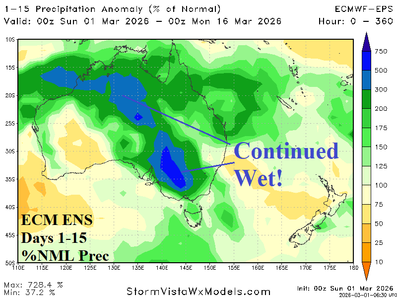
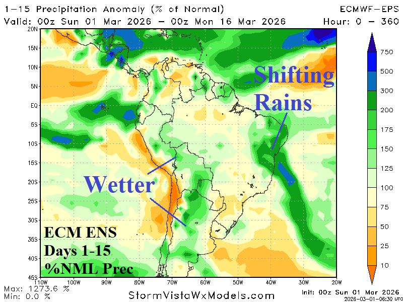
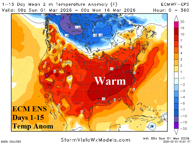
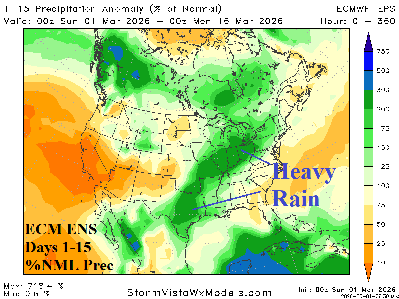
Fig. 2-5: ECM ENS percent of normal rainfall across Australia and South America during the next 15 days plus the U.S. temperature and precipitation anomaly 15-day forecast.
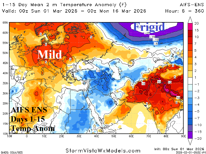
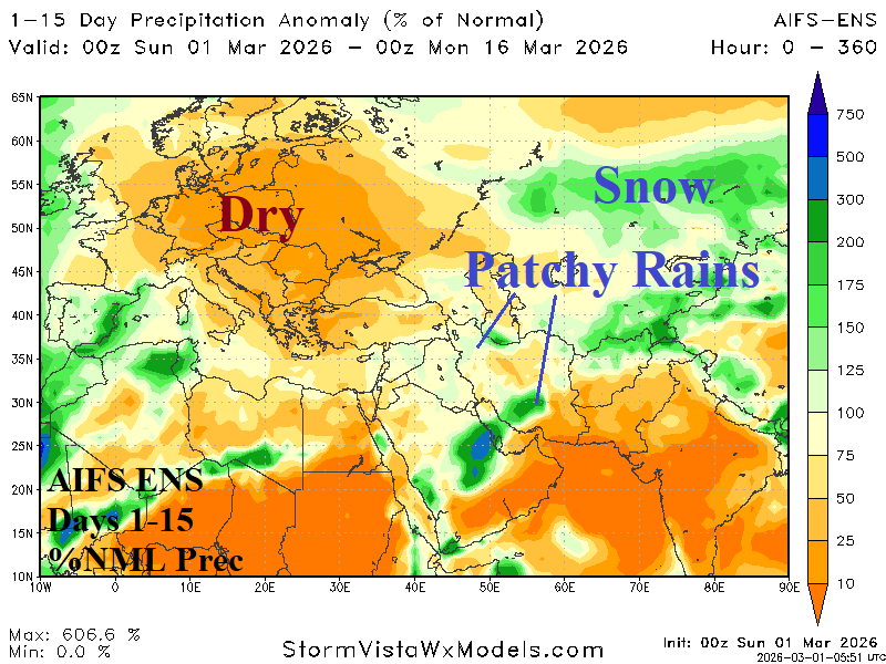
Fig. 6-7: Europe/Middle East AIFS ENS temperature anomalies and percent of normal precipitation through the next 15 days.