
Borderline La Nina/-IOD Pattern Under-performing as Rainmakers in Australia
10/02/2025, 4:43 am EDT
South America Rainfall Forecast Bias; Week 2-4 Outlook
10/07/2025, 5:18 am EDT
Climate Impact Company Sunday AG Report
Global Weather/Climate Report
Issued: Sunday October 5, 2025
Highlights: Most, not all, Brazil soybean growing areas shifting wetter. Australia shifts hotter, limited rainfall. Wet weather reaching Black Sea region.
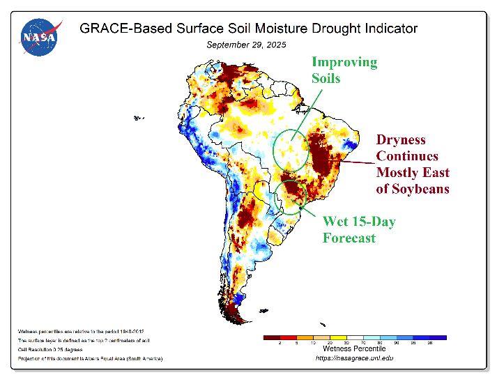
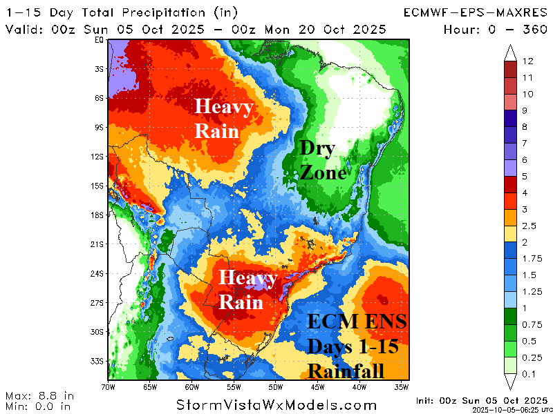
Fig. 1-2: GRACE-based soil moisture anomalies across South America and the 15-day ECM ENS rainfall amount forecast.
Discussion: Departing September, GRACE-based soil moisture anomalies analysis reveals improving conditions in the central/east-central Brazil soybean-growing areas (Fig. 1) while harsh drought in the southern soybean-growing areas receives beneficial rainfall in the latest 15-day outlook (Fig. 2). The far eastern soybean growing-areas remain in drought with a dry outlook during the next 15 days. The Madden Julian oscillation (MJO) has found a home mostly in the eastern Indian Ocean tropics through the next 8 weeks inspired by the somewhat warmer than normal SSTA in that region. A pulse of MJO convection shifts eastward through Mid-October which can enhance monsoon rainfall in South America. However, that “effect” is brief. Looking long-term, later October and November, MJO presence to inspire a wetter than normal climate is not expected. On average, “weeklies” models are normally wet in the Brazil soybean areas in the extended range.
Influence of an amplified upper trough into South Australia eases in the medium range. Enabled, is increasing high pressure. A hotter than normal national climate strengthens through the middle third of October. The rainfall forecast indicates wet weather risk is confined to Tasmania to Victoria and parts of the Western Australia southern coast this week (Fig. 3) and broadly across the North and East Coast in the week-2 outlook (Fig. 4).
A heavy rain pattern has consolidated over Southeast Europe and the western Black Sea region during late SEP/early OCT (Fig. 5). Surrounding the wet zone, very dry conditions are observed. In the 15-day outlook, ECM maintains the wet pattern expanding northward into Western Russia (Fig. 6). Dryness continues Western Europe and east of the Black Sea region.
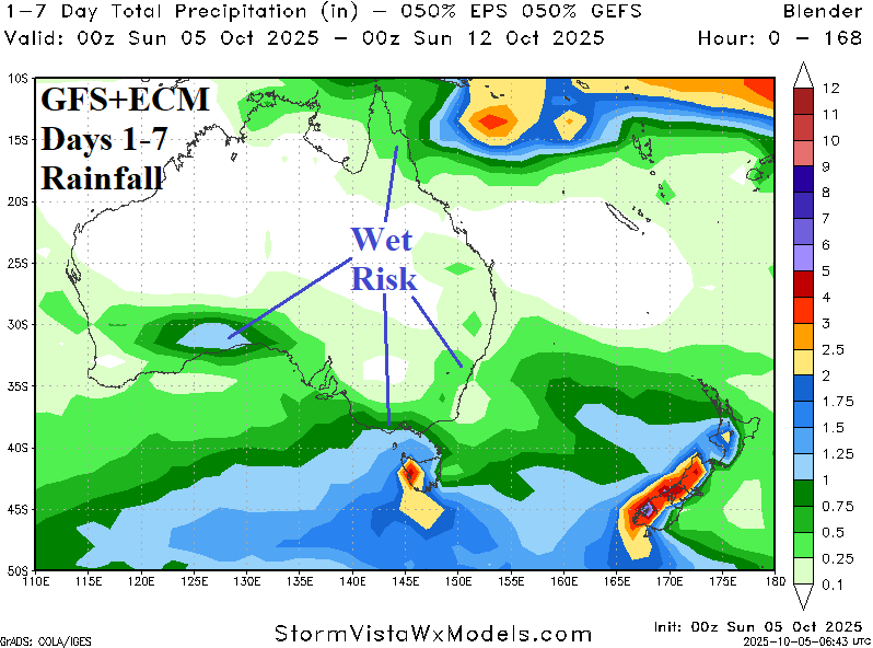
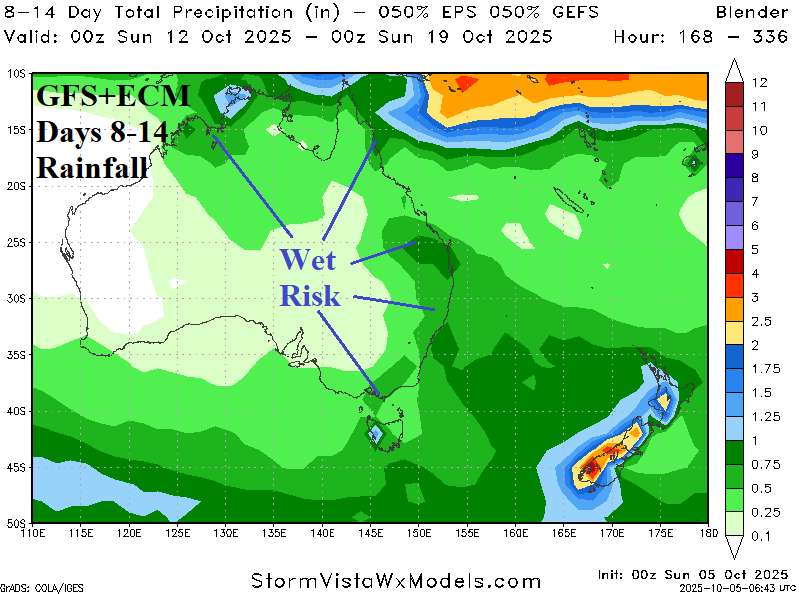
Fig. 3-4: GRACE-based soil moisture anomalies across South America and the 15-day ECM ENS rainfall amount forecast.


Fig. 5-6: The 7-day percent normal rainfall amount across Europe and ECM 15-day percent of normal rainfall forecast.