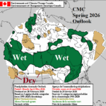
Canadian Meteorological Center Projects a Wet Spring Much of Canada
03/04/2026, 8:31 am EST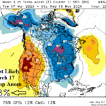
Mega-cluster Ensemble “Most Likely” Forecast Indicates Cold Spike East March 18th
03/06/2026, 3:12 pm EST
Climate Impact Company Early AG Market ALERT
Issued: Thursday March 5, 2026
Highlight: Northeast Brazil continues to trend wetter, expansion of wet pattern expected in South America. Tropical cyclones soak North/Northeast Australia.
Discussion: Northeast Brazil continues to shift much wetter (Fig. 1). Parts of Northeast Argentina are (also) recently wetter. The 15-day forecast utilizing ECM ENS indicates a wet regime across southwest to eastern Brazil AND much of Argentina (Fig. 2). Exceptions are Northeast Argentina, Uruguay, and far Southeast Brazil. The 24-hour forecast change is generally wetter (Fig. 3). One catalyst to the wetter pattern is the steadily warming Nino12 SSTA region off the northwest coast of South America adding moisture to the South America climate. Keep in mind, the wet forecast bias by all models remains. ECM ENS has the least vibrant wet bias in 15-day outlooks from the past 30 days (Fig. 4). All 16-30-day forecasts (ECM, CFS, GFS ENS, and Graph Cast) are drier for both Argentina and Brazil. However, forecasts are generated with below normal forecast confidence due to a lingering (weak) La Nina climate (as identified by ongoing positive phase southern oscillation index) combined with the confusion of an El Nin-like warming of the Nino12 SSTA region.
In Australia, heavy rain associated with tropical systems affects the north and northeast coast of the continent through the weekend an into early next week (Fig. 5). The frequent tropical cyclone presence is due to the ongoing nearby convection phase of the Madden Julian oscillation (MJO). Although tropical cyclone presence eases in the 8-14-day period, heavy rains will continue in the North (Fig. 6).
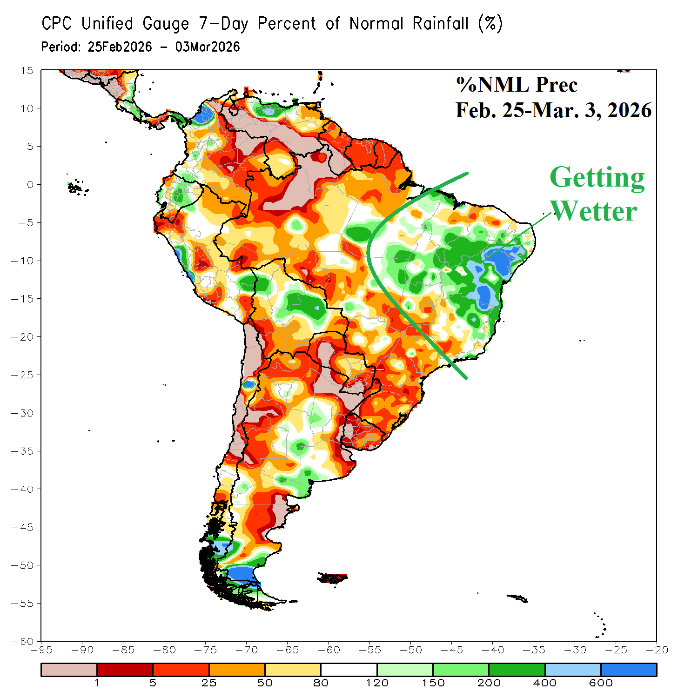
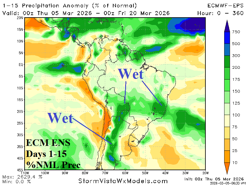
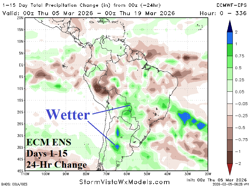
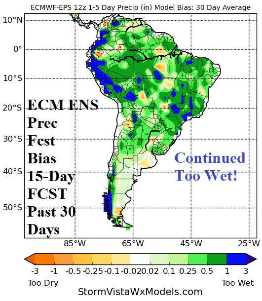
Fig. 1-4: The 7-day percent of normal rainfall observations across South America, ECM ENS 15-day percent of normal rainfall forecast and 24-hour change, plus the 15-day rainfall forecast bias of the ECM ENS.
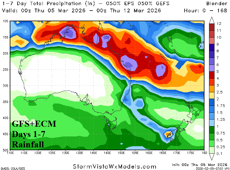
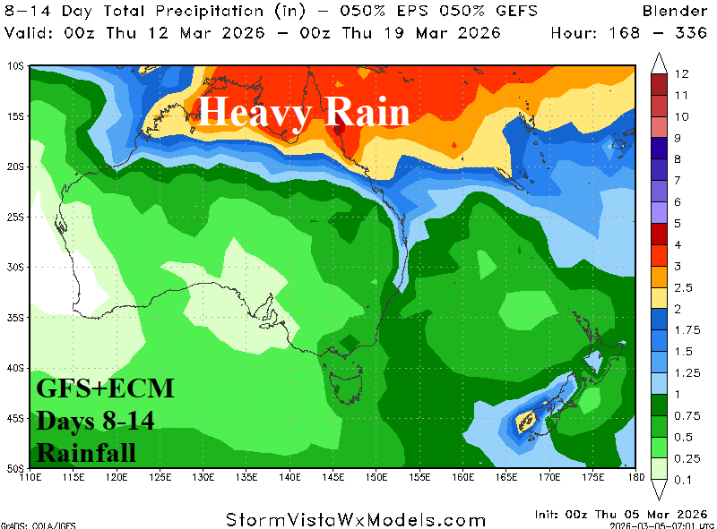
Fig. 5-6: GFS+ECM 14-day rainfall amount forecast across Australia.