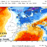
Europe Chill Arrives and Strengthens. Questions On Duration.
12/30/2025, 5:58 am EST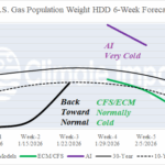
Signs of Returning U.S. Cold Later January.
01/04/2026, 7:03 am EST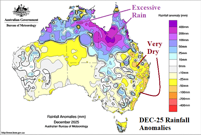

Climate Impact Company Early AG Market ALERT
Issued: Wednesday December 31, 2025, Happy New Year!
Highlight: Explaining the extremely wet Northern Australia DEC-25 climate while, despite La Nina, the East Coast was dry.
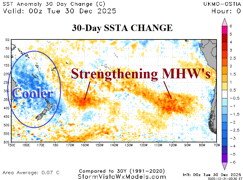
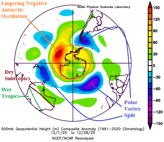

Fig. 1-4: The rainfall anomalies across Australia during DEC-25 so far, cool 30-day change of the ocean surface east of Australia, the southern hemisphere 500 MB anomalies for DEC-25, and AI Graph Cast 15-day rainfall outlook.
Discussion: Prohibitive rainfall was observed across Northern Australia during December 2025 including departures from normal >400 MM (~16 in.) in northwest Queensland (Fig. 1). Conversely, despite La Nina climate, the East Coast was extremely dry. The heavy convection driving the wet climate across Northern Australia caused previously warm SSTA to cool significantly, especially off the East Coast where 30-day changes exceed 4C (Fig. 2). The primary contributor to the unusual early summer pattern, during a La Nina climate, was lingering effects of negative Antarctic oscillation (-AAO). The -AAO regime began around Nov. 20 and persisted for about 30 days before weakening (Fig. 3). During December, -AAO forced a polar vortex split with 3 centers in the middle latitudes compensated for by a subtropical ridge to dry South and East Australia further compensated for by wet weather across tropical North Australia. The cooler SSTA are driving less wet 15-day outlooks (Fig. 4). The AI Graph Cast keeps heavy rain over Queensland while the remainder of the continent is dry, and Southern Australia is exposed to unusually hot weather especially in the 6-10-day period.
I