
Atmospheric Rivers into Western Europe
11/11/2026, 5:52 am EST
Climate Impact Company Early AG Market ALERT
Issued: Friday November 13, 2026
Highlight: Recent South America rainfall pattern is drier than forecast; Models continue to insist on wet weather ahead next 15 days.
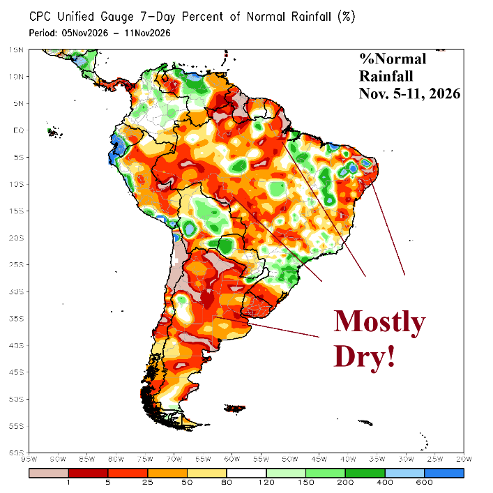
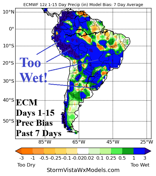
Fig. 1-2: Percent normal rainfall past 7 days and 15-day rainfall forecast bias across South America.
Discussion: Recent forecasts have offered substantial rainfall for Brazil. However, the past 7 days have featured winding dry zones especially Central Brazil and Argentina (Fig. 1). The South America rainfall forecast bias utilizing ECM reveals a strong wet bias from the past 7 days across Brazil (Fig. 2). Other forecast models are similarly too wet. High pressure across Brazil and Argentina is too strong to allow significant rain during week-2 of November. Forecast models indicate the upper ridge becomes choppy the next 2 weeks and upper troughs can interfere and cause wet weather. Forecast models are not agreeable therefore forecast confidence is below average.
Utilizing the “most likely” forecasts from the mega-cluster ensemble, the rainfall forecasts for South America continue to insist that areas of heavy rain will emerge during the next 15 days. Parts of Argentina and Northeast Brazil are wet into early next week (Fig. 3) followed by wet pulses in the 6-10-day period for Northern Argentina and East Brazil (Fig. 4). Much of East/Southeast Brazil is wetter than normal in the 11-15-day period (Fig. 5).
During the next 15 days, Madden Julian oscillation (MJO) shifts int phase_3 which is normally a drier signal for South America during November.
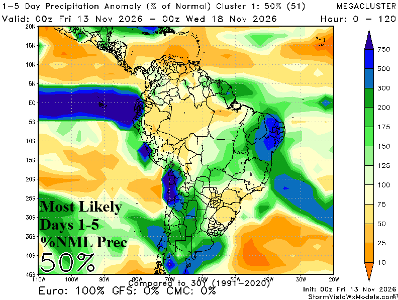
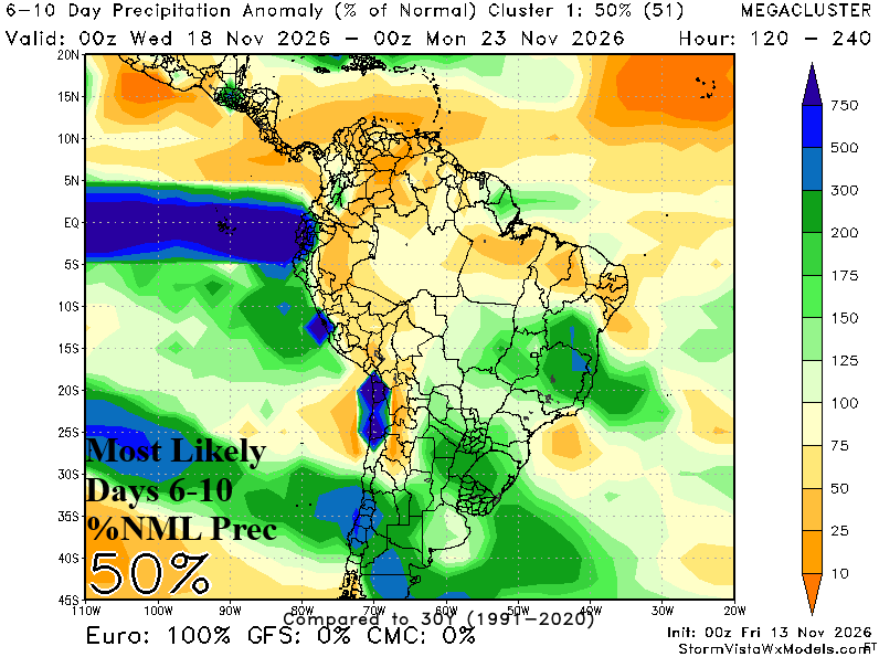
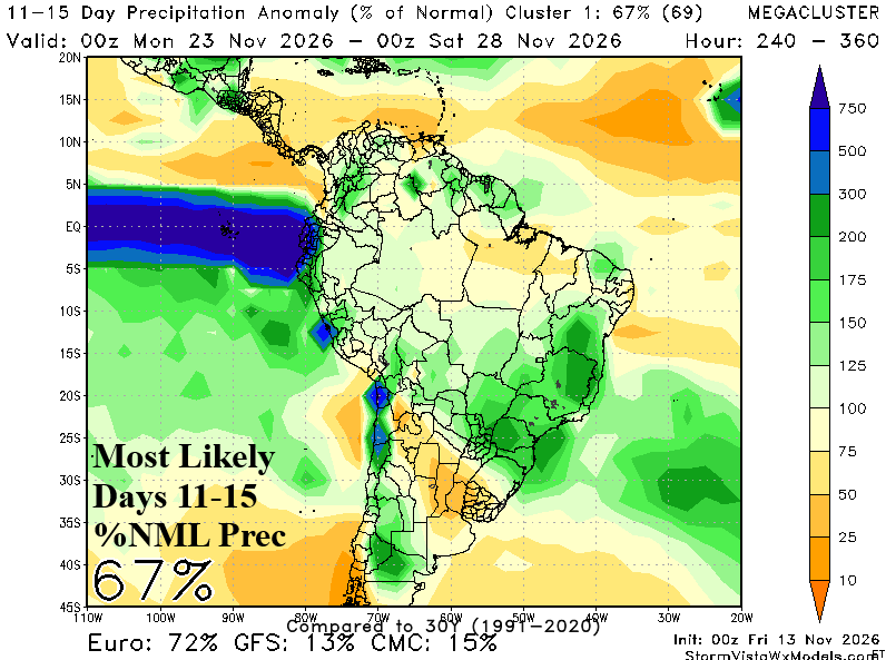
Fig. 3-5: Utilizing the mega-cluster “most likely” 15-day forecasts reveals areas of expected rainfall across South America.