12Z GFS Cooler in the East Despite Emerging Positive North Atlantic Oscillation
04/28/2026, 4:42 pm EDT
Climate Impact Company Early AG Market ALERT
Issued: Wednesday April 29, 2026
Highlight: Cool and dry surge into the Midwest U.S.; Heavy rains Paraguay/Northern Argentina shift eastward into Southeast Brazil.
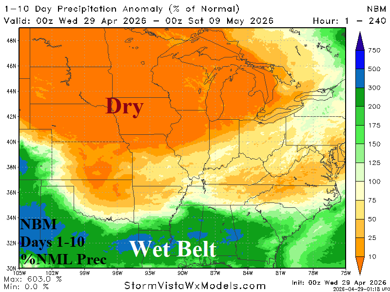
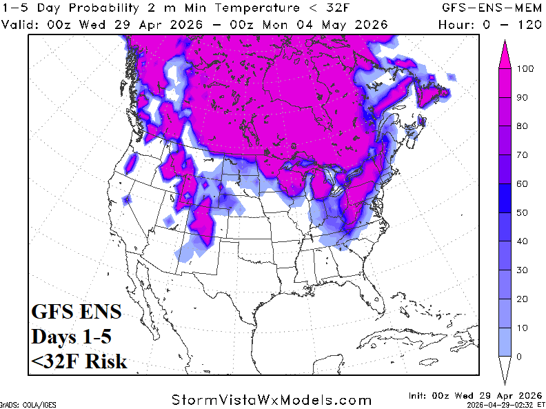
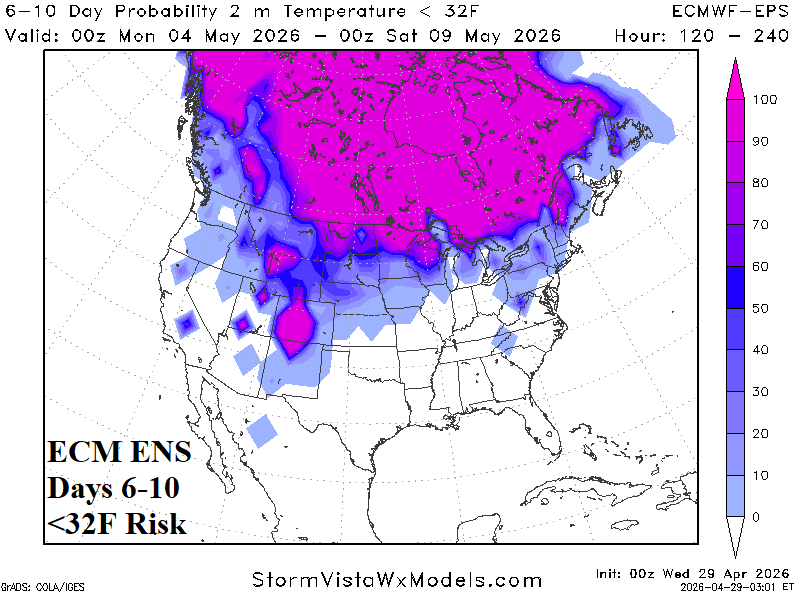
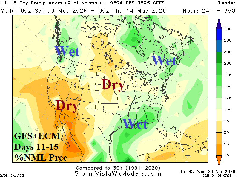
Fig. 1-4: NBM 10-day percent normal rainfall forecast across the U.S. AG Belt, 1-5-day and 6-10-day risk of <32F, and GFS+ECM 11-15-day percent of normal rainfall outlook.
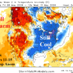
Discussion: The wet belt shifts into the Southern U.S. as early May arrives leaving the Great Plains and Midwest U.S. arid (Fig. 1). The dry air mass is accompanied by unseasonably cool air producing a <32F morning risk in the Eastern Ohio Valley in the short term (Fig. 2) and stretched out across the Northern U.S. next week (Fig. 3). In the 11-15-day period, combining equally the GFS and ECM yields sustained dryness across the North-central U.S. with some marginal shower activity possible in the Southern Great Plains and Missouri Valley while wet weather clings to the Gulf States (Fig. 4).
During the past week, heavy rains pounce on Northern Argentina and Paraguay and are edging eastward into Parana while Eastern Brazil stays dry (Fig. 5). In the outlook into early next week, no rain is forecast for Central Argentina and Central/East-central Brazil while heavy amount is likely across Southeast Brazil (Fig. 6). Combining GFS and ECM equally yields a wet forecast in the 8-14-day period across Southeast Brazil and Uruguay backing into Northeast Argentina while East-central Brazil stays dry (Fig. 7).
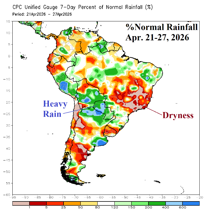
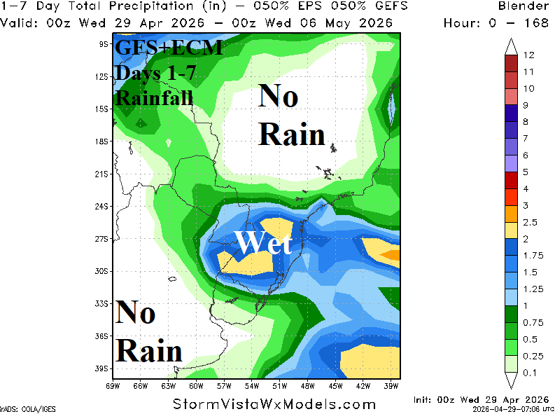
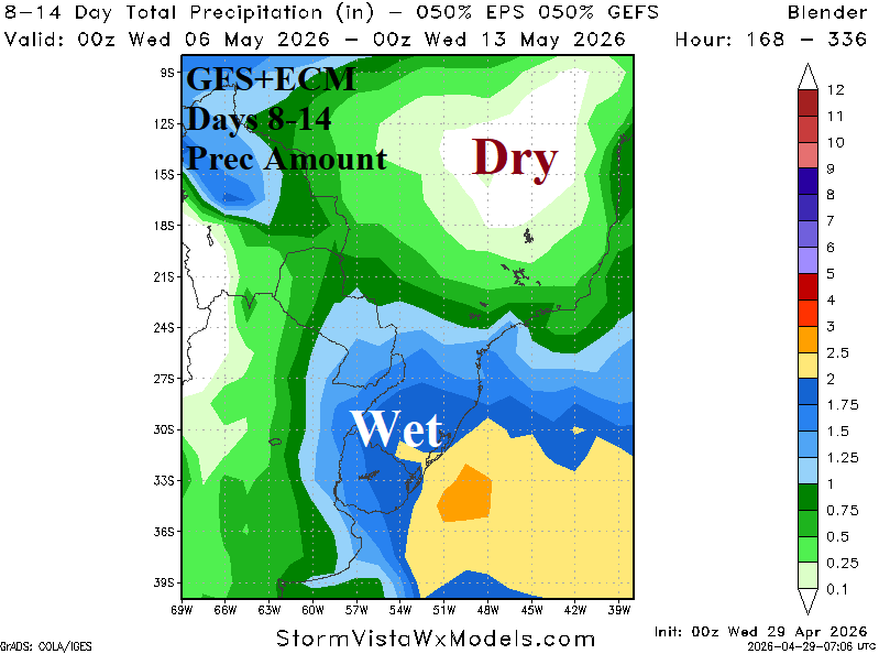
Fig. 5-7: April 21-27, 2026, percent normal rainfall observations across South America and the GFS+ECM 1-7-day and 8-14-day rainfall amount outlooks.