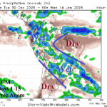
Arc of Heavy Rain in South America, Northern Australia Excessive Rainfall, and Losing the Western Canada Cold Air Source Region
12/30/2025, 6:02 am EST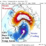
Highly Variable Stratosphere, a Kelvin Wave, and Strengthening Marine Heatwaves
01/02/2026, 4:04 am EST
Climate Impact Company U.S. Medium Range Report
Issued: Wednesday December 31, 2025, Happy New Year!
Highlight: Warm burst to start 2026! But it won’t last.
Charts of the day: A busy period ahead! Big swings in HDD forecasts.
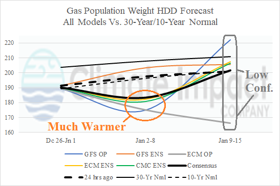

Discussion: Next week is trending warmer except GFS ENS which maintains a colder pattern. Forecast models are disagreeable for January 9-15 although majority of solutions are trending colder. The week-4 forecast is prohibitively cold according to CFS/ECM and AI. CFS/ECM trend toward a thaw by early February.
Medium-range 6-10 Day Forecast Valid January 5-9, 2026 (ECM ENS left and AIFS ENS right)
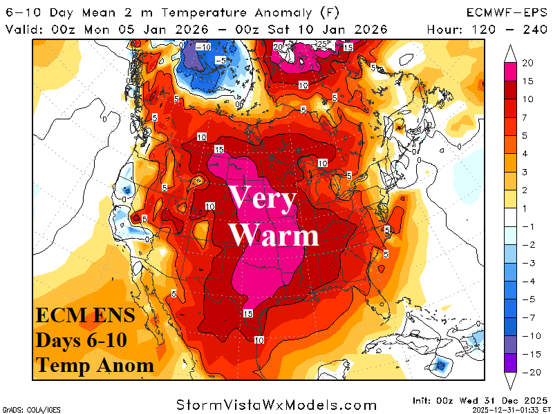
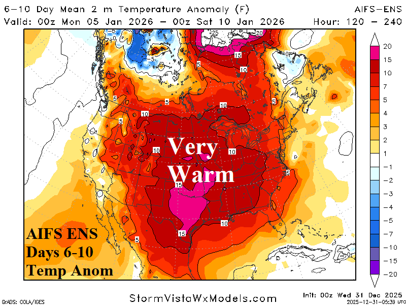
Discussion: Prohibitive warm start for 2026! The forecast trend is warmer and both ECM ENS/AIFS ENS, the top 2 skill models, are agreeable.
Medium-range 11-15 Day Forecast Valid January 10-14, 2026 (ECM ENS left and AIFS ENS right)
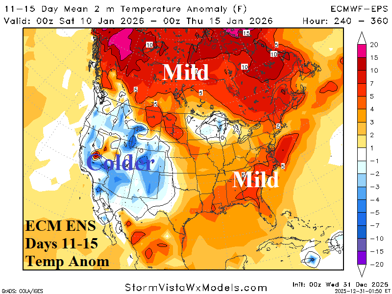
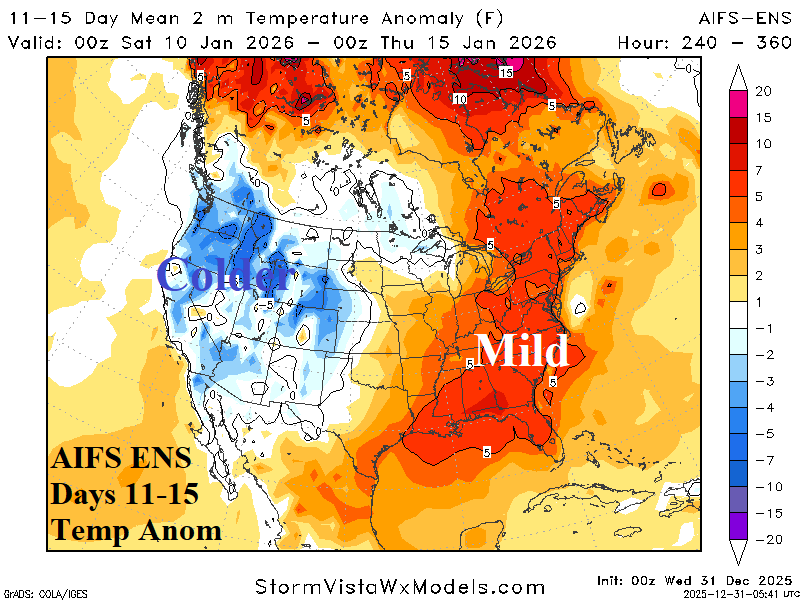
Discussion: The West warmth disappears, the warm pattern shifts eastward but loses intensity.
U.S. Medium-range Precipitation Forecast
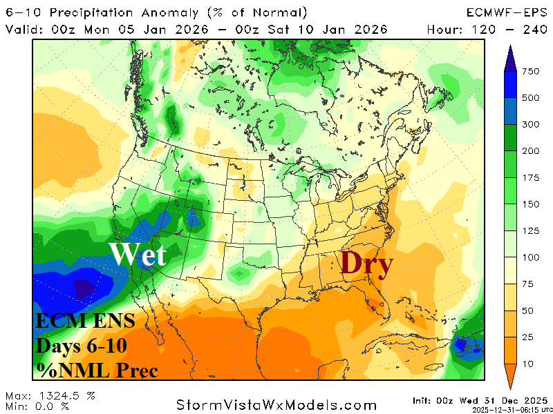
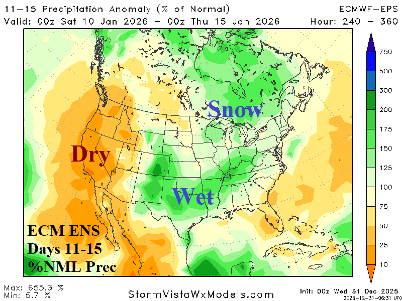
Discussion: Pacific storm track continues to whack California in the 6-10-day period and shifts east centered on the Mid-south U.S. in the 11-15-day period (when the West Coast is drier).
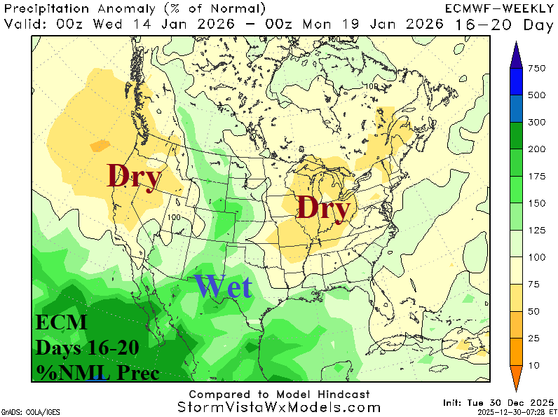
Days 16-20 Extended range Temperature Forecast valid January 15-19, 2026
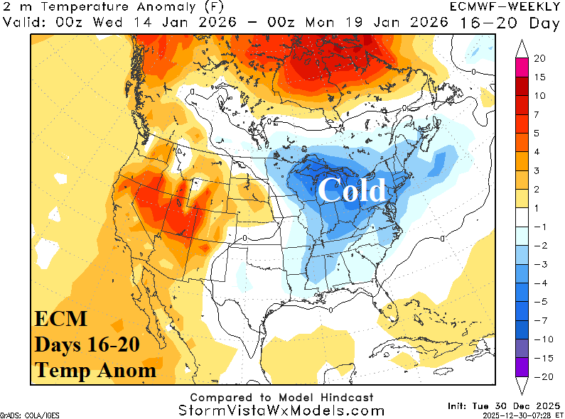
Discussion: The mega-cluster ensemble indicates 75% chance of an upper trough regenerating in the Northeast entering the 16-20-day period. Therefore the cold Northeast U.S. forecast by ECM is most compatible.