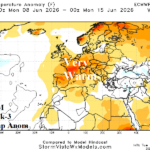
Developing/Broadening Warm/Dry Pattern Ahead for Europe
05/19/2026, 12:54 pm EDT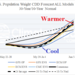
U.S. CDD Forecast Reverses Below Normal Electricity Demand Next Week to Above Normal Following Week
05/26/2026, 8:47 am EDT
Climate Impact Company Early U.S. Notes
Highlight: Wet weather South AND East through the Memorial Day weekend.
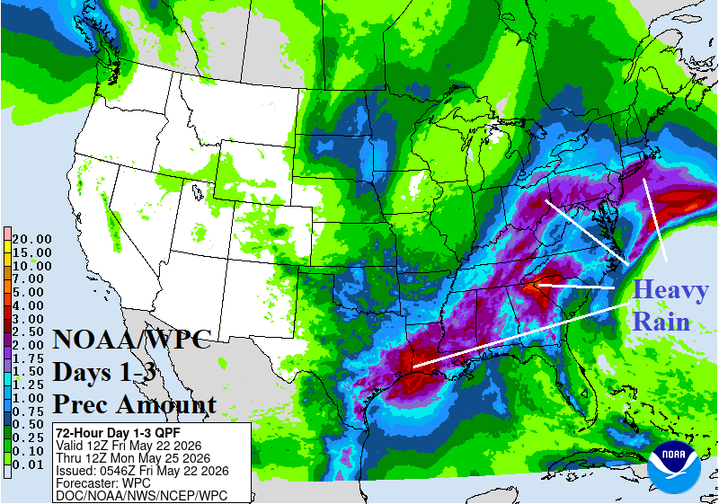
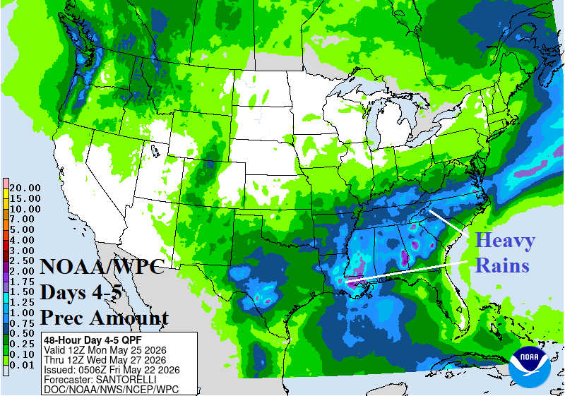
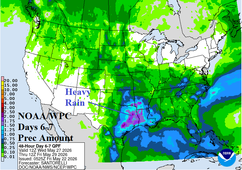
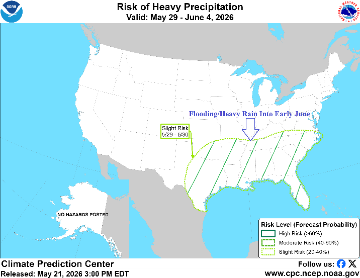
Fig. 1-4: NOAA/WPC quantitative precipitation forecasts during the next 7 days and NOAA/CPC heavy rain/flood risk areas for May 29-June 4.
Discussion: Heavy rain risk extends from East Texas and Louisiana to the Ohio Valley and eastward through the weekend (Fig. 1). Flood risk is highest in Ohio Today, Texas tomorrow, and Louisiana on Sunday. Early next week, heaviest rain lingers across the Central Gulf States plus parts of Texas (Fig. 2) convening in Texas/Louisiana middle of next week (Fig. 3). Yesterday, NOAA/CPC issued a heavy rain/flood risk alert for the entire southeast quadrant of the U.S. for May 29-June 4 (Fig. 4).
The latest U.S. population weight CDD forecasts shift cooler (due to wet weather) from 24 hours ago for the week beginning today extending into the following week (Fig. 5). The June 5-11 forecast shifts warmer to the 10-year normal. Extended range week 3-5 outlooks trend warmer with most models agreeable to a very warm week of June 16-22 (Fig. 6).
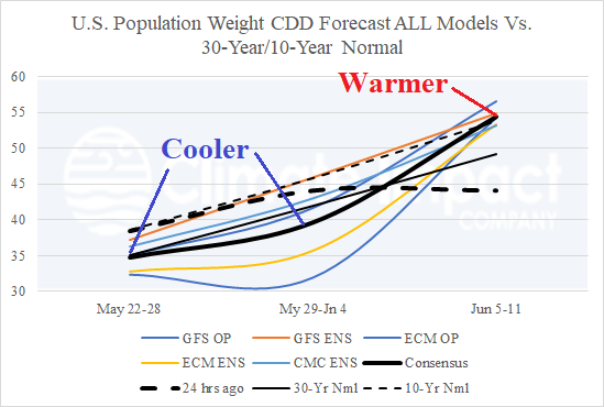
Fig. 5: The U.S. population weight CDD forecast utilizing all operational models, their consensus, and compared with 24 hours ago and 30-year/10-year normal.
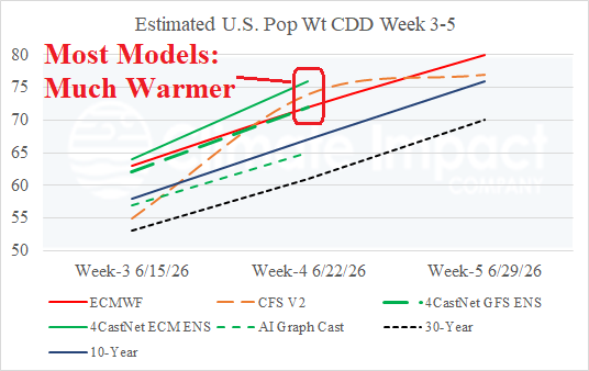
Fig. 6: Climate Impact Company CDD estimates for week 3-5 ahead based on “weeklies” forecasts from ECM, CFS V2, and 3 AI models.