Madden Julian Oscillation Rolling Eastward Again; Affects Weather Patterns
10/28/2024, 5:54 am EDTBrazil Forecasts Have Been Too Wet
11/03/2024, 11:10 am ESTCharts of the day: Monitoring early season snow cover.
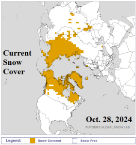
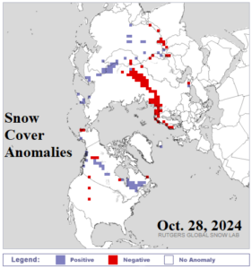
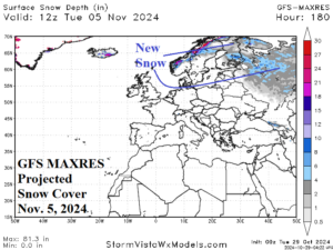
Discussion: As the cold season arrives, there is a tendency in recent years, for unusually warmer than normal weather south of snow cover. Conversely, coldest anomalies require snow on the ground. Of importance is monitoring the evolution of early season snow cover. Both the U.S. and Europe have been very warm in October. However, snow cover is evolving in the not-too-distant northern latitudes. North America snow cover is coming on strong with the northern 55% of Canada already with snow on the ground. In Eurasia, snow cover is ahead of schedule in Northeast Asia although lagging in Northwest Eurasia. A colder upper trough bringing snowfall to Northeast Eurasia is projected for next week.
Week-2 Ahead Forecast valid November 3-9, 2024: Cold and snowy West-central Russia, Kazakhstan, to near Black Sea.
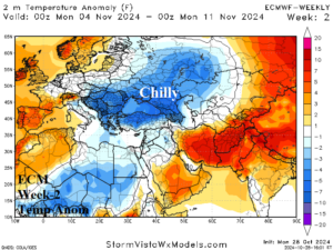
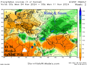
Discussion: A cold upper trough resides over West-central/Southwest Russia causing widespread chilly temperatures and a large area of above normal precipitation from Caspian Sea and vicinity northeastward to Central Russia. Much of this precipitation zone features early season snowfall.
Week-3 Ahead Forecast valid November 10-16, 2024: Western Europe is dry; East and northeast of Black Sea stays stormy.
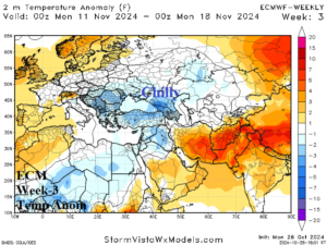
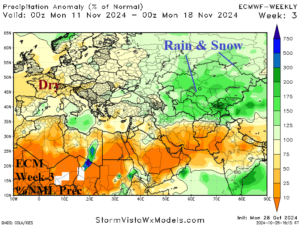
Discussion: The chilly upper trough loses amplitude but maintains widespread chilly weather and a large veil of rain and snow east and northeast of the Black Sea region.
Week-4 Ahead Forecast valid November 17-23, 2024: Cold pattern eases.
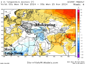
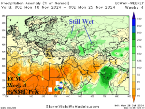
Discussion: After mid-November, moderation is forecast by ECM across Western Russia and especially Central Russia. Europe stays mostly dry and temperate.
