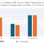
Comparing AI Vs. Dynamic Models 2-Meter Temperature Forecasts North America and Europe
05/07/2026, 4:33 am EDT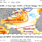
North America SSTA: Western Subtropics and Deep Tropics Significant Warming Ahead
05/12/2026, 9:24 am EDT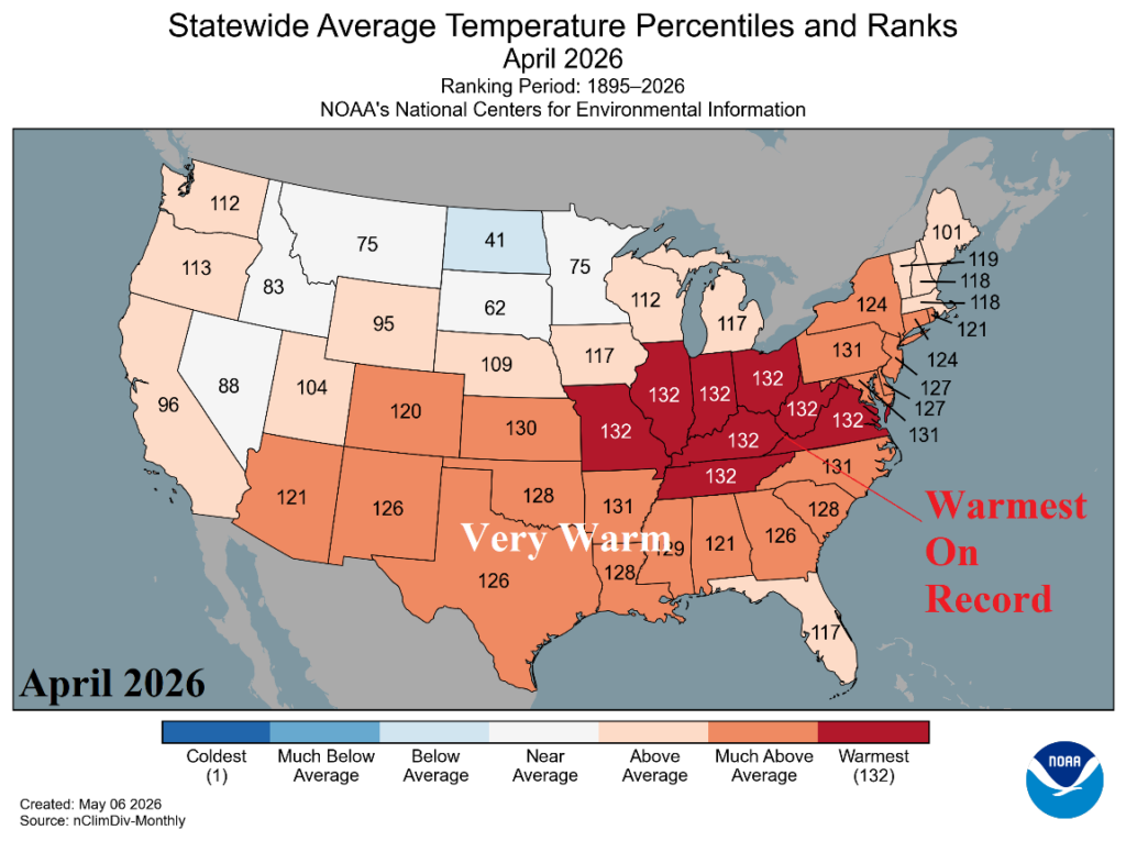

Climate Impact Company Daily Feature
Issued: Friday, May 8, 2026
Highlight: April 2026 and 2026 (so far) state temperature and precipitation rankings. Plenty of records, mostly warm.

Fig. 1: U.S. state temperature rankings for April 2026.
Discussion: During April 2026, the Ohio and Tennessee Valley to Virginia observed record warmth (Fig. 1). Most of the U.S. was MUCH WARMER than normal. The exception was slightly cooler than normal in North Dakota. The April 2026 precipitation pattern featured record amount in Wisconsin and Michigan and VERY WET conditions in Iowa and Missouri (Fig. 2). Conversely, The Southeast and Mid-Atlantic States were very dry with several states in the to-5 all-time driest.
So far in 2026, the Great Basin, California, and Southwest U.S. have observed the warmest start to a year on record with Northwest States near record values (Fig. 3). The Central Great Plains to Texas have also been remarkably warmer than normal to start 2026. All but Florida, Massachusetts, and Rhode Island have been warmer than normal for 2026 so far.
The precipitation pattern for 2026 so far is drier than normal for most of the U.S. including record dry in South Carolina and 2nd driest on record for Georgia and North Carolina (Fig. 4). Meanwhile, the wettest start to the year on record was observed in Wisconsin and Michigan.
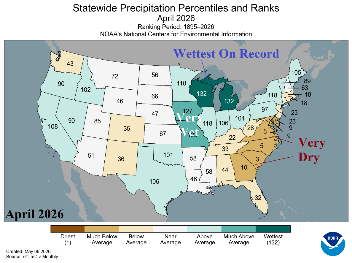
Fig. 2: U.S. state precipitation rankings for April 2026.
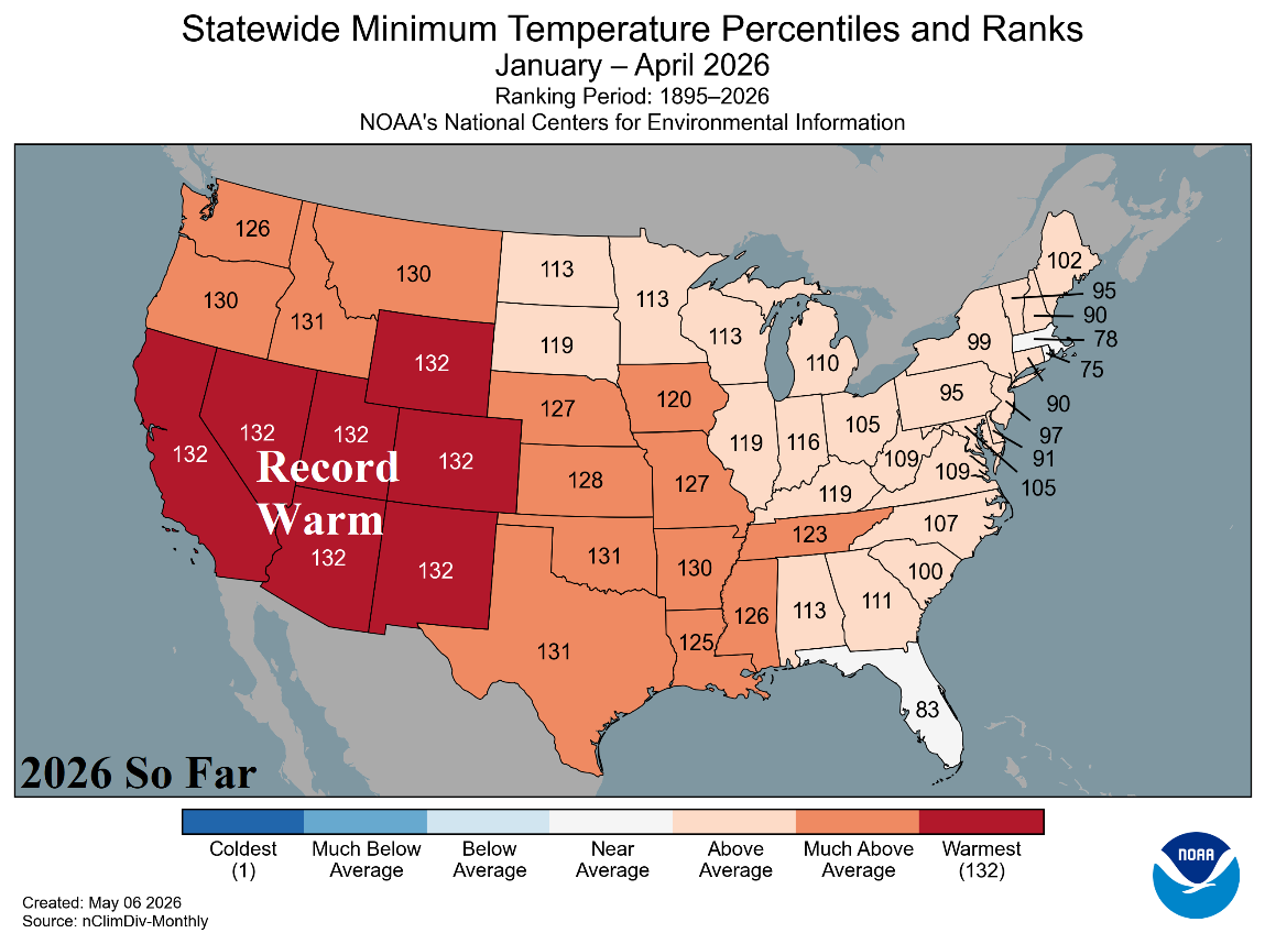
Fig. 3: U.S. state temperature rankings for 2026 so far.
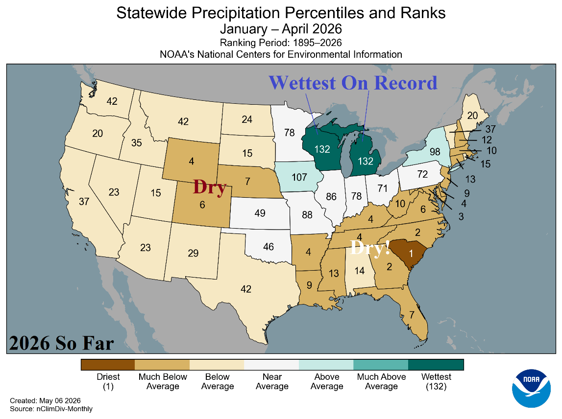
Fig. 4: U.S. state precipitation rankings for 2026 so far.