In U.S. Climate Signals Support Colder West/Warmer East Extended-range
12/07/2025, 2:50 pm EST
Deepening Snow Cover Helps To Produce Extreme Northeast Cold Early Next Week
12/09/2025, 9:06 am EST
Climate Impact Company Early AG Market ALERT
Issued: Monday December 8, 2025
Highlight: Excessive rainfall forecast by ECM Central/East-central South America; Dryness continues in Europe/Western Russia. Wetter Australia.
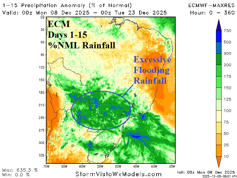
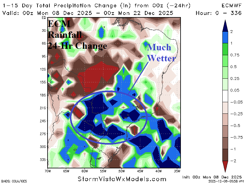
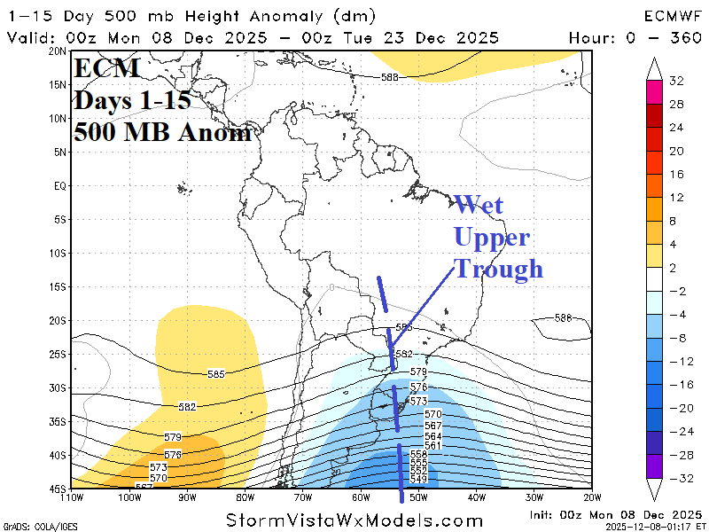
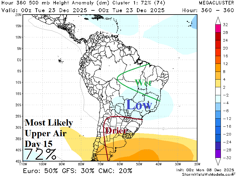
Fig. 1-4: ECM 15-day percent of normal rainfall forecast across Brazil, the 24-hour change, and the prevailing upper air pattern plus the day-15 upper air.
Discussion: ECM indicates potential for flooding rainfall during the middle third of December across Eastern Bolivia, Paraguay, and Southwest/Southeast Brazil (Fig. 1). The rain may abate in the 11-15-day period. The 24-hour change indicates a significant increase in rainfall for Paraguay and eastward (Fig. 2). The culprit is an intensifying upper trough extending from east of Argentina northwestward into Brazil during much of the next 2 weeks (Fig. 3). The “most likely” upper air scenario forecast by the mega-cluster ensemble is the upper trough cuts off over Southeast Brazil pushing the wet pattern northward while Argentina is somewhat drier (Fig. 4).
In Europe, a dry pattern (which extends to Western Russia) continues although the core of the dryness (and anomalous warmth) shifts into Southeast Europe (Fig. 5). Storminess is forecast for Coastal Western Europe and North Africa while Northwest Eurasia gains snow cover.
In Australia, the forecast trend is wetter! Heavy rains are forecast this week on the New South Wales Coast extending inland to help suppress some of the wildfire issues developing over the weekend (Fig. 6). Meanwhile, the northwest and north coast have shifted much wetter during the middle third of December.
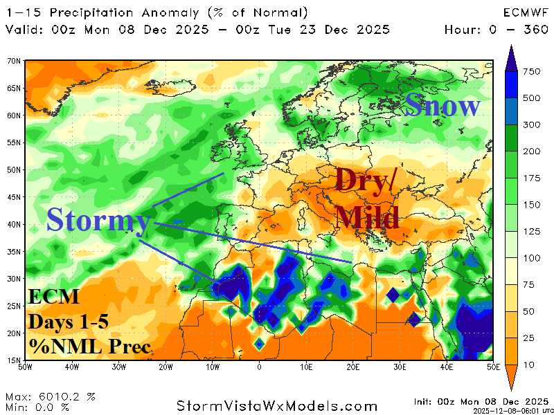
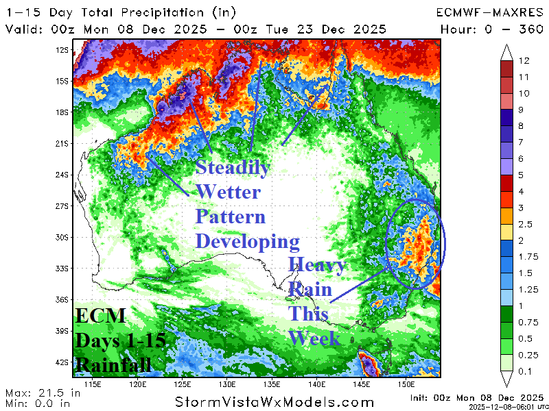
Fig. 5-6: The 15-day percent of normal precipitation forecast across Europe and total rainfall projection for the next 15 days across Australia.