
Potential Excessive Rainfall Pattern for Mid-Atlantic into Early October
09/25/2025, 6:44 am EDT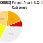
Midwest/Mid-south/Gulf Coast Drought Worsening
09/28/2025, 12:21 pm EDT
Climate Impact Company Tropical Feature
Issued: Saturday September 27, 2025
Highlight: Imelda approaches but does not reach South Carolina coast in a forecast change.
Discussion: The forecast track for Imelda has changed for days 4 and 5 whereas the storm slows down approaching the South Carolina Coast with veering eastward (Fig. 1) due to developing southwest wind aloft ahead of an elongating East Coast upper trough (Fig. 2) and (also) by the northerly low-level circulation around Humberto to the east.
Humberto is a powerful major hurricane expected to maintain intensity while tracking northwestward this weekend and turning north just missing Bermuda to the east Tuesday night. Humberto’s power and aerial coverage will have an influence on Imelda’s track and intensity early-to-middle of next week.
As always, until a new tropical cyclone is fully formed, 5-day forecasts are generally made with near average to below average forecast confidence.
Hurricane forecast models vary on exposure of the South Carolina Coast to Imelda. HMON continues to take the storm to the coast as a minimal hurricane Tuesday morning (Fig. 3) while HWRF has a category-2 hurricane at that time staying offshore (Fig. 4).
The primary weather effects/hazards on the Southeast U.S. Coast remains heavy rain but adds a long duration strong easterly wind flow likely to raise havoc on coastal beaches with extensive erosion and inland flowing ocean water through river inlets flooding areas well inland. The onshore wind flow/accelerating water rise problem lasts well beyond the immediate storm as strong high pressure over the northeast maintains strong east wind through next week.
Rainfall forecast remains impressive with over 12 inches near the South Carolina Coast and 5-10 inches for central and eastern South Carolina (Fig. 5). 3-6 inches of rain is possible in North Carolina. High wind/squalls threaten the Florida East Coast. Onshore wind causing flooding will extend northward in the Mid-Atlantic region.
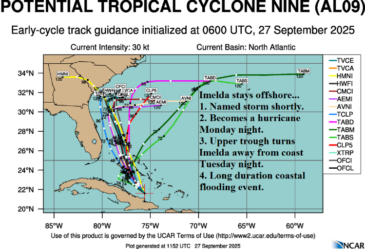
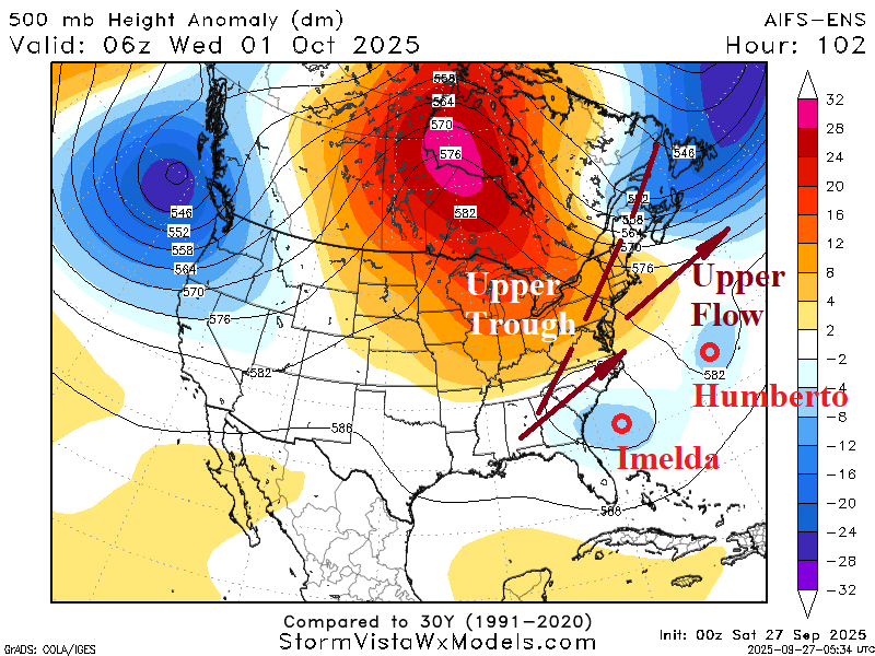
Fig. 1-2: Latest tropical cyclone models forecast tracks for Tropical Cyclone 9 (Imelda) and the upper air forecast for Tuesday night.

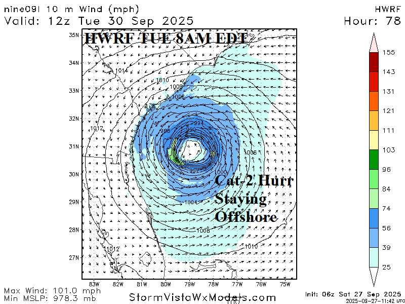
Fig. 3-4: HMON and HWRF sea level pressure forecasts for 8AM EDT identify uncertainty of the forecast.
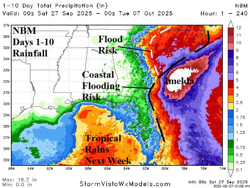
Fig. 5: The NBM 10-day rainfall amount forecast for the Southeast U.S.