
Latest ENSO, PDO, AMO, and IOD Outlooks
06/11/2025, 9:47 am EDT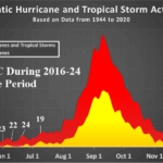
Tropical Cyclone Season 2025 Delayed Compared to Past 10 Years
06/16/2025, 8:46 am EDT
Climate Impact Company Early AG Market ALERT
Issued: Friday June 13, 2025
Highlight: ECM is wetter in Europe days 11-15; Days 8-14…drier/hotter Great Plains.

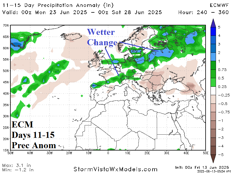
Fig. 1-2: The dry ECM 1-10-day precipitation anomaly forecast across Europe followed by a wetter change in the 11-15-day period.
Discussion: Observed are many (at least 5) periods of negative Scandinavia Index (-SCAND) during 2025 so far when a deep trough resides over Northwest/West-central Russia and a compensating ridge sits across Europe. Another -SCAND pattern is developing and forecast to last through 15 days. Consequently, Europe turns hotter and drier beneath the ridge and Western Russia is showery and cool. In the 11-15-day period, ECM breaks the pattern. For now, the ECM is the only model making this effort. After a dry and hot 1-10-day period across Europe (Fig. 1), ECM shifts a wet trough into Europe to bring some rain and cool the northern half of Europe (Fig. 2). Regardless, through at least 10 days, drought is likely to expand southward and strengthen. In the Great Plains, summer heat is on the horizon. The forecast remains wet across all major crop areas (except western Great Plains wheat) well into next week (Fig. 3). However, the wet belt is lifting northward in the 8-14-day period (Fig. 4) and the risk of >95F/35C is developing and expanding (Fig. 5).
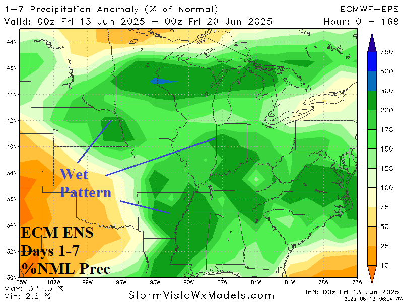


Fig. 3-5: A wet AG Belt 1-7-day forecast shifting much drier in the 8-14-day period with widening risk of >95F/35C in the 11-15-day forecast.