11/05/2025, 3:54 am EST
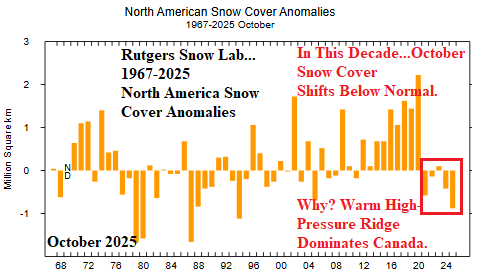
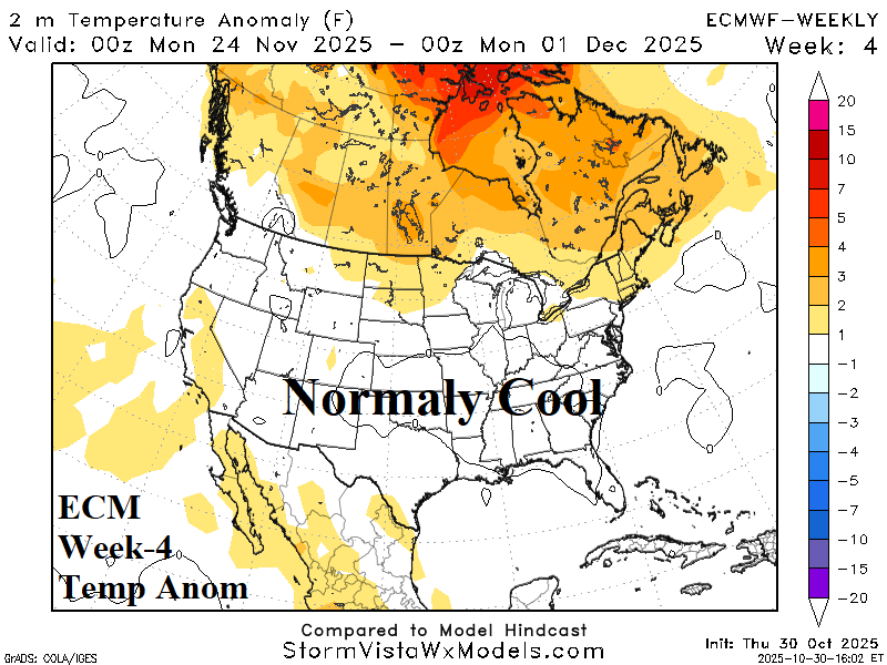
The North America snow cover lagged below normal during mid-autumn thanks to a warm Canadian climate while advection snows across the open water north of Eurasia during October allowed snow cover to build above normal during mid-autumn for the 15th straight year.
