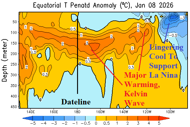
An impressive looking Kelvin Wave has moved east of the Dateline and has strengthened. Cool waters remain in the subsurface off the northwest coast of South America fueling La Nina cool signatures in the Nino SSTA regions.
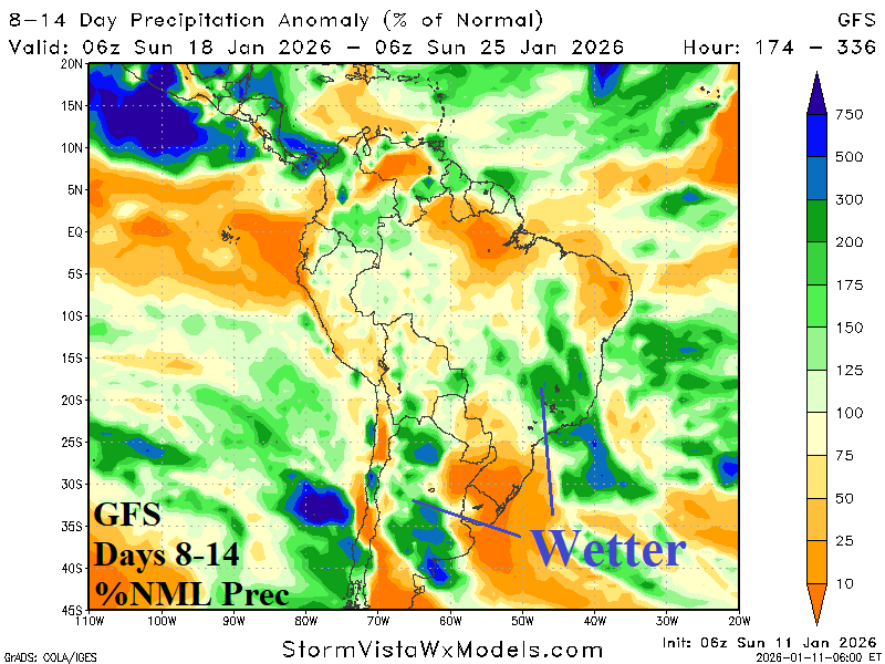
The convection phase of the Madden Julian oscillation (MJO) is moderately strong near the Dateline. Forecasts indicate an eastward shift toward the longitude of the Americas in the extended range. While the current (phase_6) of MJO favors a drier than normal climate for most of Argentina/Brazil, the shift into phase_7 favors broadly wetter than normal climate. Consequently, wetter 8-14/11-15-day (model) forecasts are favored. The wetter bias should last into the 16-20-day timeframe.
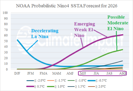
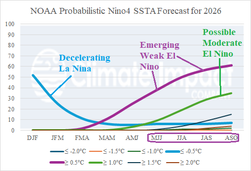
The equatorial subsurface East Pacific has warmed significantly and oceanic La Nina demise is ahead for late winter. La Nina climate is likely to last longer, lasting until mid-to-late spring. We’re entering the “springtime prediction barrier” for ENSO forecasts. Recent research has revealed that already low skill of ENSO forecasts made at this time of year has worsened.
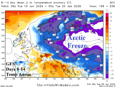
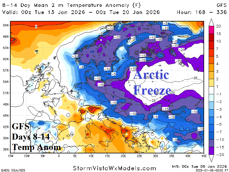
The GFS 1-7-day forecast indicates expansive cold to very cold weather enhanced by widespread above normal snow cover. Both GFS and ECM agree that arctic air becomes involved in the 8-14-day period adhering to East Europe and West Russia. Snow cover is above normal as indicated by GFS for midday today and increases/deepens over the next 2 weeks.

