07/14/2025, 4:38 am EDT
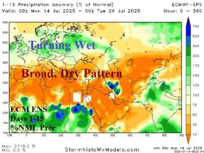
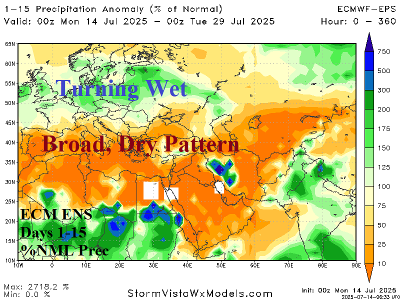
The persistent high-pressure area over Europe producing hot and dry weather during meteorological summer so far is associated with the North Atlantic SSTA pattern featuring a vivid North Atlantic warm hole (NAWH) south of Greenland and marine heat waves (MHW) west of Europe and across the Mediterranean Sea. As mid-summer arrives, persistence begins to shift causing a pattern change for Europe for the second half of July.

