05/19/2026, 8:49 am EDT
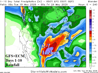
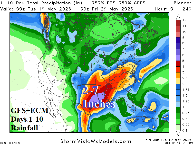
Combining GFS and ECM yields a heavy rain weather pattern evolving this week and extending into next week yielding 7+ inches of rain in East Texas to Southwest Arkansas and Northwest Louisiana. The forecast is made increasingly convincing by a potentially eastward shifting active Madden Julian oscillation (MJO) as forecast by GFS.