11/06/2024, 2:48 pm EST
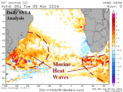
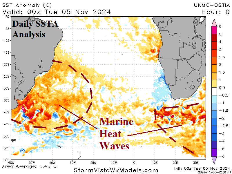
A developing marine heatwave off the East Coast of South America is expected to continue strengthening while shifting southward toward and off the Argentina Coast. MHW's in this position during summertime are well-correlated to an upper low-pressure area near the southeast coast of Brazil. Subsidence on the back side of the low leads to a dry climate and increased drought risk in Argentina and possibly Western Brazil.

